Region
Argyll
A thousand miles of coastline, more islands than you can count, and the sea kayaking capital of Scotland.
- Munros
- 33
- Corbetts
- 24
- Grahams
- 42
- Bothies
- 3
- Trail centres
- 1
- Long-distance trails
- 5
- Wild swimming
- 4
- Gravel routes
- 2
- Dark sky sites
- 2
- Highest peak
- Bidean nam Bian (1149.4m)
Argyll has more coastline than France — or so the frequently repeated claim goes. Whether it's exactly accurate depends on how you count the islands, but the general point stands: this is a landscape defined by sea. The Firth of Lorn, the Sound of Jura, the Firth of Clyde, and the dozens of sea lochs that cut into the mainland create a fractured geography where distances by road are always longer than distances by water. Sea kayaking here is not a peripheral activity — it's how you understand the landscape.
The islands of Argyll are varied enough to sustain multiple visits. Islay is famous for whisky — eight working distilleries — and for the 50,000 barnacle geese that arrive every October from Greenland. Jura has the famous Paps (three quartzite mountains above 700m) and a road that goes nowhere. Mull is the most accessible and most varied: the Ardmeanach peninsula in the west is genuinely wild, Tobermory is a photogenic harbour town, and from Fionnphort you can take the ferry to Iona — three minutes across the Sound — to walk around one of the most significant early Christian sites in Scotland. Colonsay has a hotel, some excellent beach walking, and connects to Oban and Islay by ferry.
On the mainland, Oban is the main ferry hub and a decent base — functional rather than beautiful, but with good fish and chips and a direct train from Glasgow. Inveraray on Loch Fyne is the most photographed town in Argyll, with the whitewashed town and the castle reflected in the loch. Kilmartin Glen, south of Inveraray, has the densest concentration of Neolithic and Bronze Age monuments in Scotland — standing stones, cairns, and rock carvings in a flat valley that rewards slow exploration.
Glens2 glen guides
All glens →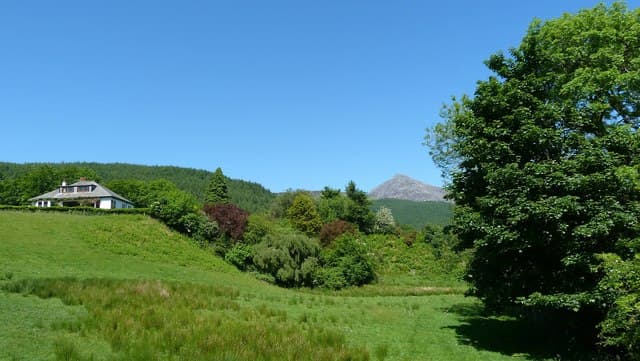
Glen Rosa
A sea crossing, a 3km walk, and then granite mountains above a glacial trough — the most complete mountain day reachable from Glasgow without a car.
Glen Croe
The A83 summit pass where exhausted soldiers carved "Rest and be Thankful" in 1753 — one of Scotland's most evocative road names, and a hillside that has been sliding onto that road ever since.
Hills33 Munros · 24 Corbetts · 42 Grahams
Long-distance trails
Bothies3 in this region
Mountain biking
Wild swimming4 spots
Gravel cycling2 routes
Dark sky & northern lights2 sites
Map
Hills (dark/mid green), bothies (brown), wild swimming (blue), dark sky (purple).
Getting there
Glasgow
1.5 hr drive
Edinburgh
2 hr drive
Oban
0 min drive
Guided support for Argyll
If you'd prefer a guided experience, these operators run trips in this area.
Wilderness Scotland
Premium guided expeditions, all regions
Macs Adventure
Self-guided LDP specialists
Hillwalk Tours
Self-guided routes, luggage transfer
Absolute Escapes
Edinburgh-based independent operator
Affiliate links — disclosure
Our take
The Paps of Jura require a long day and reasonable navigation skills — the quartzite paths are rough, the terrain is trackless in places, and the descent is harder on the knees than the ascent. The classic round of all three takes eight to ten hours and is physically demanding. But Jura itself is worth the ferry regardless: 200 red deer to every person, golden eagles over the Paps in the evening, and a pub in Craighouse with a single-malt selection that deserves more attention than it gets.
For sea kayaking beginners, the sheltered waters of Loch Melfort, Loch Craignish, and the Seil Sound are the obvious starting point — calmer water, manageable tides, and spectacular scenery. The Atlantic coast of Jura and the Garvellachs require tidal planning and open-water experience. Scottish Sea Kayak Trail maps the full coastline route and is the standard reference for planning a longer paddle.
Track your Argyll hills
Log your completions across the Argyll hills and plan your next route.
Open Hill Tracker →Explore nearby regions
Scotland outdoor updates
Route guides, condition reports and seasonal picks — once a week, no noise.
Around Argyll on the SCOT network
Sister sites covering food, drink and travel context for the same area. Linked direct.
Campbeltown whisky region
Once the whisky capital of the world; now Springbank, Glen Scotia, Glengyle and a cult following.
tastescot.co.uk
On TasteSCOTIslay whisky region
11 distilleries on Scotland's peat island — Laphroaig, Lagavulin, Ardbeg, Bowmore.
tastescot.co.uk
On TripSCOTOban
Argyll ferry hub — Mull, Lismore, Coll, Tiree, Barra
tripscot.co.uk
On TripSCOTRothesay
Isle of Bute base; West Island Way; short Glasgow break
tripscot.co.uk
On TripSCOTIsle of Bute
West Island Way, Rothesay, Mount Stuart — easy Glasgow break
tripscot.co.uk