Graham · Argyll & Bute
Beinn Talaidh
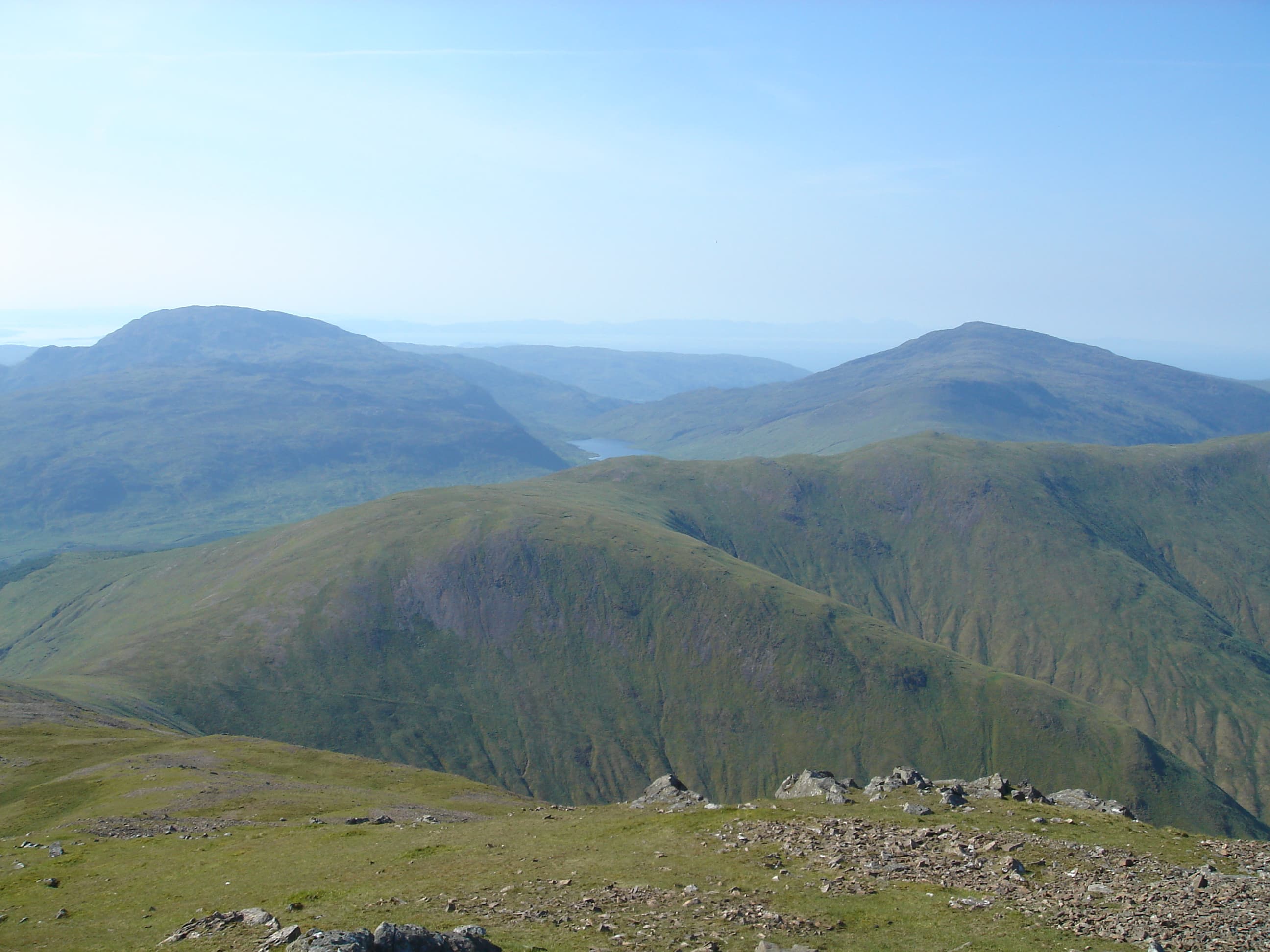
A near-perfect conical peak in central Mull, isolated between Glen Forsa and Glen More and visible for miles as a steep grassy cone. Its 430m of prominence makes Beinn Talaidh the dominant landmark of inner Mull, with Ben More away to the west and Dun da Ghaoithe shouldering up to the east.
Quick facts
- Height
- 761.6m/ 2499ft
- Prominence
- 430 m
- Distance
- 14 km
- Ascent
- 624 m
- Time
- 4–7 hrs
- Grid ref
- NM625347
- Parking
- NM625309
- Nearest city
- Oban· 24km
- Dogs
- Dogs on lead required near livestockDog-friendly guide ↗
Height and prominence cross-checked against the Database of British and Irish Hills (CC BY).
No GPX track yet
Walked this route? Share your track to help other walkers.
Standard route
moorland path 25% · heather hillside 45% · rocky upper slopes 20% · summit area 10%
Most parties start from the layby on the A849 in Glen More and head north up the open south flank, or use the Glen Forsa track from the north. Either way it is a steep direct pull on grass and scree with no path beyond the lower bracken, finishing on a small stony cone.
Terrain
Trackless steep grass on the lower flanks giving way to loose scree and basalt rubble near the top. No constructed paths anywhere on the hill — expect wet bracken and tussock low down.
In winter
Mull rarely holds deep snow at this altitude but the cone is fully exposed to Atlantic gales and ice forms readily on the scree. A heavy soaking from horizontal rain is the more usual hazard.
Best time of year
Getting there
- Glasgow3h 2m
- Edinburgh4h 50m
Ferry access
Oban → Craignure
- Crossing time45 min
- Summer sailingsUp to 8 sailings daily (Apr–Oct)
- Winter sailings4–5 sailings daily (Nov–Mar)
- Book ahead7 days
- Last ferry backCheck CalMac timetable — sailings run until ~21:00 in peak summer
Foot passengers can usually turn up without booking. Book vehicle spaces in advance. The Lochaline → Fishnish crossing (15 min) is shorter but serves east Mull only.
Book on CalMac ↗OS maps: OS Landranger 49
Mobile signal: Brief signal on Mull — 1-2 bars on the summit
Current conditions
Daylight Today
- Sunrise
- 04:52
- Sunset
- 22:06
- Civil dawn
- 03:53
- Civil dusk
- 23:05
NOAA Solar Calculator · 13 July 2026
Pair with
Curated multi-hill combinations from Beinn Talaidh.
Around Beinn Talaidh on the SCOT network
Getting there, basing yourself, and what to do off the hill.
Getting there: Oban station
Argyll ferry hub; Mull, Lismore, Coll, Tiree, Barra connections
24km from the hill
tripscot.co.uk
On TripSCOTBase yourself in Oban
Argyll ferry hub — Mull, Lismore, Coll, Tiree, Barra
24km from the hill
tripscot.co.uk
On TasteSCOTAfter the hill: Oban
Oban town centre — tiny two-still distillery bridging Highland and West Coast styles
24km from the hill
tastescot.co.uk
Beinn Talaidh — common questions
- How difficult is Beinn Talaidh?
- Beinn Talaidh carries a 4/5 (challenging) grade on the OutdoorSCOT scale. Count on about 14km, 624m of ascent and a 4-7 hour day on the standard route. Ground conditions: Trackless steep grass on the lower flanks giving way to loose scree and basalt rubble near the top.
- How much drop does Beinn Talaidh have?
- The drop is 430m: measured from the summit of Beinn Talaidh down to the saddle joining it to higher terrain.
- Where's the parking for Beinn Talaidh?
- Park at NM625309. Double-check the grid reference on an OS map first; informal laybys here fill early in high season.
- What's the best month to climb Beinn Talaidh?
- Aim for May, June, July, August, September on Beinn Talaidh. In the remaining months treat it as a winter hill — full kit, solid navigation, and a look at the relevant SAIS avalanche forecast before you go.
- Can dogs go up Beinn Talaidh?
- Dogs are fine on a lead. The route passes livestock or ground-nesting bird habitat, so keep them close throughout.
- Will I get phone signal on Beinn Talaidh?
- Brief signal on Mull — 1-2 bars on the summit
- How do I get the ferry to Beinn Talaidh?
- Oban → Craignure. Up to 8 sailings daily (Apr–Oct) in summer; 4–5 sailings daily (Nov–Mar) in winter. Book at least 7 days ahead. Foot passengers can usually turn up without booking. Book vehicle spaces in advance. The Lochaline → Fishnish crossing (15 min) is shorter but serves east Mull only.
- Is Beinn Talaidh safe in winter?
- Mull rarely holds deep snow at this altitude but the cone is fully exposed to Atlantic gales and ice forms readily on the scree. A heavy soaking from horizontal rain is the more usual hazard.
Get the OutdoorSCOT weekly
One email a week — new route, hill and bothy guides, seasonal conditions and the odd hard-won lesson. No spam, unsubscribe in one click.