Graham · Argyll & Bute
Cruach Choireadail
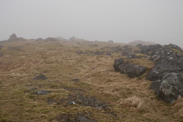
Cruach Choireadail (618m) rises in the rough country of central Mull in the NM53 square, immediately east of Glen More on the road across the island to Loch Buie. The volcanic rock summit overlooks the great basalt sweep of Ben More to the north-west and looks south down the wooded length of Loch Spelve. As a Mull hill it shares the boggy, lochan-spotted character of its neighbours rather than the cleaner ridges of the mainland.
Quick facts
- Height
- 618m/ 2028ft
- Prominence
- 194 m
- Distance
- 12 km
- Ascent
- 464 m
- Time
- 3–5 hrs
- Grid ref
- NM594304
- Parking
- NM628333
- Nearest city
- Oban· 26km
- Dogs
- Dogs on lead required near livestockDog-friendly guide ↗
Height and prominence cross-checked against the Database of British and Irish Hills (CC BY).
No GPX track yet
Walked this route? Share your track to help other walkers.
Standard route
heather and bog 60% · grass and deer sedge 30% · rocky summit 10%
From the verge at NM628333 on the A849 in Glen More, cross the bog south toward the small reservoir and climb the west flank on rough grass and broken outcrops. The summit rock is on the eastern of two tops; the link between the two is a short and untaxing walk. Allow six hours given the trackless terrain — Mull walking is always slower than the map suggests.
Terrain
Bog, tussock and rough basalt outcrops fill the approach. The lochan-strewn lower hillside hides peat trenches that drag heels. The upper ridge is firmer with tussocky grass and weathered black rock; views are constantly interrupted by the next rise.
In winter
Mull rarely holds deep snow but freezing rain on basalt makes for treacherous footing on Cruach Choireadail's outcrops. The boggy lower ground often freezes into iron-hard pavement, faster to walk but unforgiving on ankles. Wind off the Sound of Mull can be punishing on the open crest.
Best time of year
Getting there
- Glasgow3h 2m
- Edinburgh4h 52m
Ferry access
Oban → Craignure
- Crossing time45 min
- Summer sailingsUp to 8 sailings daily (Apr–Oct)
- Winter sailings4–5 sailings daily (Nov–Mar)
- Book ahead7 days
- Last ferry backCheck CalMac timetable — sailings run until ~21:00 in peak summer
Foot passengers can usually turn up without booking. Book vehicle spaces in advance. The Lochaline → Fishnish crossing (15 min) is shorter but serves east Mull only.
Book on CalMac ↗OS maps: OS Landranger 48
Mobile signal: Poor. Mull interior; very limited coverage in Glen More.
Current conditions
Daylight Today
- Sunrise
- 04:59
- Sunset
- 22:01
- Civil dawn
- 04:02
- Civil dusk
- 22:58
NOAA Solar Calculator · 17 July 2026
Around Cruach Choireadail on the SCOT network
Getting there, basing yourself, and what to do off the hill.
Getting there: Oban station
Argyll ferry hub; Mull, Lismore, Coll, Tiree, Barra connections
26km from the hill
tripscot.co.uk
On TripSCOTBase yourself in Oban
Argyll ferry hub — Mull, Lismore, Coll, Tiree, Barra
26km from the hill
tripscot.co.uk
On TasteSCOTAfter the hill: Oban
Oban town centre — tiny two-still distillery bridging Highland and West Coast styles
26km from the hill
tastescot.co.uk
Cruach Choireadail — common questions
- What difficulty is Cruach Choireadail?
- On the OutdoorSCOT scale, Cruach Choireadail comes in at 3/5 — moderately challenging. Expect roughly 12km and 464m of ascent on the usual route — 3-5 hours for most parties. Terrain: Bog, tussock and rough basalt outcrops fill the approach.
- How prominent is Cruach Choireadail?
- Cruach Choireadail has 194m of topographic prominence — the height of its summit above the highest col connecting it to higher ground.
- Where should I park to climb Cruach Choireadail?
- Standard parking is at NM628333. Check the parking grid reference on an OS map before travel; informal laybys can fill on summer weekends.
- When should I climb Cruach Choireadail?
- The standard good-weather months for Cruach Choireadail are May, June, July, August, September. Outside those months, expect winter conditions on the high ground — full mountain kit, navigation skills, and a check of the SAIS avalanche forecast for the relevant region.
- Can I bring my dog up Cruach Choireadail?
- On a lead only — the route crosses ground with livestock or nesting-bird interest.
- What's mobile reception like on Cruach Choireadail?
- Poor. Mull interior; very limited coverage in Glen More.
- How do I get the ferry to Cruach Choireadail?
- Oban → Craignure. Up to 8 sailings daily (Apr–Oct) in summer; 4–5 sailings daily (Nov–Mar) in winter. Book at least 7 days ahead. Foot passengers can usually turn up without booking. Book vehicle spaces in advance. The Lochaline → Fishnish crossing (15 min) is shorter but serves east Mull only.
- Is Cruach Choireadail safe in winter?
- Mull rarely holds deep snow but freezing rain on basalt makes for treacherous footing on Cruach Choireadail's outcrops. The boggy lower ground often freezes into iron-hard pavement, faster to walk but unforgiving on ankles. Wind off the Sound of Mull can be punishing on the open crest.
Get the OutdoorSCOT weekly
One email a week — new route, hill and bothy guides, seasonal conditions and the odd hard-won lesson. No spam, unsubscribe in one click.