Long distance
John Muir Way
Coast-to-coast route across central Scotland named for John Muir, running from Helensburgh on the Clyde to Dunbar (Muir Stretches 215 km (134 mi) and around 2,000 m of climbing; most parties take 10 days walking best west-to-east with the prevailing weather behind you — an accessible introduction to long-distance walking.'s birthplace) on the East Lothian coast.
Quick facts
- Distance
- 215 km/ 134 mi
- Typical days
- 10
- Total ascent
- 2000 m
- Difficulty
- easy
- Start → Finish
- Helensburgh → Dunbar
- Best direction
- West to East
- Water sources
- Tap water at every town along this lowland route — Helensburgh, Strathblane, Kirkintilloch, Falkirk, Linlithgow, South Queensferry, Edinburgh, Prestonpans, North Berwick, Dunbar. Cafes, pubs and station facilities throughout. Never more than 4km from a tap.
- Mobile signal
- EE/Vodafone/O2 coverage continuous along the populated Central Belt corridor. The only signal gaps are brief moorland crossings between Strathblane and Kirkintilloch and on Croft Roy moor north of Linlithgow.
✔ Waymarked throughout
Approximate profile derived from per-stage ascent — accurate on total climb and pattern, not a pixel-precise GPX trace.
Our take
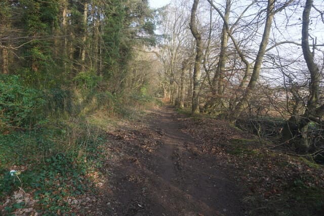
The John Muir Way is the easiest Scottish long-distance walk by some distance — mostly flat, mostly low-level, and intentionally designed to be doable by anyone. It's not a wilderness experience; it's a walk through Scotland's central belt and countryside. Brilliant for first-timers, families, and cyclists (it's entirely rideable).
Highlights
- Clyde waterfront at Helensburgh
- The Falkirk Wheel and the Kelpies
- Edinburgh city section via the canal
- East Lothian coast and North Berwick Law
Mid-route waypoints
Navigation by progression marker rather than total distance.
| km | Waypoint | Type |
|---|---|---|
| 0 km | HelensburghWest coast start on Firth of Clyde | start |
| 18 km | Balloch / Loch LomondSouthern shore of Loch Lomond; National Park gateway | water |
| 42 km | StrathblaneBelow the Campsie Fells; Glengoyne Distillery near | village |
| 70 km | Kilsyth / CroyCrosses the Antonine Wall (Roman frontier UNESCO site) | village |
| 90 km | Falkirk WheelWorld's only rotating boat lift between the Forth & Clyde and Union Canals | water |
| 108 km | LinlithgowBirthplace of Mary Queen of Scots; royal palace ruins | village |
| 130 km | South QueensferryUnder the three Forth Bridges (UNESCO Forth Rail Bridge) | bridge |
| 150 km | Edinburgh (Cramond / Portobello)Coastal stretch through Scotland's capital | village |
| 188 km | North BerwickEast Lothian coastal town with views to Bass Rock | village |
| 215 km | DunbarFinish at John Muir's birthplace and John Muir Country Park | finish |
Day-by-day itinerary
A suggested 10-day schedule. Adjust to your fitness and conditions.
1Helensburgh to Balloch22km · 200m ascent
From Helensburgh seafront along the Clyde coast and through Renton to Balloch at the foot of Loch Lomond. The terrain is overwhelmingly low-level — canal towpaths, coast paths and gentle farmland — and it is rideable on a hybrid bike; ideal for first-time long-distance walkers, families and shoulder-season trips.
- Terrain
- Coastal promenade, cycle paths, riverside paths. Flat and easy.
- Overnight
- Balloch has hotels and B&Bs. Good transport links to Glasgow.
- Stats
- Helensburgh → Balloch · 22km · ↑200m
2Balloch to Strathblane22km · 250m ascent
Through farmland and along the Endrick Water to Strathblane beneath the Campsie Fells. Pleasant lowland walking.
- Terrain
- Farm tracks, riverside paths, quiet lanes.
- Overnight
- Strathblane has B&Bs and a pub. Milngavie is accessible by bus.
- Stats
- Balloch → Strathblane · 22km · ↑250m
3Strathblane to Kilsyth20km · 200m ascent
Along the base of the Campsie Fells and through farmland to Kilsyth. The Antonine Wall heritage is visible along this section.
- Terrain
- Farm paths, canal towpath, quiet roads.
- Overnight
- Kilsyth has B&Bs and pubs. Kirkintilloch is nearby with more options.
- Stats
- Strathblane → Kilsyth · 20km · ↑200m
4Kilsyth to Falkirk22km · 150m ascent
Along the Forth and Clyde Canal towpath to the Falkirk Wheel — the world's only rotating boat lift. The Kelpies sculptures are a highlight.
- Terrain
- Canal towpath throughout. Flat and surfaced.
- Overnight
- Falkirk has hotels and B&Bs. Good rail links.
- Stats
- Kilsyth → Falkirk · 22km · ↑150m
5Falkirk to Linlithgow19km · 150m ascent
Past the Kelpies and along the canal to Linlithgow, birthplace of Mary Queen of Scots. Linlithgow Palace is magnificent.
- Terrain
- Canal towpath, some road walking. Easy and flat.
- Overnight
- Linlithgow has hotels, B&Bs and good restaurants.
- Stats
- Falkirk → Linlithgow · 19km · ↑150m
6Linlithgow to South Queensferry22km · 200m ascent
Through West Lothian farmland to South Queensferry beneath the iconic Forth bridges. The bridges are stunning at sunset.
- Terrain
- Farm paths, cycle paths, quiet lanes.
- Overnight
- South Queensferry has hotels and B&Bs with views of the bridges.
- Stats
- Linlithgow → South Queensferry · 22km · ↑200m
7South Queensferry to Edinburgh22km · 200m ascent
Along the shore past Cramond and into Edinburgh via the Water of Leith. An urban day with unexpected green spaces.
- Terrain
- Coastal promenade, riverside paths, city walking.
- Overnight
- Edinburgh has unlimited accommodation. Rest day recommended.
- Stats
- South Queensferry → Edinburgh · 22km · ↑200m
8Edinburgh to Musselburgh16km · 100m ascent
Through Holyrood Park past Arthur's Seat and Portobello beach to Musselburgh. A short urban day with fine views from Calton Hill.
- Terrain
- City paths, coastal promenade, beach walking.
- Overnight
- Musselburgh has B&Bs and is close to Edinburgh by bus.
- Stats
- Edinburgh → Musselburgh · 16km · ↑100m
9Musselburgh to North Berwick28km · 300m ascent
Along the East Lothian coast past Aberlady Bay nature reserve and Gullane beaches. North Berwick Law dominates the skyline ahead.
- Terrain
- Coastal paths, beach walking, links grassland.
- Overnight
- North Berwick has excellent hotels, B&Bs and restaurants.
- Stats
- Musselburgh → North Berwick · 28km · ↑300m
10North Berwick to Dunbar22km · 250m ascent
The final stretch along dramatic coastal cliffs past Tantallon Castle and the Bass Rock seabird colony to Dunbar, John Muir's birthplace.
- Terrain
- Cliff-top paths, beach walking, some farmland.
- Overnight
- Dunbar has hotels and B&Bs. Visit John Muir's birthplace museum.
- Stats
- North Berwick → Dunbar · 22km · ↑250m
Transport
To start (Helensburgh)
Train · ScotRail North Clyde Line
Glasgow Queen Street to Helensburgh Central
Half-hourly; ~45 min
Check times & book →
From finish (Dunbar)
Train · LNER / ScotRail East Coast Main Line
Dunbar to Edinburgh Waverley (29 miles)
Roughly hourly; ~25 min
Check times & book →
Best months
Accommodation
Urban sections mean hotels are easy. Rural sections between have B&Bs and campsites. Plentiful in Helensburgh, Balloch, Linlithgow, Edinburgh, North Berwick and Dunbar; Travelodge, Premier Inn and B&B platforms all cover the route. Wild camping is limited but possible near the coast.
Night-by-night guide: where to stay →Resupply
Resupply is never more than a few hours away at any point. The longest gap between shops is under 10km; supermarkets in Falkirk, Linlithgow and North Berwick suit larger stock-ups. Coastal sections have cafes every few miles.
Connect with
Chain into a longer expedition by combining with adjacent long-distance routes.
John Muir Way + Fife Coastal Path
Both meet the Firth of Forth — easy transition from Edinburgh
Finish the John Muir Way and cross the Forth to start the Fife Coastal Path north from Kincardine. An east-coast Scotland sampler.
John Muir Way + Borders Abbeys Way
Adjoins Borders region from JMW finish at Dunbar
After Dunbar drive south to Melrose to start the Borders Abbeys Way circular — combines well as a week-long Scotland Borders trip.
Current conditions
Weather at the start point (Helensburgh)
Daylight Today
- Sunrise
- 04:57
- Sunset
- 21:54
- Civil dawn
- 04:01
- Civil dusk
- 22:49
NOAA Solar Calculator · 17 July 2026
Share your experience
Walked the John Muir Way? Help others plan their trip.
Getting to and from the John Muir Way
Train and town anchors at each end of the route — on TripSCOT.
Start: Helensburgh Upper station
Three Lochs Way; Gareloch and Loch Long ridge approaches
0km from Helensburgh
tripscot.co.uk
On TripSCOTFinish: Dunbar station
John Muir Country Park; surf and coast walks
0km from Dunbar
tripscot.co.uk
On TripSCOTStock up: Luss
West Loch Lomond village — Highland Boundary, Loch Lomond Way
tripscot.co.uk