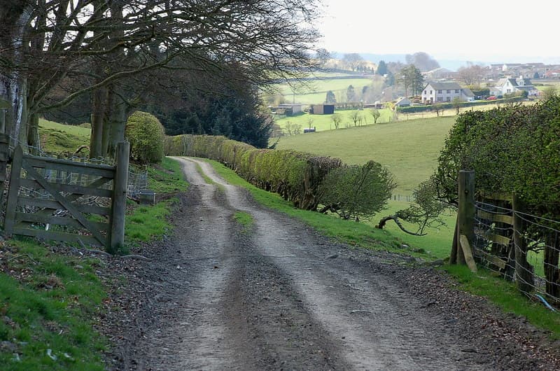
Long distance
Borders Abbeys Way
A circuit linking the four great ruined abbeys of the Scottish Borders — Melrose, Dryburgh, Kelso and Jedburgh — past Abbotsford House and along the Tweed and the Teviot. 109 km (68 mi), 1,300 m of cumulative ascent, in 5–6 days; well waymarked and usually walked clockwise from Tweedbank or Melrose, though it can be started anywhere.
Quick facts
- Distance
- 109 km/ 68 mi
- Typical days
- 5
- Total ascent
- 1300 m
- Difficulty
- easy
- Start → Finish
- Melrose → Melrose
- Best direction
- Either direction
- Water sources
- Melrose, Kelso, Jedburgh, Hawick and Selkirk (and St Boswells off-route) have taps, cafes and shops. Fill up in town before each stage; treat any water taken from the rivers.
- Mobile signal
- Signal in the Borders towns; it can be patchy on the higher ground between them.
✔ Waymarked throughout
Approximate profile derived from per-stage ascent — accurate on total climb and pattern, not a pixel-precise GPX trace.
Our take
The Borders Abbeys Way is one of the gentlest of Scotland's Great Trails and one of the best for a first long-distance walk. The waymarking is good, and every one of the five council sections ends in a town with pubs and B&Bs. The first, Melrose to Kelso, is the longest at 29 km, and many walkers split it by stepping off-route to St Boswells village, making it six days. In poor visibility the section over Black Hill may need a map and compass. The abbeys themselves are magnificent. Walk it in autumn when the Tweed valley turns gold.
Highlights
- Melrose, Dryburgh, Kelso and Jedburgh abbeys
- Abbotsford House, home of Sir Walter Scott
- Riverside walking beside the Tweed and the Teviot
- Views from the high ground towards the Cheviots
Day-by-day itinerary
A suggested 5-day schedule. Adjust to your fitness and conditions.
1Melrose to Kelso29km · 175m ascent
The long first stage: through Newtown St Boswells to Dryburgh Abbey and the Clintmains road end, then along the northern side of the Tweed by Makerstoun to Kelso Abbey. Many walkers split it with a night in St Boswells village, off the line.
- Terrain
- Riverside paths, farm tracks, quiet lanes.
- Overnight
- St Boswells (split) and Kelso have B&Bs and hotels.
- Stats
- Melrose → Kelso · 29km · ↑175m
2Kelso to Jedburgh22km · 100m ascent
From Kelso Abbey south-west, largely beside the River Teviot, to Jedburgh and its ruined abbey.
- Terrain
- Riverside paths, farm tracks, quiet lanes.
- Overnight
- Jedburgh has hotels and B&Bs.
- Stats
- Kelso → Jedburgh · 22km · ↑100m
3Jedburgh to Hawick23km · 350m ascent
A steady climb out of Jedburgh, then west into Teviotdale and on to Hawick.
- Terrain
- Farm tracks, field paths, riverside sections.
- Overnight
- Hawick has hotels and B&Bs.
- Stats
- Jedburgh → Hawick · 23km · ↑350m
4Hawick to Selkirk19km · 350m ascent
A long, steady climb out of Hawick, then north over rolling country to Selkirk above the Ettrick Water.
- Terrain
- Farm tracks, field paths, woodland.
- Overnight
- Selkirk has B&Bs and shops.
- Stats
- Hawick → Selkirk · 19km · ↑350m
5Selkirk to Melrose16km · 300m ascent
Over Selkirk Hill, then along the Tweed past Abbotsford House, Sir Walter Scott's home, to close the circuit at Melrose Abbey.
- Terrain
- Riverside paths, estate tracks, quiet lanes.
- Overnight
- Melrose has B&Bs and hotels; Tweedbank station for the train home.
- Stats
- Selkirk → Melrose · 16km · ↑300m
Transport
To start (Melrose)
Train · ScotRail (Borders Railway)
Edinburgh Waverley to Tweedbank, then bus / taxi to Melrose (~1.5 miles)
Borders Buses run between Tweedbank and Melrose.
Check times & book →
From finish (Melrose)
Train · ScotRail (Borders Railway)
Melrose to Tweedbank to Edinburgh Waverley
Circular route — start = finish at Melrose.
Check times & book →
Best months
Accommodation
B&Bs and hotels in Melrose, Kelso, Jedburgh, Hawick and Selkirk, and at St Boswells for walkers splitting the first stage. Some close out of season and most are busy in season, so book ahead.
Night-by-night guide: where to stay →Resupply
Shops in Melrose, Kelso, Jedburgh, Hawick and Selkirk — every overnight town — so you are never more than a day from resupply.
Connect with
Chain into a longer expedition by combining with adjacent long-distance routes.
Borders Abbeys Way + St Cuthberts Way
Both share Melrose as start point
Walk the Borders Abbeys Way circular then continue east on St Cuthberts Way to Lindisfarne.
Borders Abbeys Way + Cross Borders Drove Road
The Drove Road finishes at Hawick, on the Borders Abbeys Way
Scotland's Great Trails also links the Romans and Reivers Route.
Borders Abbeys Way + Southern Upland Way
Both pass through Melrose
The Southern Upland Way's Traquair–Melrose and Melrose–Lauder stages meet the Borders Abbeys Way in Melrose.
Current conditions
Weather at the start point (Melrose)
Daylight Today
- Sunrise
- 07:07
- Sunset
- 16:42
- Civil dawn
- 06:29
- Civil dusk
- 17:21
NOAA Solar Calculator · 28 October 2026
Share your experience
Walked the Borders Abbeys Way? Help others plan their trip.
Getting to and from the Borders Abbeys Way
Train and town anchors at each end of the route — on TripSCOT.