Long distance
Kintyre Way
Follows the length of the Kintyre peninsula from Tarbert to Machrihanish. Coastal walking, forest tracks, remote moorland and the famous Mull of Kintyre. Stretches 161 km (100 mi) and around 3,500 m of climbing; most parties take 7 days walking best north-to-south — a sustained week-plus walk.
Quick facts
- Distance
- 161 km/ 100 mi
- Typical days
- 7
- Total ascent
- 3500 m
- Difficulty
- moderate
- Start → Finish
- Tarbert → Machrihanish
- Best direction
- North to South
- Water sources
- Tarbert, Skipness, Carradale, Campbeltown, Southend, Machrihanish — all have taps and shops. The forest tracks and moor crossings between villages are well-watered. Treat all sources. Carry 2L for the inland forest sections.
- Mobile signal
- EE/Vodafone reliable in the Kintyre towns and along the coast. The forest interior sections (Skipness to Carradale, Campbeltown to Southend over Conie Glen) drop signal. Tarbert and Campbeltown are the main signal hubs.
✔ Waymarked throughout
Approximate profile derived from per-stage ascent — accurate on total climb and pattern, not a pixel-precise GPX trace.
Our take
The Kintyre Way is longer than most people expect and wilder than its southern latitude suggests. The middle section through Carradale forest and over moorland can feel genuinely remote. The coastal stretches are spectacular. Campbeltown is a surprisingly good town with a reviving whisky scene. The Mull of Kintyre detour is weather-dependent but unmissable on a clear day.
Highlights
- Tarbert harbour start
- Carradale Bay
- Campbeltown and Springbank Distillery
- Mull of Kintyre lighthouse
Day-by-day itinerary
A suggested 7-day schedule. Adjust to your fitness and conditions.
1Tarbert to Skipness22km · 500m ascent
From the picturesque harbour at Tarbert along the east coast of Kintyre to Skipness Castle. Views across Kilbrannan Sound to Arran. The terrain mixes coastal paths, forest tracks and moorland passes with one or two longer hill days; suits walkers wanting wild Argyll feel without the navigation demands of the Cape Wrath Trail.
- Terrain
- Coastal paths, forest tracks, some road walking.
- Overnight
- Skipness has the Seafood Cabin and limited B&Bs. Wild camping near the castle.
- Stats
- Tarbert → Skipness · 22km · ↑500m
2Skipness to Claonaig18km · 400m ascent
Through forest and along the coast to the Claonaig ferry terminal. Remote coastal walking with Arran views throughout.
- Terrain
- Forest roads, coastal paths, quiet lanes.
- Overnight
- Very limited at Claonaig. Wild camping or arrange B&B transport.
- Stats
- Skipness → Claonaig · 18km · ↑400m
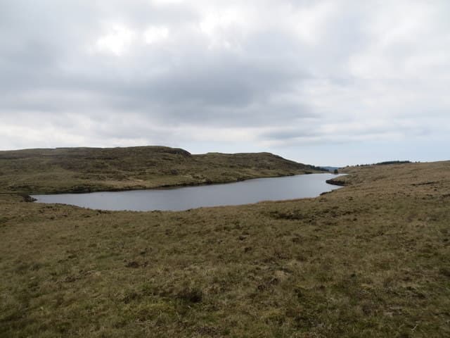
3Claonaig to Carradale20km · 500m ascent
Over the moorland spine of the peninsula and down to the fishing village of Carradale. The walking is remote and wild on the hill sections.
- Terrain
- Moorland paths, forest tracks, descent to coast.
- Overnight
- Carradale has the Carradale Hotel, B&Bs and a campsite. Small village shop.
- Stats
- Claonaig → Carradale · 20km · ↑500m
4Carradale to Saddell18km · 400m ascent
Along the coast past Torrisdale Bay and through forest to Saddell with its medieval abbey ruins. Quiet and beautiful.
- Terrain
- Coastal paths, forest tracks, beach sections.
- Overnight
- Saddell has Landmark Trust cottages. Wild camping at Saddell Bay.
- Stats
- Carradale → Saddell · 18km · ↑400m
5Saddell to Campbeltown28km · 600m ascent
The longest day, down the coast and over moorland to Campbeltown. The town has a reviving whisky scene — Springbank, Glen Scotia and Glengyle distilleries.
- Terrain
- Coastal paths, moorland tracks, road walking into town.
- Overnight
- Campbeltown has hotels, B&Bs and restaurants. Major resupply point.
- Stats
- Saddell → Campbeltown · 28km · ↑600m
6Campbeltown to Southend24km · 500m ascent
South to the tip of Kintyre past Davaar Island and along the coast to Southend. The Mull of Kintyre lighthouse is a detour from here.
- Terrain
- Coastal paths, farm tracks, moorland. Some exposed sections.
- Overnight
- Southend has the Argyll Arms Hotel and B&Bs.
- Stats
- Campbeltown → Southend · 24km · ↑500m
7Southend to Machrihanish31km · 600m ascent
Around the south coast and up the Atlantic side to Machrihanish and its famous beach. The west coast is wild and exposed with ocean views.
- Terrain
- Coastal paths, beach walking, moorland tracks.
- Overnight
- Machrihanish has the Ugadale Hotel and B&Bs. Machrihanish beach is spectacular.
- Stats
- Southend → Machrihanish · 31km · ↑600m
Transport
To start (Tarbert)
Bus · Scottish Citylink / West Coast Motors (926)
Glasgow Buchanan St to Tarbert (Loch Fyne)
4–5 daily; ~3h journey
Same coach continues to Campbeltown if needed.
Check times & book →
From finish (Machrihanish)
Bus · West Coast Motors (200 / 442) + Citylink (926)
Machrihanish to Campbeltown (local bus), then Citylink 926 to Glasgow
Local bus every ~2 hours; Citylink 4–5 daily (~4h to Glasgow)
Campbeltown also has Loganair flights to Glasgow as a quicker alternative.
Check times & book →
Best months
Accommodation
B&Bs at Tarbert, Carradale, Campbeltown and Southend. Wild camping works well on the moorland sections. B&Bs and hotels in Tarbert, Carradale, Campbeltown, Southend and Machrihanish; Springbank Distillery in Campbeltown runs hostel-style accommodation by arrangement.
Night-by-night guide: where to stay →Resupply
Tarbert and Campbeltown have full shops. Carradale has a small shop. Carry food for 2 days between Tarbert and Carradale. Co-op in Tarbert and Campbeltown; smaller shops at Carradale and Southend. Longest gap is around 40km between Tarbert and Carradale — carry two days of food.
Connect with
Chain into a longer expedition by combining with adjacent long-distance routes.
Current conditions
Weather at the start point (Tarbert)
Daylight Today
- Sunrise
- 05:22
- Sunset
- 21:34
- Civil dawn
- 04:33
- Civil dusk
- 22:23
NOAA Solar Calculator · 30 July 2026
Share your experience
Walked the Kintyre Way? Help others plan their trip.
Getting to and from the Kintyre Way
Train and town anchors at each end of the route — on TripSCOT.