Long distance
Cowal Way
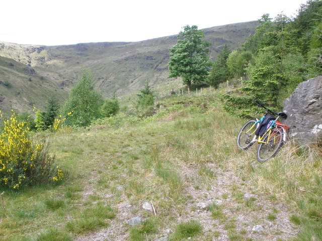
Traverses the Cowal Peninsula from Loch Fyne to Loch Lomond through quiet forests, coastal stretches and hill passes. One of the least-walked Great Trails. 5 days, 92 km (57 mi), 2,800 m of cumulative ascent; a waymarked route best tackled best south-to-north — a manageable mid-distance route.
Quick facts
- Distance
- 92 km/ 57 mi
- Typical days
- 5
- Total ascent
- 2800 m
- Difficulty
- moderate
- Start → Finish
- Portavadie → Inveruglas
- Best direction
- South to North
- Water sources
- Portavadie, Tighnabruaich, Glendaruel, Strachur, Lochgoilhead, Arrochar — all have taps and shops. The hills between Strachur and Lochgoilhead have reliable burns. Treat all sources. Carry 1.5L for the Lochgoilhead-Arrochar day over Beinn Bheula.
- Mobile signal
- EE/Vodafone reliable in all named villages on the route. The high ground above Lochgoilhead and around Beinn Bheula is out of signal. Argyll Forest Park sections drop signal in deep glens.
✔ Waymarked throughout
Approximate profile derived from per-stage ascent — accurate on total climb and pattern, not a pixel-precise GPX trace.
Our take
The Cowal Way has a problem: it sits between the West Highland Way and Kintyre, both better known, and nobody quite knows it exists. That is also its greatest asset. You will see almost no other walkers. The terrain is varied — coastal, forest, moorland — and the finish at Loch Lomondside links neatly into the WHW. Ferry access from Portavadie adds a genuine adventure feel.
Highlights
- Loch Fyne coastline
- Strachur to Lochgoilhead hill crossing
- Ardgartan forest
- Loch Lomond arrival at Inveruglas
Day-by-day itinerary
A suggested 5-day schedule. Adjust to your fitness and conditions.
1Portavadie to Tighnabruaich16km · 400m ascent
From the ferry terminal along the Loch Fyne coast and through forest to the yachting village of Tighnabruaich on the Kyles of Bute.
- Terrain
- Coastal paths, forest tracks, some hill walking.
- Overnight
- Tighnabruaich has the Royal An Lochan Hotel and B&Bs.
- Stats
- Portavadie → Tighnabruaich · 16km · ↑400m
2Tighnabruaich to Strachur20km · 650m ascent
Over the spine of Cowal through forest and open moorland. The hill crossing between the Kyles of Bute and Loch Fyne is the toughest on the route.
- Terrain
- Hill paths, moorland, forest tracks. Significant ascent.
- Overnight
- Strachur has the Creggans Inn and B&Bs on Loch Fyne.
- Stats
- Tighnabruaich → Strachur · 20km · ↑650m
3Strachur to Lochgoilhead18km · 600m ascent
Over another hill crossing through Argyll forest to Lochgoilhead at the head of its remote sea loch. Quiet and beautiful walking.
- Terrain
- Forest roads, hill paths, some rough ground.
- Overnight
- Lochgoilhead has B&Bs and a caravan park.
- Stats
- Strachur → Lochgoilhead · 18km · ↑600m
4Lochgoilhead to Arrochar20km · 650m ascent
Through the Ardgartan Forest and over the pass to Arrochar at the head of Loch Long. The Arrochar Alps are visible throughout.
- Terrain
- Forest paths, hill tracks, descent through glen.
- Overnight
- Arrochar has the Village Inn, B&Bs and a campsite.
- Stats
- Lochgoilhead → Arrochar · 20km · ↑650m
5Arrochar to Inveruglas18km · 500m ascent
The final stretch along Loch Long and over to Loch Lomond at Inveruglas. The walk ends where the West Highland Way passes.
- Terrain
- Loch-shore paths, forest tracks, some road walking.
- Overnight
- Inveruglas has the Drovers Inn nearby. Bus connections to Glasgow.
- Stats
- Arrochar → Inveruglas · 18km · ↑500m
Hills along the route
Munros, Corbetts, Grahams and Donalds within 5km of the route line — extensions or rest-day options.
Transport
To start (Portavadie)
Bus · Scottish Citylink (926) + CalMac
Glasgow Buchanan St to Tarbert (Loch Fyne) on Citylink 926, then CalMac Tarbert–Portavadie ferry
Citylink 926 4–5×/day; ferry roughly hourly (~25 min crossing)
Alternative via Dunoon: McGill's 907 Glasgow to Dunoon then West Coast Motors 478 to Portavadie.
Check times & book →
From finish (Inveruglas)
Bus · Scottish Citylink
Inveruglas / Tarbet (Loch Lomond) to Glasgow (route 914 / 915 / 916)
Up to ~8 daily
Inveruglas is on the A82 with regular Citylink stops to Glasgow Buchanan St.
Check times & book →
Best months
Accommodation
B&Bs at Tighnabruaich, Strachur, Lochgoilhead and Arrochar. Wild camping possible throughout. Limited compared to the WHW. B&Bs at Tighnabruaich, Strachur, Lochgoilhead and Arrochar; the Argyll Backpackers in Tighnabruaich is a useful budget option. Wild camping is straightforward throughout the route.
Night-by-night guide: where to stay →Resupply
Small shops at Tighnabruaich, Strachur and Arrochar. Carry a full day of food for the middle sections. Small shops at Tighnabruaich, Strachur and Arrochar; longest gap is around 25km on the Strachur-to-Lochgoilhead stage. The Creggans Inn at Strachur serves good meals.
Connect with
Chain into a longer expedition by combining with adjacent long-distance routes.
Cowal Way + Three Lochs Way
Connects at Inveruglas / Loch Lomond shore
Walk the Three Lochs Way (also Loch Lomond and Cowal Way) east from Inveruglas to Helensburgh — they share the eastern terminus.
Cowal Way + Kintyre Way
Cowal and Kintyre peninsulas — short ferry between
Take the Portavadie–Tarbert ferry from the Cowal Way start to Tarbert and join the Kintyre Way south.
Current conditions
Weather at the start point (Portavadie)
Daylight Today
- Sunrise
- 05:22
- Sunset
- 21:34
- Civil dawn
- 04:33
- Civil dusk
- 22:23
NOAA Solar Calculator · 30 July 2026
Share your experience
Walked the Cowal Way? Help others plan their trip.
Getting to and from the Cowal Way
Train and town anchors at each end of the route — on TripSCOT.
Start: Wemyss Bay station
Ferry to Rothesay (Isle of Bute) — West Island Way start
26km from Portavadie
tripscot.co.uk
On TripSCOTFinish: Arrochar & Tarbet station
Arrochar Alps — The Cobbler, Beinn Ime, Beinn Narnain, Ben Vane, Ben Vorlich
5km from Inveruglas
tripscot.co.uk
On TripSCOTStock up: Rothesay
Isle of Bute base; West Island Way; short Glasgow break
tripscot.co.uk