Graham · Argyll & Bute
Beinn Ruadh
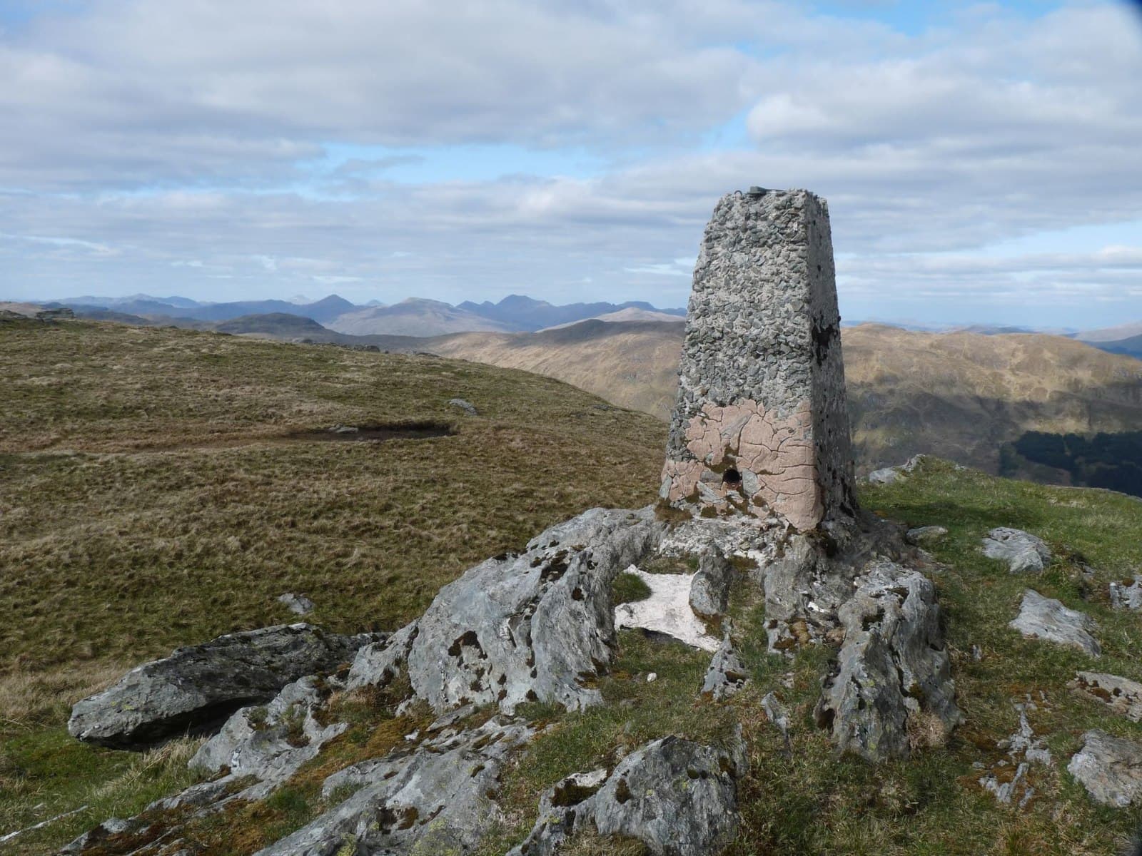
Beinn Ruadh (664m) — the red hill — is a wedge-shaped summit on the Cowal peninsula in NS18, standing between Loch Eck and Loch Long. Its 502m of prominence makes it a striking landmark on the Argyll skyline. The flat-topped rock summit looks east across the Firth of Clyde to the cones of Arran and west into the heart of the Argyll Forest Park.
Gaelic: “mountain, red” · Pronunciation: bine roo-ah
Quick facts
- Height
- 664.6m/ 2180ft
- Prominence
- 502 m
- Distance
- 13 km
- Ascent
- 544 m
- Time
- 3–6 hrs
- Grid ref
- NS155884
- Parking
- NS152921
- Nearest city
- Glasgow· 49km
- Dogs
- Dogs on lead required near livestockDog-friendly guide ↗
Height and prominence cross-checked against the Database of British and Irish Hills (CC BY).
No GPX track yet
Walked this route? Share your track to help other walkers.
Standard route
heather and bracken 60% · grass slopes 25% · rocky summit 15%
Start from the Forestry car park at Glenbranter on the A815 north of Dunoon and follow the forest road south-east into Glen Massan. Climb the steep west flank through forestry, breaking out above the treeline at around 350m onto bracken and heather. The summit ridge is gained directly with the large rock cairn appearing at the eastern end of the broad top.
Terrain
Forestry road on the lower slopes, then thick bracken and windthrow at the treeline that can be awkward to thread. Above the forest the going is bilberry and short heather onto a broad summit ridge. The rock cairn is unmistakable.
In winter
Cowal winters bring wet snow more often than dry powder. Beinn Ruadh's steep west face holds rotten snow on bracken slopes — best avoided in any thaw cycle. The summit area is generally wind-scoured. Ferries and the A83 can be disrupted by storms.
Best time of year
Getting there
- Glasgow1h 10m
- Edinburgh2h 22m
OS maps: OS Landranger 56
Mobile signal: Variable. EE flickers up top; better near the Cowal coast.
Current conditions
Daylight Today
- Sunrise
- 04:51
- Sunset
- 22:00
- Civil dawn
- 03:54
- Civil dusk
- 22:57
NOAA Solar Calculator · 13 July 2026
On a long-distance route
Beinn Ruadh sits within 5km of these named long-distance walks — useful for trail-pack rest days or section extensions.
Around Beinn Ruadh on the SCOT network
Getting there, basing yourself, and what to do off the hill.
Getting there: Gourock station
Ferry to Dunoon and Kilcreggan; Inverclyde coast walks
13km from the hill
tripscot.co.uk
On TripSCOTBase yourself in Luss
West Loch Lomond village — Highland Boundary, Loch Lomond Way
21km from the hill
tripscot.co.uk
On TasteSCOTAfter the hill: Loch Lomond
Alexandria — sprawling distillery on the south end of the loch
24km from the hill
tastescot.co.uk
Beinn Ruadh — common questions
- Is Beinn Ruadh a hard climb?
- Beinn Ruadh is rated 3/5 (moderately challenging) on the OutdoorSCOT scale. The standard route covers about 13km with 544m of ascent and takes most walkers 3-6 hours. Ground conditions: Forestry road on the lower slopes, then thick bracken and windthrow at the treeline that can be awkward to thread.
- How much drop does Beinn Ruadh have?
- The drop is 502m: measured from the summit of Beinn Ruadh down to the saddle joining it to higher terrain.
- Where's the parking for Beinn Ruadh?
- Park at NS152921. Double-check the grid reference on an OS map first; informal laybys here fill early in high season.
- What's the best month to climb Beinn Ruadh?
- Aim for March, April, May, June, July, August, September, October, November on Beinn Ruadh. In the remaining months treat it as a winter hill — full kit, solid navigation, and a look at the relevant SAIS avalanche forecast before you go.
- Can dogs go up Beinn Ruadh?
- Dogs are fine on a lead. The route passes livestock or ground-nesting bird habitat, so keep them close throughout.
- Will I get phone signal on Beinn Ruadh?
- Variable. EE flickers up top; better near the Cowal coast.
- Is Beinn Ruadh safe in winter?
- Cowal winters bring wet snow more often than dry powder. Beinn Ruadh's steep west face holds rotten snow on bracken slopes — best avoided in any thaw cycle. The summit area is generally wind-scoured. Ferries and the A83 can be disrupted by storms.
Get the OutdoorSCOT weekly
One email a week — new route, hill and bothy guides, seasonal conditions and the odd hard-won lesson. No spam, unsubscribe in one click.