Long distance
Three Lochs Way
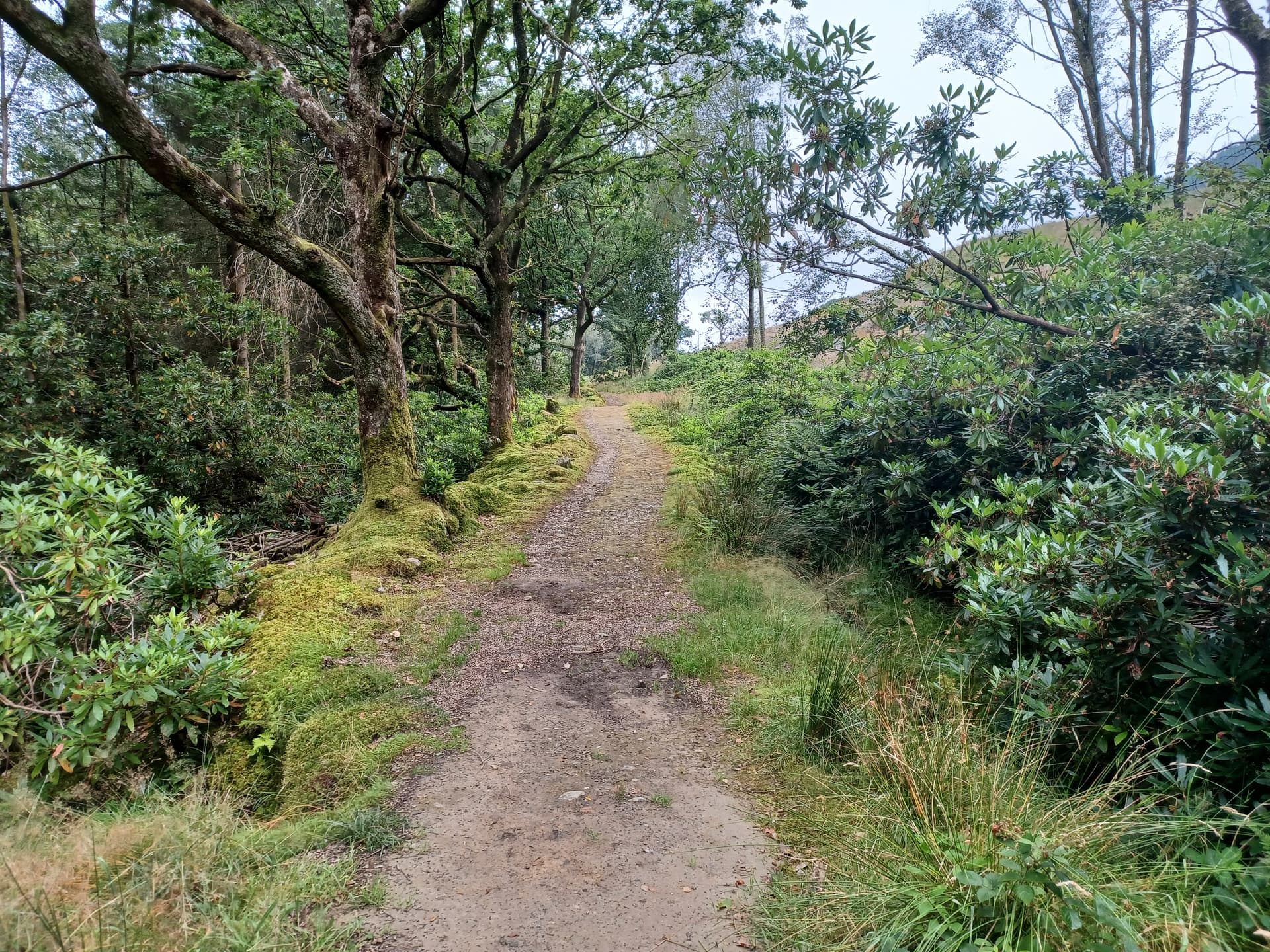
A short route from Balloch to Inveruglas linking Loch Lomond, the Gareloch and Loch Long, crossing the Highland Boundary Fault towards the Southern Highlands. 55 km (34 mi), about 1,500 m of ascent, rarely rising above 250 m, walked in 3–4 days. The surface is minor roads, old coffin and drove routes, forestry and landrover tracks, with the West Highland Line never far away.
Quick facts
- Distance
- 55 km/ 34 mi
- Typical days
- 4
- Total ascent
- 1500 m
- Difficulty
- easy
- Start → Finish
- Balloch → Inveruglas
- Best direction
- South to North
- Water sources
- Balloch, Helensburgh, Garelochhead (off-route), Arrochar and Tarbet have taps and shops. Stage 3 through the training area has no facilities — carry the day's water and treat anything from burns.
- Mobile signal
- Signal in Balloch, Helensburgh, Garelochhead, Arrochar and Tarbet; it may drop on the training area and Glen Loin sections.
✔ Waymarked throughout
Approximate profile derived from per-stage ascent — accurate on total climb and pattern, not a pixel-precise GPX trace.
Our take
The Three Lochs Way is a fine long-weekend route for Glasgow residents — train to Balloch, walk for three or four days, bus home from Inveruglas. The gradients are never severe; the character changes from the Stoneymollan Road and Helensburgh's leafy streets to the Garelochhead military training area and then the Arrochar Alps over Loch Long. A confidence-builder before tackling something longer.
Highlights
- Stoneymollan Road and the Loch Lomond view from Goukhill Muir
- The Hill House in Helensburgh and the Highlandman's Road
- Glen Fruin, site of the 1603 clan battle
- Loch Long and the Arrochar Alps north of Glen Douglas; Glen Loin and the Sloy hydro scheme
Day-by-day itinerary
A suggested 4-day schedule. Adjust to your fitness and conditions.
1Balloch to Helensburgh14.5km · 400m ascent
From Balloch station past Loch Lomond Shores onto the Stoneymollan Road, an old drove and coffin road, over the Killoeter escarpment (with a short detour to the Goukhill Muir viewpoint over Loch Lomond), then down through Camis Eskan forest to The Hill House in Helensburgh.
- Terrain
- Minor roads, a historic right of way, forest roads, footpaths and informal trods.
- Overnight
- Helensburgh has a good range of accommodation and three railway stations.
- Stats
- Balloch → Helensburgh · 14.5km · ↑400m
2Helensburgh to the Yankee Road (Garelochhead)10.5km · 200m ascent
From The Hill House up the Highlandman's Road, an old coffin road, across the River Fruin and west along the quiet road through Glen Fruin past the 1603 battle stone to the southern end of the Yankee Road at the Garelochhead military training area.
- Terrain
- Improved track, then a long section of quiet minor road. Cattle with calves on the Highlandman's Road in spring — dogs on a lead.
- Overnight
- Garelochhead village is about 2 km along the Yankee Road and a 1.5 km path down, or 4 km by the minor road. Arrange a pick-up if you can.
- Stats
- Helensburgh → Garelochhead · 10.5km · ↑200m
3Garelochhead to Arrochar20.5km · 490m ascent
North through the Garelochhead military training area on the Yankee Road and forest roads to Glen Douglas, then the most scenic section of the route: a landrover track high above Loch Long with views to the Arrochar Alps, to Arrochar and on to Tarbet.
- Terrain
- Tarmac military road, forest roads and landrover tracks. The training area occasionally closes — check before you go (the official site gives the number and an A814 alternative).
- Overnight
- Arrochar and Tarbet have plenty of accommodation.
- Stats
- Garelochhead → Arrochar · 20.5km · ↑490m
4Arrochar to Inveruglas9.5km · 411m ascent
From Tarbet station through Glen Loin woodland, over a low bealach to Coiregrogain under Ben Vorlich, A' Chrois and Ben Vane, then down the Sloy hydro road to Inveruglas. The last kilometre is beside the busy A82.
- Terrain
- Good paths, tracks and the hydro road.
- Overnight
- Limited accommodation at Inveruglas (Loch Lomond Holiday Park); more at Tarbet. Citylink buses on the A82.
- Stats
- Arrochar → Inveruglas · 9.5km · ↑411m
Hills along the route
Munros, Corbetts, Grahams and Donalds near the route line — extensions or rest-day options.
Transport
To start (Balloch)
Train · ScotRail
Glasgow Queen Street to Balloch (terminus), where the Way starts
Helensburgh, Garelochhead and Arrochar & Tarbet stations are on or near the route for section walking.
Check times & book →
From finish (Inveruglas)
Bus · Scottish Citylink
The Glasgow bus up the west shore of Loch Lomond stops at Inveruglas — listed as "Loch Sloy Power Station" in many timetables
Check which services stop there before you travel; Arrochar & Tarbet station is the rail alternative.
Check times & book →Train · ScotRail
Nearest station Arrochar & Tarbet (~3 miles south) on the West Highland Line
Check times & book →
Best months
Accommodation
A range of accommodation in Balloch, Helensburgh, Garelochhead, Arrochar and Tarbet. Garelochhead is off the route: stage 2 ends at the Yankee Road on the edge of the military training area, about 2 km plus a 1.5 km path from the village — the official site suggests arranging a pick-up from your hosts. At Inveruglas there is only limited accommodation at the holiday park. Do not use the timber shelters in the training area; they are for military use only.
Night-by-night guide: where to stay →Resupply
Shops in Balloch, Helensburgh, Garelochhead, Arrochar and Tarbet; never more than a day from a town.
Connect with
Chain into a longer expedition by combining with adjacent long-distance routes.
Three Lochs Way + Loch Lomond & Cowal Way
The Cowal Way can be joined at Arrochar (threelochsway.co.uk, read 2026-10-27)
Join the Cowal Way at Arrochar to continue west into the Argyll peninsulas.
Three Lochs Way + West Highland Way
No path link: the WHW runs up the east shore of Loch Lomond. Cruise Loch Lomond ferries from Tarbet cross to it (threelochsway.co.uk, read 2026-10-27).
Walk the Three Lochs Way to Tarbet, take the ferry across Loch Lomond and continue north on the West Highland Way.
Current conditions
Weather at the start point (Balloch)
Daylight Today
- Sunrise
- 07:16
- Sunset
- 16:48
- Civil dawn
- 06:37
- Civil dusk
- 17:27
NOAA Solar Calculator · 28 October 2026
Share your experience
Walked the Three Lochs Way? Help others plan their trip.
Getting to and from the Three Lochs Way
Train and town anchors at each end of the route — on TripSCOT.
Start: Balloch station
South Loch Lomond — WHW start at Drymen / Conic Hill
0km from Balloch
tripscot.co.uk
On TripSCOTFinish: Arrochar & Tarbet station
Arrochar Alps — The Cobbler, Beinn Ime, Beinn Narnain, Ben Vane, Ben Vorlich
5km from Inveruglas
tripscot.co.uk
On TripSCOTStock up: Luss
West Loch Lomond village — Highland Boundary, Loch Lomond Way
tripscot.co.uk