Graham · Arrochar & Trossachs
Beinn Bhreac
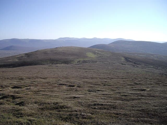
Beinn Bhreac (680m) sits east of Loch Lomond in the NN32 square, a flecked greenstone dome above Glen Luss whose Gaelic name means simply speckled hill. With 530m of prominence it is the high point of a quiet quarter of the Luss Hills, looking across the loch to the Arrochar peaks and southward over the Vale of Leven toward Glasgow.
Quick facts
- Height
- 680.8m/ 2234ft
- Prominence
- 530 m
- Distance
- 13 km
- Ascent
- 558 m
- Time
- 3–6 hrs
- Grid ref
- NN321000
- Parking
- NN275001
- Nearest
- Glasgow· Glasgow 44km
- Dogs
- Dogs on lead required near livestockDog-friendly guide ↗
Height and prominence cross-checked against the Database of British and Irish Hills (CC BY).
No GPX track yet
Walked this route? Share your track to help other walkers.
Standard route
heather and bog 60% · rocky slopes 25% · grassy summit 15%
From the parking pull-in at Edentaggart in Glen Luss, follow the estate track north-east into the corrie beneath the south-west face. Strike up bracken and tussock onto the broad shoulder at around 500m, then take the grassy crest to the trig. Most parties return by the same line, though a continuation north over Doune Hill makes a satisfying longer day.
Terrain
Estate track then bracken and waist-high tussock on the shoulder, easing onto cropped grass above 550m. A short band of broken mica-schist near the summit ridge offers easy hands-on steps. The crest itself is broad and friendly underfoot.
In winter
The Luss Hills hold snow patchily — usually thawed at the base, plastered above 500m on the north-east face. Verglas on the schist outcrop near the trig is the most common winter hazard. SAIS does not cover this corner so judge by what Arrochar across the loch has received.
This hill is in the Southern Highlands SAIS forecast area. Check SAIS forecasts in winter (December–April).
Best time of year
Getting there
- Glasgow1h 3m
- Edinburgh2h 4m
OS maps: OS Landranger 56
Mobile signal: Poor. Remote Knoydart; no reliable signal from any network.
Current conditions
Daylight Today
- Sunrise
- 04:49
- Sunset
- 22:00
- Civil dawn
- 03:52
- Civil dusk
- 22:57
NOAA Solar Calculator · 13 July 2026
On a long-distance route
Beinn Bhreac sits within 5km of these named long-distance walks — useful for trail-pack rest days or section extensions.
Around Beinn Bhreac on the SCOT network
Getting there, basing yourself, and what to do off the hill.
Getting there: Arrochar & Tarbet station
Arrochar Alps — The Cobbler, Beinn Ime, Beinn Narnain, Ben Vane, Ben Vorlich
5km from the hill
tripscot.co.uk
On TripSCOTBase yourself in Luss
West Loch Lomond village — Highland Boundary, Loch Lomond Way
8km from the hill
tripscot.co.uk
On TasteSCOTAfter the hill: Loch Lomond
Alexandria — sprawling distillery on the south end of the loch
21km from the hill
tastescot.co.uk
Beinn Bhreac — common questions
- What difficulty is Beinn Bhreac?
- On the OutdoorSCOT scale, Beinn Bhreac comes in at 3/5 — moderately challenging. Expect roughly 13km and 558m of ascent on the usual route — 3-6 hours for most parties. Terrain: Estate track then bracken and waist-high tussock on the shoulder, easing onto cropped grass above 550m.
- How prominent is Beinn Bhreac?
- Beinn Bhreac has 530m of topographic prominence — the height of its summit above the highest col connecting it to higher ground.
- Where should I park to climb Beinn Bhreac?
- Standard parking is at NN275001 near Glasgow. Check the parking grid reference on an OS map before travel; informal laybys can fill on summer weekends.
- When should I climb Beinn Bhreac?
- The standard good-weather months for Beinn Bhreac are March, April, May, June, July, August, September, October, November. Outside those months, expect winter conditions on the high ground — full mountain kit, navigation skills, and a check of the SAIS avalanche forecast for the relevant region.
- Can I bring my dog up Beinn Bhreac?
- On a lead only — the route crosses ground with livestock or nesting-bird interest.
- What's mobile reception like on Beinn Bhreac?
- Poor. Remote Knoydart; no reliable signal from any network.
- Is Beinn Bhreac safe in winter?
- The Luss Hills hold snow patchily — usually thawed at the base, plastered above 500m on the north-east face. Verglas on the schist outcrop near the trig is the most common winter hazard. SAIS does not cover this corner so judge by what Arrochar across the loch has received.
Get the OutdoorSCOT weekly
One email a week — new route, hill and bothy guides, seasonal conditions and the odd hard-won lesson. No spam, unsubscribe in one click.