Graham · Arrochar & Trossachs
Beinn Eich
Beinn Eich (701m) is the prominent cone of the Luss Hills above the western shore of Loch Lomond, set in the NS39 square. The name — hill of the horse — refers to the high pony track that once crossed its eastern shoulder. As the most accessible of the group from Glen Luss, it forms a fine short day or the first peak in the classic horseshoe with Doune Hill and Beinn Lochain.
Quick facts
- Height
- 701.5m/ 2302ft
- Prominence
- 157 m
- Distance
- 13 km
- Ascent
- 575 m
- Time
- 3–6 hrs
- Grid ref
- NS302946
- Parking
- NS295953
- Nearest city
- Glasgow· 41km
- Dogs
- Dogs on lead required near livestockDog-friendly guide ↗
Height and prominence cross-checked against the Database of British and Irish Hills (CC BY).
No GPX track yet
Walked this route? Share your track to help other walkers.
Standard route
heather and bracken 55% · grass slopes 30% · rocky summit 15%
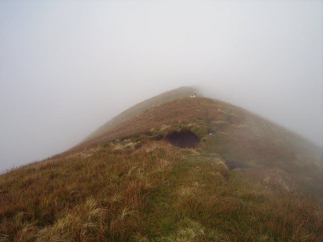
From the parking area at Glen Striddle in Glen Luss the gravel estate road climbs north-west for 1km before a clear path strikes up the south-east ridge. The going is steady on cropped grass with one short steepening at 500m where the path eases left. The cairn sits on a tiny rocky platform with the whole Loch Lomond basin opening at your feet.
Terrain
Estate track for the first kilometre, then a rebuilt path on the south-east ridge climbing through bracken and short turf. The upper third is on schist and mica gravel with occasional outcrop but no scrambling. Bracken is a real obstacle late summer if you stray from the path.
In winter
Loch Lomond hills sit just inside the Highland Boundary Fault and rarely hold deep snow, but the south-east ridge can ice hard in February. Wind off Loch Long funnels onto the summit unpleasantly. With the trailhead under an hour from Glasgow these hills make a fine winter half-day when the bigger Munros are out of condition.
This hill is in the Southern Highlands SAIS forecast area. Check SAIS forecasts in winter (December–April).
Best time of year
Getting there
- Glasgow1h 59m
- Edinburgh2h 5m
OS maps: OS Landranger 56
Mobile signal: Good signal throughout; EE reliable with clear views to Loch Lomond and Firth of Clyde.
Current conditions
Daylight Today
- Sunrise
- 04:50
- Sunset
- 21:59
- Civil dawn
- 03:52
- Civil dusk
- 22:57
NOAA Solar Calculator · 13 July 2026
Pair with
Curated multi-hill combinations from Beinn Eich.
Around Beinn Eich on the SCOT network
Getting there, basing yourself, and what to do off the hill.
Getting there: Arrochar & Tarbet station
Arrochar Alps — The Cobbler, Beinn Ime, Beinn Narnain, Ben Vane, Ben Vorlich
10km from the hill
tripscot.co.uk
On TripSCOTBase yourself in Luss
West Loch Lomond village — Highland Boundary, Loch Lomond Way
6km from the hill
tripscot.co.uk
On TasteSCOTAfter the hill: Loch Lomond
Alexandria — sprawling distillery on the south end of the loch
17km from the hill
tastescot.co.uk
Beinn Eich — common questions
- How difficult is Beinn Eich?
- Beinn Eich carries a 3/5 (moderately challenging) grade on the OutdoorSCOT scale. Count on about 13km, 575m of ascent and a 3-6 hour day on the standard route. Ground conditions: Estate track for the first kilometre, then a rebuilt path on the south-east ridge climbing through bracken and short turf.
- How much drop does Beinn Eich have?
- The drop is 157m: measured from the summit of Beinn Eich down to the saddle joining it to higher terrain.
- Where's the parking for Beinn Eich?
- Park at NS295953. Double-check the grid reference on an OS map first; informal laybys here fill early in high season.
- What's the best month to climb Beinn Eich?
- Aim for April, May, June, July, August, September, October on Beinn Eich. In the remaining months treat it as a winter hill — full kit, solid navigation, and a look at the relevant SAIS avalanche forecast before you go.
- Can dogs go up Beinn Eich?
- Dogs are fine on a lead. The route passes livestock or ground-nesting bird habitat, so keep them close throughout.
- Will I get phone signal on Beinn Eich?
- Good signal throughout; EE reliable with clear views to Loch Lomond and Firth of Clyde.
- Is Beinn Eich safe in winter?
- Loch Lomond hills sit just inside the Highland Boundary Fault and rarely hold deep snow, but the south-east ridge can ice hard in February. Wind off Loch Long funnels onto the summit unpleasantly. With the trailhead under an hour from Glasgow these hills make a fine winter half-day when the bigger Munros are out of condition.
Get the OutdoorSCOT weekly
One email a week — new route, hill and bothy guides, seasonal conditions and the odd hard-won lesson. No spam, unsubscribe in one click.