Corbett · Arrochar & Trossachs
Beinn a' Choin
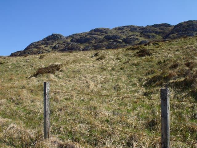
Beinn a' Choin — "hill of the dog" — is a 768m Corbett above the wild east shore of Loch Lomond, between Inversnaid and Glen Falloch. The hill sits in some of the most attractive country in the Loch Lomond National Park, with the long arm of the loch directly below the summit and the Arrochar Alps filling the western horizon. The 345m prominence puts it well clear of its neighbours and the summit is a small cairn on a wide grassy top.
Quick facts
- Height
- 768.7m/ 2522ft
- Prominence
- 345 m
- Distance
- 14 km
- Ascent
- 630 m
- Time
- 4–6 hrs
- Grid ref
- NN354130
- Parking
- NN405099
- Nearest city
- Stirling· 48km
- Dogs
- Dogs on lead required near livestockDog-friendly guide ↗
Height and prominence cross-checked against the Database of British and Irish Hills (CC BY).
No GPX track yet
Walked this route? Share your track to help other walkers.
Standard route
WHW path 20% · rough heather 40% · grassy ridge 30% · summit area 10%
Start from the Inveruglas Visitor Centre on the A82 west of Loch Lomond and take the ferry across to Inversnaid (or drive round via Aberfoyle and Stronachlachar). From Inversnaid follow the West Highland Way north a short way then climb the rough east-side hillside onto the broad south ridge of Beinn a' Choin. Around 14km return with 630m of ascent. The Stronachlachar approach is the dry-foot alternative.
Terrain
The West Highland Way path is well-built. Off it the lower hill is bracken and oak woodland with no path — steep and slippery in the wet. The upper ridge is short heather and grass with the summit cairn at the highest of several small bumps. No exposure or scrambling. Watch for adders in heather on warm summer days.
In winter
A typical Loch Lomond winter hill — the maritime position means snow is intermittent but the steep east face above the loch ices up readily. The Cruachan ferry from Inveruglas is seasonal; check schedules. The Stronachlachar approach via the B829 is the most reliable winter access.
This hill is in the Southern Highlands SAIS forecast area. Check SAIS forecasts in winter (December–April).
Best time of year
Getting there
- Glasgow1h 16m
- Edinburgh2h 5m
OS maps: OS Landranger 50, OS Landranger 56
Mobile signal: Intermittent in the Loch Lomond National Park; zero higher on the hill
Current conditions
Daylight Today
- Sunrise
- 04:48
- Sunset
- 22:00
- Civil dawn
- 03:50
- Civil dusk
- 22:58
NOAA Solar Calculator · 13 July 2026
Pair with
Curated multi-hill combinations from Beinn a' Choin.
On a long-distance route
Beinn a' Choin sits within 5km of these named long-distance walks — useful for trail-pack rest days or section extensions.
Around Beinn a' Choin on the SCOT network
Getting there, basing yourself, and what to do off the hill.
Beinn a' Choin — common questions
- How difficult is Beinn a' Choin?
- Beinn a' Choin carries a 3/5 (moderately challenging) grade on the OutdoorSCOT scale. Count on about 14km, 630m of ascent and a 4-6 hour day on the standard route. Terrain: The West Highland Way path is well-built.
- How prominent is Beinn a' Choin?
- Beinn a' Choin has 345m of topographic prominence — the height of its summit above the highest col connecting it to higher ground.
- Where should I park to climb Beinn a' Choin?
- Standard parking is at NN405099. Check the parking grid reference on an OS map before travel; informal laybys can fill on summer weekends.
- When should I climb Beinn a' Choin?
- The standard good-weather months for Beinn a' Choin are April, May, June, July, August, September, October. Outside those months, expect winter conditions on the high ground — full mountain kit, navigation skills, and a check of the SAIS avalanche forecast for the relevant region.
- Can I bring my dog up Beinn a' Choin?
- On a lead only — the route crosses ground with livestock or nesting-bird interest.
- What's mobile reception like on Beinn a' Choin?
- Intermittent in the Loch Lomond National Park; zero higher on the hill
- Is Beinn a' Choin safe in winter?
- A typical Loch Lomond winter hill — the maritime position means snow is intermittent but the steep east face above the loch ices up readily. The Cruachan ferry from Inveruglas is seasonal; check schedules. The Stronachlachar approach via the B829 is the most reliable winter access.
Get the OutdoorSCOT weekly
One email a week — new route, hill and bothy guides, seasonal conditions and the odd hard-won lesson. No spam, unsubscribe in one click.