Corbett · Arrochar & Trossachs
Meall an Fhudair
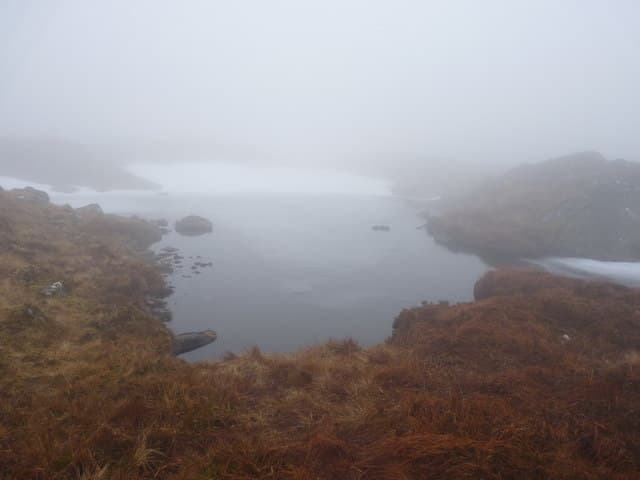
Meall an Fhudair — "hill of the powder", apparently a reference to old whisky-still smoke — is a 764m Corbett at the head of Glen Falloch, between Tyndrum and Loch Lomond. The hill sits in the rolling country east of the A82, with 382m of prominence putting it well clear of any near neighbour. The summit is a wide grassy dome rather than a defined peak; the highest point is unmarked except by a few small stones on broad mossy turf. View south down the length of Loch Lomond is exceptional.
Quick facts
- Height
- 764m/ 2507ft
- Prominence
- 382 m
- Distance
- 14 km
- Ascent
- 626 m
- Time
- 4–6 hrs
- Grid ref
- NN270192
- Parking
- NN320185
- Nearest city
- Oban· 42km
- Dogs
- Dogs on lead required near livestockDog-friendly guide ↗
Height and prominence cross-checked against the Database of British and Irish Hills (CC BY).
No GPX track yet
Walked this route? Share your track to help other walkers.
Standard route
glen path 20% · steep heather 40% · grassy ridge 30% · summit area 10%
Park at Inverarnan on the A82 at the head of Loch Lomond and follow the rough estate track east up Glen Falloch toward Beinglas. After roughly 3km on the track, climb open grass slopes north onto the broad south ridge of Meall an Fhudair. The ridge gives a steady pull to the summit dome. Around 14km return with 626m of ascent.
Terrain
The estate track in Glen Falloch is firm. Beyond the track the slopes are short heather and grass mixed with patches of bog — pathless but undemanding. The summit area is broad mossy turf with no clear high point; carry a GPS or take a careful bearing in mist. No exposure or scrambling.
In winter
A gentle winter Corbett — easy gradients, no avalanche risk, and a reliable A82 approach. The summit dome is featureless in whiteout; navigation is the main concern. The Glen Falloch road and Inverarnan are gritted year-round. Often used as an alternative on days when the higher Arrochar Alps are weathered out.
This hill is in the Southern Highlands SAIS forecast area. Check SAIS forecasts in winter (December–April).
Best time of year
Getting there
- Glasgow2h 30m
- Edinburgh2h 18m
OS maps: OS Landranger 50, OS Landranger 56
Mobile signal: Reasonable signal at Inverarnan; intermittent on the summit
Current conditions
Daylight Today
- Sunrise
- 04:49
- Sunset
- 22:01
- Civil dawn
- 03:50
- Civil dusk
- 22:59
NOAA Solar Calculator · 13 July 2026
Around Meall an Fhudair on the SCOT network
Getting there, basing yourself, and what to do off the hill.
Meall an Fhudair — common questions
- Is Meall an Fhudair a hard climb?
- Meall an Fhudair is rated 3/5 (moderately challenging) on the OutdoorSCOT scale. The standard route covers about 14km with 626m of ascent and takes most walkers 4-6 hours. Ground conditions: The estate track in Glen Falloch is firm.
- How much drop does Meall an Fhudair have?
- The drop is 382m: measured from the summit of Meall an Fhudair down to the saddle joining it to higher terrain.
- Where's the parking for Meall an Fhudair?
- Park at NN320185. Double-check the grid reference on an OS map first; informal laybys here fill early in high season.
- What's the best month to climb Meall an Fhudair?
- Aim for April, May, June, July, August, September, October on Meall an Fhudair. In the remaining months treat it as a winter hill — full kit, solid navigation, and a look at the relevant SAIS avalanche forecast before you go.
- Can dogs go up Meall an Fhudair?
- Dogs are fine on a lead. The route passes livestock or ground-nesting bird habitat, so keep them close throughout.
- Will I get phone signal on Meall an Fhudair?
- Reasonable signal at Inverarnan; intermittent on the summit
- Is Meall an Fhudair safe in winter?
- A gentle winter Corbett — easy gradients, no avalanche risk, and a reliable A82 approach. The summit dome is featureless in whiteout; navigation is the main concern. The Glen Falloch road and Inverarnan are gritted year-round. Often used as an alternative on days when the higher Arrochar Alps are weathered out.
Get the OutdoorSCOT weekly
One email a week — new route, hill and bothy guides, seasonal conditions and the odd hard-won lesson. No spam, unsubscribe in one click.