Graham · Arrochar & Trossachs
Beinn Damhain
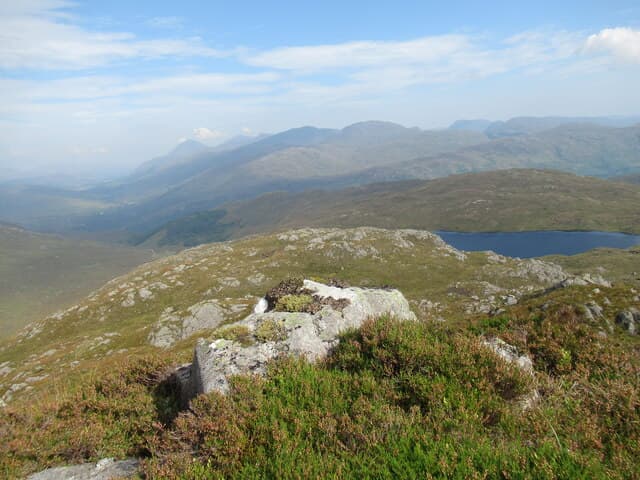
Beinn Damhain (684m) — the hill of the stag — is a pyramidal schist peak above Glen Falloch, set in the NN21 square west of Crianlarich. Its steep northern face plunges over 400m to the West Highland Way in the glen below. The summit looks east to Beinn a' Chleibh and west toward Beinn Bhuidhe.
Quick facts
- Height
- 684.2m/ 2245ft
- Prominence
- 220 m
- Distance
- 13 km
- Ascent
- 561 m
- Time
- 3–6 hrs
- Grid ref
- NN282172
- Parking
- NN250133
- Nearest city
- Oban· 44km
- Dogs
- Dogs on lead required near livestockDog-friendly guide ↗
Height and prominence cross-checked against the Database of British and Irish Hills (CC BY).
No GPX track yet
Walked this route? Share your track to help other walkers.
Standard route
heather and bog 60% · grass slopes 25% · rocky summit 15%
From the parking pull-in on the A82 at the foot of Glen Falloch take the West Highland Way north for 1km then cross the river by the footbridge. Climb the south-east ridge directly on cropped grass and schist outcrop. The ridge is steep and unrelenting but the going is firm.
Terrain
West Highland Way and bridge, then very steep grass and outcrop to the summit. The south-east ridge has occasional schist steps requiring use of hands but stays well within walking. The summit is a tiny cropped turf platform with no shelter.
In winter
Glen Falloch sits in the wet western belt and snow is heavy but transient. Beinn Damhain's steep south-east ridge ices fast and becomes a serious Grade I outing. Cornices form along the northern crags above the West Highland Way. SAIS Glen Coe forecasts apply.
This hill is in the Southern Highlands SAIS forecast area. Check SAIS forecasts in winter (December–April).
Best time of year
Getting there
- Glasgow1h 26m
- Edinburgh2h 16m
OS maps: OS Landranger 50, OS Landranger 56
Mobile signal: Poor. Remote Cowal/Knapdale area; limited coverage.
Current conditions
Daylight Today
- Sunrise
- 04:49
- Sunset
- 22:01
- Civil dawn
- 03:51
- Civil dusk
- 22:59
NOAA Solar Calculator · 13 July 2026
Around Beinn Damhain on the SCOT network
Getting there, basing yourself, and what to do off the hill.
Beinn Damhain — common questions
- Is Beinn Damhain a hard climb?
- Beinn Damhain is rated 3/5 (moderately challenging) on the OutdoorSCOT scale. The standard route covers about 13km with 561m of ascent and takes most walkers 3-6 hours. Underfoot: West Highland Way and bridge, then very steep grass and outcrop to the summit.
- What is Beinn Damhain's prominence?
- 220m of prominence. That's the vertical drop from the summit to the col that links Beinn Damhain to the next higher ground.
- Where do I park for Beinn Damhain?
- Most walkers start from NN250133. Verify the grid reference on an OS map before you set off — space is tight on busy summer weekends.
- When is the best time to climb Beinn Damhain?
- March, April, May, June, July, August, September, October, November give the most reliable conditions on Beinn Damhain. Beyond that window the high ground turns wintry: carry full mountain kit, be confident navigating, and check the SAIS avalanche forecast for the area.
- Is Beinn Damhain dog-friendly?
- Yes, but dogs must be kept on a lead — there is livestock or ground-nesting bird interest on the route.
- Is there mobile signal on Beinn Damhain?
- Poor. Remote Cowal/Knapdale area; limited coverage.
- Is Beinn Damhain safe in winter?
- Glen Falloch sits in the wet western belt and snow is heavy but transient. Beinn Damhain's steep south-east ridge ices fast and becomes a serious Grade I outing. Cornices form along the northern crags above the West Highland Way. SAIS Glen Coe forecasts apply.
Get the OutdoorSCOT weekly
One email a week — new route, hill and bothy guides, seasonal conditions and the odd hard-won lesson. No spam, unsubscribe in one click.