Graham · Arrochar & Trossachs
Meall Mor
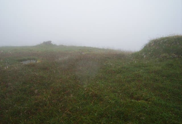
A grassy dome between Glen Falloch and Glen Gyle on the eastern flanks of Loch Lomond, looking across the head of the loch to Ben Vorlich and Ben Vane. Quiet country compared with the nearby Arrochar Alps, with deer and few walkers.
Gaelic: “rounded hill, big” · Pronunciation: myowl more
Quick facts
- Height
- 746m/ 2448ft
- Prominence
- 264 m
- Distance
- 14 km
- Ascent
- 612 m
- Time
- 4–6 hrs
- Grid ref
- NN383151
- Parking
- NN362188
- Nearest city
- Stirling· 47km
- Dogs
- Dogs on lead required near livestockDog-friendly guide ↗
Height and prominence cross-checked against the Database of British and Irish Hills (CC BY).
No GPX track yet
Walked this route? Share your track to help other walkers.
Standard route
glen path 20% · heather hillside 50% · grassy upper slopes 20% · summit area 10%
Park at Inverarnan or use the small layby at the south end of Loch Sloy access road, then follow a hill track up Glen Gyle and grind up the south-east slopes via short heather and grass to the broad top.
Terrain
Hydro service tracks low down, then trackless heather and a long grassy whaleback. Wet underfoot after rain — the area drains slowly.
In winter
Mild winter conditions are the norm given the maritime location, but rapid wet-snow dumps from south-westerly fronts plaster the upper slopes. Treat hidden burn channels under fresh snow with respect.
This hill is in the Southern Highlands SAIS forecast area. Check SAIS forecasts in winter (December–April).
Best time of year
Getting there
- Glasgow1h 17m
- Edinburgh2h 3m
OS maps: OS Landranger 50, OS Explorer 364
Mobile signal: Poor signal in this Loch Lomond/Arrochar area
Current conditions
Daylight Today
- Sunrise
- 04:54
- Sunset
- 21:55
- Civil dawn
- 03:58
- Civil dusk
- 22:51
NOAA Solar Calculator · 17 July 2026
Pair with
Curated multi-hill combinations from Meall Mor.
On a long-distance route
Meall Mor sits within 5km of these named long-distance walks — useful for trail-pack rest days or section extensions.
Around Meall Mor on the SCOT network
Getting there, basing yourself, and what to do off the hill.
Meall Mor — common questions
- What difficulty is Meall Mor?
- On the OutdoorSCOT scale, Meall Mor comes in at 3/5 — moderately challenging. Expect roughly 14km and 612m of ascent on the usual route — 4-6 hours for most parties. Terrain: Hydro service tracks low down, then trackless heather and a long grassy whaleback.
- How prominent is Meall Mor?
- Meall Mor has 264m of topographic prominence — the height of its summit above the highest col connecting it to higher ground.
- Where should I park to climb Meall Mor?
- Standard parking is at NN362188. Check the parking grid reference on an OS map before travel; informal laybys can fill on summer weekends.
- When should I climb Meall Mor?
- The standard good-weather months for Meall Mor are April, May, June, July, August, September, October. Outside those months, expect winter conditions on the high ground — full mountain kit, navigation skills, and a check of the SAIS avalanche forecast for the relevant region.
- Can I bring my dog up Meall Mor?
- On a lead only — the route crosses ground with livestock or nesting-bird interest.
- What's mobile reception like on Meall Mor?
- Poor signal in this Loch Lomond/Arrochar area
- Is Meall Mor safe in winter?
- Mild winter conditions are the norm given the maritime location, but rapid wet-snow dumps from south-westerly fronts plaster the upper slopes. Treat hidden burn channels under fresh snow with respect.
Get the OutdoorSCOT weekly
One email a week — new route, hill and bothy guides, seasonal conditions and the odd hard-won lesson. No spam, unsubscribe in one click.