Graham · Arrochar & Trossachs
Fiarach
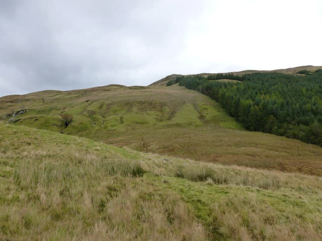
Fiarach (652m) — the slanting one — is the long ridge that closes the south side of Strath Fillan in the NN32 square. The small cairn on rock at the high point overlooks the West Highland Way, with Ben More and Stob Binnein filling the south-east skyline.
Quick facts
- Height
- 652.2m/ 2140ft
- Prominence
- 181 m
- Distance
- 13 km
- Ascent
- 535 m
- Time
- 3–6 hrs
- Grid ref
- NN344261
- Parking
- NN352291
- Nearest city
- Oban· 49km
- Dogs
- Dogs on lead required near livestockDog-friendly guide ↗
Height and prominence cross-checked against the Database of British and Irish Hills (CC BY).
No GPX track yet
Walked this route? Share your track to help other walkers.
Standard route
heather and bog 65% · grass slopes 20% · rocky summit 15%
Park at Auchtertyre by the West Highland Way. Walk south on the WHW past the wigwams, then leave it to cross the Crom Allt and zig-zag up the broad north flank of Fiarach. A faint quad rut leads onto the long ridge — turn south-west along the crest to gain the small cairn perched on a rock platform.
Terrain
WHW tarmac and gravel at the start, then bog and rough heather climbing the north flank. The summit ridge is firm grass with rock breaks; the cairn is small but the platform itself is unmistakable.
In winter
Strath Fillan sees regular snow that softens fast in maritime air. Fiarach's ridge holds drifted snow on its east flank toward Glen Falloch and a careful look at the cornice line is worthwhile in fresh fall. Daylight from Crianlarich is just enough for a winter half-day from the WHW.
This hill is in the Southern Highlands SAIS forecast area. Check SAIS forecasts in winter (December–April).
Best time of year
Getting there
- Glasgow2h 34m
- Edinburgh2h 14m
OS maps: OS Landranger 50
Mobile signal: Moderate. EE near Crianlarich and the WHW; weaker on the ridge crest.
Current conditions
Daylight Today
- Sunrise
- 04:48
- Sunset
- 22:01
- Civil dawn
- 03:49
- Civil dusk
- 23:00
NOAA Solar Calculator · 13 July 2026
Around Fiarach on the SCOT network
Getting there, basing yourself, and what to do off the hill.
Fiarach — common questions
- What difficulty is Fiarach?
- On the OutdoorSCOT scale, Fiarach comes in at 3/5 — moderately challenging. Expect roughly 13km and 535m of ascent on the usual route — 3-6 hours for most parties. Ground conditions: WHW tarmac and gravel at the start, then bog and rough heather climbing the north flank.
- How much drop does Fiarach have?
- The drop is 181m: measured from the summit of Fiarach down to the saddle joining it to higher terrain.
- Where's the parking for Fiarach?
- Park at NN352291. Double-check the grid reference on an OS map first; informal laybys here fill early in high season.
- What's the best month to climb Fiarach?
- Aim for March, April, May, June, July, August, September, October, November on Fiarach. In the remaining months treat it as a winter hill — full kit, solid navigation, and a look at the relevant SAIS avalanche forecast before you go.
- Can dogs go up Fiarach?
- Dogs are fine on a lead. The route passes livestock or ground-nesting bird habitat, so keep them close throughout.
- Will I get phone signal on Fiarach?
- Moderate. EE near Crianlarich and the WHW; weaker on the ridge crest.
- Is Fiarach safe in winter?
- Strath Fillan sees regular snow that softens fast in maritime air. Fiarach's ridge holds drifted snow on its east flank toward Glen Falloch and a careful look at the cornice line is worthwhile in fresh fall. Daylight from Crianlarich is just enough for a winter half-day from the WHW.
Get the OutdoorSCOT weekly
One email a week — new route, hill and bothy guides, seasonal conditions and the odd hard-won lesson. No spam, unsubscribe in one click.