Graham · Glen Coe & Lochaber
Beinn na Sroine
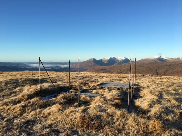
Beinn na Sroine (635m), the "hill of the nose," forms a long ridge above Glen Strae in the NN23 square, between Dalmally and Loch Etive. Its summit rock looks west over the gathering point where Strae, Orchy and Lochy waters meet, with Ben Cruachan rising massively to the south-west. A rough estate track from the B8077 gives the most direct line, though the descent off the broad shoulders is often slower than the climb.
Quick facts
- Height
- 635.8m/ 2086ft
- Prominence
- 221 m
- Distance
- 12 km
- Ascent
- 476 m
- Time
- 3–5 hrs
- Grid ref
- NN234289
- Parking
- NN250304
- Nearest city
- Oban· 37km
- Dogs
- Dogs on lead required near livestockDog-friendly guide ↗
Height and prominence cross-checked against the Database of British and Irish Hills (CC BY).
No GPX track yet
Walked this route? Share your track to help other walkers.
Standard route
heather moorland 65% · grass slopes 25% · rocky summit 10%
Park near the steading at NN250304 and follow the estate track north into the lower glen before bearing west onto rough deer grass. The crest is a sequence of small rises rather than a single dome, so navigation is by burn lines and bealachs rather than a single path. Allow five hours for the round; the descent into Strae demands care to avoid a steep nose of broken ground above the river.
Terrain
Wet grass, deer grass and occasional outcrops of mica schist make for slow walking above the estate track. The upper crest is gentler but the small rises mean a steady drip of re-ascent. Tributaries of the Allt Coire na Sroine cut deep gullies on the west side and should be skirted rather than crossed.
In winter
Glen Strae sits in the path of moisture-laden west winds, so the hill takes a dose of wet snow that crusts then thaws repeatedly. The schist outcrops glaze fast and the broad upper ridges hold drifted snow in hollows that hide watercourses. Check the SAIS South Argyll forecast before committing to a winter ascent.
This hill is in the Glen Coe SAIS forecast area. Check SAIS forecasts in winter (December–April).
Best time of year
Getting there
- Glasgow2h 44m
- Edinburgh2h 28m
OS maps: OS Landranger 50
Mobile signal: Poor. Remote Loch Lochy/Great Glen area; limited coverage.
Current conditions
Daylight Today
- Sunrise
- 04:54
- Sunset
- 21:57
- Civil dawn
- 03:58
- Civil dusk
- 22:54
NOAA Solar Calculator · 17 July 2026
Around Beinn na Sroine on the SCOT network
Getting there, basing yourself, and what to do off the hill.
Beinn na Sroine — common questions
- Is Beinn na Sroine a hard climb?
- Beinn na Sroine is rated 3/5 (moderately challenging) on the OutdoorSCOT scale. The standard route covers about 12km with 476m of ascent and takes most walkers 3-5 hours. Ground conditions: Wet grass, deer grass and occasional outcrops of mica schist make for slow walking above the estate track.
- How much drop does Beinn na Sroine have?
- The drop is 221m: measured from the summit of Beinn na Sroine down to the saddle joining it to higher terrain.
- Where's the parking for Beinn na Sroine?
- Park at NN250304. Double-check the grid reference on an OS map first; informal laybys here fill early in high season.
- What's the best month to climb Beinn na Sroine?
- Aim for March, April, May, June, July, August, September, October, November on Beinn na Sroine. In the remaining months treat it as a winter hill — full kit, solid navigation, and a look at the relevant SAIS avalanche forecast before you go.
- Can dogs go up Beinn na Sroine?
- Dogs are fine on a lead. The route passes livestock or ground-nesting bird habitat, so keep them close throughout.
- Will I get phone signal on Beinn na Sroine?
- Poor. Remote Loch Lochy/Great Glen area; limited coverage.
- Is Beinn na Sroine safe in winter?
- Glen Strae sits in the path of moisture-laden west winds, so the hill takes a dose of wet snow that crusts then thaws repeatedly. The schist outcrops glaze fast and the broad upper ridges hold drifted snow in hollows that hide watercourses. Check the SAIS South Argyll forecast before committing to a winter ascent.
Get the OutdoorSCOT weekly
One email a week — new route, hill and bothy guides, seasonal conditions and the odd hard-won lesson. No spam, unsubscribe in one click.