Graham · Arrochar & Trossachs
Meall nan Gabhar
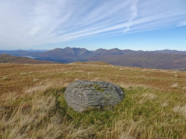
A grassy summit at the head of Glen Strae north-east of Loch Awe, an outlier of the Beinn Eunaich-Beinn a' Chochuill ridge across the glen. Quiet and seldom climbed, with the bulk of Ben Cruachan filling the south-west view.
Gaelic: “rounded hill, of the, goat” · Pronunciation: myowl nan gabhar
Quick facts
- Height
- 744m/ 2441ft
- Prominence
- 265 m
- Distance
- 14 km
- Ascent
- 610 m
- Time
- 4–6 hrs
- Grid ref
- NN235240
- Parking
- NN140290
- Nearest city
- Oban· 38km
- Dogs
- Dogs on lead required near livestockDog-friendly guide ↗
Height and prominence cross-checked against the Database of British and Irish Hills (CC BY).
No GPX track yet
Walked this route? Share your track to help other walkers.
Standard route
estate track 30% · heather hillside 45% · grassy ridge 15% · summit area 10%
From the bridge at Castles in Glen Strae, walk the estate track north into the glen, then ascend the long grassy south-west spur. Featureless ridge walking leads to the summit boulder.
Terrain
Decent estate track, then trackless soft grass and scattered boulders. The ridge gives easy walking but no shelter.
In winter
Wet snow from passing Atlantic systems is the dominant winter condition. The ridge holds little snow but the burns lower down can be substantial obstacles when in spate after a thaw.
This hill is in the Southern Highlands SAIS forecast area. Check SAIS forecasts in winter (December–April).
Best time of year
Getting there
- Glasgow2h 38m
- Edinburgh2h 25m
OS maps: OS Landranger 50
Mobile signal: Marginal signal in upper Glen Lyon area
Current conditions
Daylight Today
- Sunrise
- 04:55
- Sunset
- 21:57
- Civil dawn
- 03:58
- Civil dusk
- 22:53
NOAA Solar Calculator · 17 July 2026
Around Meall nan Gabhar on the SCOT network
Getting there, basing yourself, and what to do off the hill.
Meall nan Gabhar — common questions
- Is Meall nan Gabhar a hard climb?
- Meall nan Gabhar is rated 3/5 (moderately challenging) on the OutdoorSCOT scale. The standard route covers about 14km with 610m of ascent and takes most walkers 4-6 hours. Underfoot: Decent estate track, then trackless soft grass and scattered boulders.
- What is Meall nan Gabhar's prominence?
- 265m of prominence. That's the vertical drop from the summit to the col that links Meall nan Gabhar to the next higher ground.
- Where do I park for Meall nan Gabhar?
- Most walkers start from NN140290. Verify the grid reference on an OS map before you set off — space is tight on busy summer weekends.
- When is the best time to climb Meall nan Gabhar?
- April, May, June, July, August, September, October give the most reliable conditions on Meall nan Gabhar. Beyond that window the high ground turns wintry: carry full mountain kit, be confident navigating, and check the SAIS avalanche forecast for the area.
- Is Meall nan Gabhar dog-friendly?
- Yes, but dogs must be kept on a lead — there is livestock or ground-nesting bird interest on the route.
- Is there mobile signal on Meall nan Gabhar?
- Marginal signal in upper Glen Lyon area
- Is Meall nan Gabhar safe in winter?
- Wet snow from passing Atlantic systems is the dominant winter condition. The ridge holds little snow but the burns lower down can be substantial obstacles when in spate after a thaw.
Get the OutdoorSCOT weekly
One email a week — new route, hill and bothy guides, seasonal conditions and the odd hard-won lesson. No spam, unsubscribe in one click.