Long distance
West Highland Way
Scotland's most famous long-distance trail and the busiest in the UK. Runs from a northern Glasgow suburb to Fort William under the shadow of Ben Nevis, via Loch Lomond, Glen Coe and Rannoch Moor. Best walked best south-to-north over 7 days. The full route covers 154 km (96 mi) with 3,200 m of climbing — a sustained week-plus walk.
Quick facts
- Distance
- 154 km/ 96 mi
- Typical days
- 7
- Total ascent
- 3200 m
- Difficulty
- moderate
- Start → Finish
- Milngavie → Fort William
- Best direction
- South to North
- Water sources
- Tap water at every overnight stop (Drymen, Rowardennan, Inverarnan, Tyndrum, Bridge of Orchy, Kingshouse, Kinlochleven, Fort William). Multiple inns and cafes along the route fill bottles. Burns on the Conic Hill descent and Rannoch Moor are reliable but slow to treat. Carry 1.5L between stops on the Rannoch Moor day.
- Mobile signal
- EE/Vodafone/O2 coverage at all main towns and most overnight stops. Signal patchy along Loch Lomond east shore and across Rannoch Moor; reliable again from Bridge of Orchy north. The Devil's Staircase / Kinlochleven section can drop signal entirely.
✔ Waymarked throughout
Approximate profile derived from per-stage ascent — accurate on total climb and pattern, not a pixel-precise GPX trace.
Our take
The West Highland Way is the beginner's long-distance walk — waymarked to a fault, supported by a dense chain of hostels, campsites and bunkhouses, and achievable by anyone fit enough to walk 20km a day for a week. It's also crowded in July and August, and the Loch Lomond section is genuinely busy. Do it in April or September for the best experience. Skip it entirely if your idea of a long-distance walk is solitude.
Highlights
- Conic Hill viewpoint over Loch Lomond
- The Devils Staircase descent into Kinlochleven
- Rannoch Moor crossing
- Final approach to Fort William under Ben Nevis
Mid-route waypoints
Navigation by progression marker rather than total distance.
| km | Waypoint | Type |
|---|---|---|
| 19 km | DrymenFirst major village; pubs, shops; route enters Garadhban Forest beyond | village |
| 32 km | Conic Hill / Balmaha361m summit with first big Loch Lomond views, then descent to lochside village | summit |
| 45 km | RowardennanFoot of Ben Lomond; popular overnight stop on Loch Lomond | village |
| 58 km | InversnaidHotel mid-route on rough east shore of Loch Lomond | inn |
| 67 km | Inverarnan / BeinglasDrovers Inn area; route leaves Loch Lomond shore | inn |
| 86 km | TyndrumTrail junction; rail and Citylink connections | village |
| 100 km | Bridge of OrchyStone bridge, hotel, request stop on West Highland Line | station |
| 122 km | KingshouseHistoric inn at gateway to Glencoe, edge of Rannoch Moor | inn |
| 137 km | KinlochlevenAfter the Devil's Staircase descent; last village before Fort William | village |
| 154 km | Fort WilliamFinish at the Gordon Square statue beneath Ben Nevis | finish |
Day-by-day itinerary
A suggested 7-day schedule. Adjust to your fitness and conditions.
1Milngavie to Drymen19km · 250m ascent
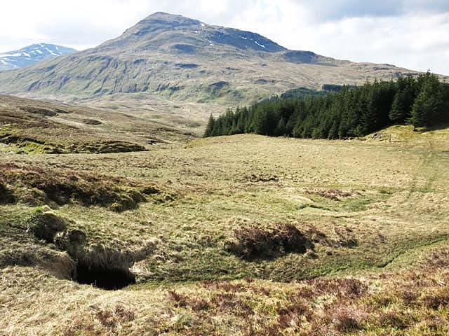
A gentle start through farmland and along the Allander Water. The walking is easy and flat, easing you into the trail before the hills begin. The terrain ranges from flat lochside paths to exposed moorland crossings, making it suitable for fit beginners and a confidence-builder before tackling harder Scottish trails.
- Terrain
- Farm tracks, woodland paths, quiet lanes. Flat throughout.
- Overnight
- Drymen has hotels, B&Bs, a campsite and a bunkhouse. The Clachan Inn is a popular first-night stop.
- Stats
- Milngavie → Drymen · 19km · ↑250m
2Drymen to Rowardennan23km · 450m ascent
Over Conic Hill with the first views of Loch Lomond, then along the east shore through oak woodland. Conic Hill is the day's highlight — a short, sharp climb with panoramic loch views.
- Terrain
- Hill path over Conic Hill (361m), then loch-shore woodland paths. Some rocky sections.
- Overnight
- Rowardennan Hotel, SYHA hostel, or wild camping on the loch shore (within camping management zone rules).
- Stats
- Drymen → Rowardennan · 23km · ↑450m
3Rowardennan to Inverarnan22km · 350m ascent
The tough loch-shore section. Roots, rocks and mud through oak woodland with the loch always beside you. Beautiful but physically demanding — allow more time than the distance suggests.
- Terrain
- Rocky loch-shore path, tree roots, muddy sections. Slow going despite flat profile.
- Overnight
- Inverarnan has the Drovers Inn (atmospheric), Beinglas Farm campsite, and a bunkhouse.
- Stats
- Rowardennan → Inverarnan · 22km · ↑350m
4Inverarnan to Tyndrum21km · 400m ascent
Through Glen Falloch and Strath Fillan — the landscape opens up as you leave Loch Lomond behind. The walking is easier than yesterday. Crianlarich offers a mid-day rest stop.
- Terrain
- Glen paths, river crossings (bridged), farm tracks. Moderate gradients.
- Overnight
- Tyndrum has the By The Way hostel, Green Welly Stop, hotels and a campsite. Crianlarich (2km off-route) has more options.
- Stats
- Inverarnan → Tyndrum · 21km · ↑400m
5Tyndrum to Kingshouse30km · 500m ascent
The longest day crosses Rannoch Moor — one of the great wilderness crossings in Britain. Flat but exposed, with the Black Mount hills rising on either side. The Kingshouse at the end is a welcome sight.
- Terrain
- Old military road, moorland paths, exposed moorland. Little shelter from wind and rain.
- Overnight
- Kingshouse Hotel (recently rebuilt, excellent), or wild camping on the moor. No other options for 30km.
- Stats
- Tyndrum → Kingshouse Hotel · 30km · ↑500m
6Kingshouse to Kinlochleven14km · 350m ascent
A short day over the Devil's Staircase — the highest point on the WHW at 548m. The zigzag climb is famous and the views back to Rannoch Moor and Buachaille Etive Mor are magnificent.
- Terrain
- Steep zigzag climb (Devil's Staircase), then good path descending to Kinlochleven.
- Overnight
- Kinlochleven has the Blackwater Hostel, Tailrace Inn, B&Bs and a bunkhouse. Good shops for resupply.
- Stats
- Kingshouse Hotel → Kinlochleven · 14km · ↑350m
7Kinlochleven to Fort William25km · 550m ascent
The final day climbs through the Lairigmor pass then descends through forest to Fort William. The last stretch through the suburbs is anticlimactic, but the finish at the statue in the town centre is satisfying.
- Terrain
- Hill pass (good path), forest tracks, suburban walking. One significant climb early in the day.
- Overnight
- Fort William has everything — celebrate with a proper meal and a bed.
- Stats
- Kinlochleven → Fort William · 25km · ↑550m
Hills along the route
Munros, Corbetts, Grahams and Donalds within 5km of the route line — extensions or rest-day options.
- Buachaille Etive Beag - Stob Coire Raineachmunro0km
- Garbh Bheinncorbett0.2km
- Stob Ghabharmunro0.3km
- Stob Banmunro0.3km
- Meall Odhargraham0.5km
- Beinn Udlaidhcorbett0.7km
- Beinn Mhic Chasgaigcorbett0.9km
- Buachaille Etive Mor - Stob na Broigemunro1km
- Beinn Chabhairmunro1km
- Meall Morgraham1.2km
- Aonach Eagach - Meall Deargmunro1.3km
- Beinn Dubhchraigmunro1.4km
Transport
To start (Milngavie)
Train · ScotRail
Glasgow Queen Street / Central to Milngavie (start of WHW)
Every 15–30 min; ~26 min journey
WHW obelisk is 200m walk from Milngavie station
Check times & book →
From finish (Fort William)
Train · ScotRail West Highland Line
Fort William to Glasgow Queen Street
3 daily plus sleeper
3h45 journey; one of the UK's most scenic rail routes
Check times & book →Bus · Scottish Citylink 914/915/916
Fort William to Glasgow Buchanan Bus Station
Several daily; ~3 hrs
Check times & book →Train · Caledonian Sleeper
Fort William to London Euston overnight
Nightly except Saturday
Check times & book →
Best months
Accommodation
Everything from campsites to 4-star hotels. Book 6+ months ahead for high season. Macs Adventure and similar companies run baggage-transfer itineraries.
Night-by-night guide: where to stay →Resupply
Resupply available at Drymen, Balmaha, Rowardennan, Inverarnan, Tyndrum, Kingshouse, Kinlochleven, Fort William. No genuinely remote sections. The longest gap is roughly 30km between Inverarnan and Tyndrum, though both have shops and pubs at either end. Bunkhouses and hostels often sell breakfast and trail food on top of accommodation.
Connect with
Chain into a longer expedition by combining with adjacent long-distance routes.
West Highland Way + Great Glen Way
Connects at Fort William (north end of WHW)
Walk the WHW from Milngavie to Fort William, then continue on the Great Glen Way to Inverness. Roughly 250km / 156mi over 12–14 days — the classic Lowlands-to-Highlands traverse.
West Highland Way + Cape Wrath Trail
Cape Wrath Trail starts at Fort William
For the full Scottish traverse: WHW to Fort William, then the unmarked Cape Wrath Trail north to the top of the country. Total ~470km / 290mi over 4–5 weeks.
Current conditions
Weather at the start point (Milngavie)
Daylight Today
- Sunrise
- 04:55
- Sunset
- 21:52
- Civil dawn
- 04:00
- Civil dusk
- 22:47
NOAA Solar Calculator · 17 July 2026
Share your experience
Walked the West Highland Way? Help others plan their trip.
Getting to and from the West Highland Way
Train and town anchors at each end of the route — on TripSCOT.
Start: Glasgow Queen Street
West Highland Line southern terminus; Highland Main Line
10km from Milngavie
tripscot.co.uk
On TripSCOTFinish: Fort William station
Ben Nevis, Mamores, Aonachs, Knoydart ferry connection
0km from Fort William
tripscot.co.uk
On TripSCOTStock up: Luss
West Loch Lomond village — Highland Boundary, Loch Lomond Way
tripscot.co.uk