Corbett · Glen Coe
Beinn Mhic Chasgaig
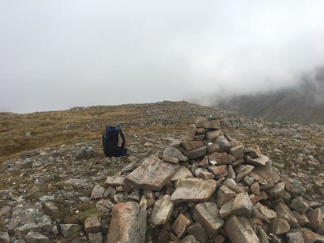
Beinn Mhic Chasgaig — 'the hill of MacChaschuig's son' — sits at the eastern edge of the Black Mount above the south side of Glen Etive, looking across to the Glen Coe peaks and north to the Buachailles. At 864m it is a satisfying short Corbett day from the Glen Etive road, often climbed by Munroists basing themselves at Inveroran or Bridge of Orchy with a free day from the higher peaks. The summit looks down on Loch Tulla and the long sweep of the Black Mount Munros to the north-west.
Gaelic: “mountain, son of” · Pronunciation: bine mhic chasgaig
Quick facts
- Height
- 864m/ 2835ft
- Prominence
- 166 m
- Distance
- 9 km
- Ascent
- 740 m
- Time
- 2–4 hrs
- Grid ref
- NN221502
- Parking
- NN187531
- Nearest city
- Fort William· 26km
- Dogs
- Dogs on lead required near livestockDog-friendly guide ↗
Height and prominence cross-checked against the Database of British and Irish Hills (CC BY).
No GPX track yet
Walked this route? Share your track to help other walkers.
Standard route
forest track 20% · deep bog 45% · heather moorland 25% · summit area 10%
Park at the bridge over the River Etive at Coupall (NN187531), where the A82 leaves the open Rannoch Moor and begins climbing into Glen Coe. Walk south along the old Glen Etive road for around 2km, then climb west up the broad east ridge of Beinn Mhic Chasgaig. The route gains height steadily through grass and rock outcrops to the summit. Strong walkers extend by traversing south-west to Clach Leathad and Stob Ghabhar (both Munros). Allow 4.5–5 hours for Beinn Mhic Chasgaig alone.
Terrain
Old road for the approach — easy. The hillside is steep grass with bands of rock outcrop; pick lines around the steeper sections. Summit is broad with a clear cairn. The ridge connecting to Clach Leathad is narrow and exposed at the col — committing terrain for the longer round.
In winter
In firm winter conditions Beinn Mhic Chasgaig is a fine short snow climb up the east face. The Black Mount avalanche profile applies; check the SAIS Glen Coe bulletin daily. The A82 at the Kingshouse can drift in heavy north-east winds. Good winter introduction for parties wanting an alternative to the bigger Black Mount Munros nearby.
This hill is in the Glen Coe SAIS forecast area. Check SAIS forecasts in winter (December–April).
Best time of year
Getting there
- Glasgow2h 58m
- Edinburgh3h 44m
OS maps: OS Landranger 41
Mobile signal: EE/Vodafone reasonable on the A82 between Kingshouse and the Black Mount; intermittent on the east ridge; brief on summit
Current conditions
Daylight Today
- Sunrise
- 04:47
- Sunset
- 22:04
- Civil dawn
- 03:48
- Civil dusk
- 23:03
NOAA Solar Calculator · 13 July 2026
On a long-distance route
Beinn Mhic Chasgaig sits within 5km of these named long-distance walks — useful for trail-pack rest days or section extensions.
Around Beinn Mhic Chasgaig on the SCOT network
Getting there, basing yourself, and what to do off the hill.
Getting there: Bridge of Orchy station
Black Mount; Beinn Dorain, Beinn an Dothaidh, Beinn Achaladair, Beinn a Chreachain
13km from the hill
tripscot.co.uk
On TripSCOTBase yourself in Fort William
Ben Nevis base, West Highland Line, gateway to Lochaber
26km from the hill
tripscot.co.uk
On TasteSCOTAfter the hill: Ben Nevis Distillery
Fort William — Lochaber distillery at the foot of the Ben; long-aged Japanese-owned classics
28km from the hill
tastescot.co.uk
Beinn Mhic Chasgaig — common questions
- How difficult is Beinn Mhic Chasgaig?
- Beinn Mhic Chasgaig carries a 2/5 (moderate) grade on the OutdoorSCOT scale. Count on about 9km, 740m of ascent and a 2-4 hour day on the standard route. Underfoot: Old road for the approach — easy.
- What is Beinn Mhic Chasgaig's prominence?
- 166m of prominence. That's the vertical drop from the summit to the col that links Beinn Mhic Chasgaig to the next higher ground.
- Where do I park for Beinn Mhic Chasgaig?
- Most walkers start from NN187531. Verify the grid reference on an OS map before you set off — space is tight on busy summer weekends.
- When is the best time to climb Beinn Mhic Chasgaig?
- May, June, July, August, September, October give the most reliable conditions on Beinn Mhic Chasgaig. Beyond that window the high ground turns wintry: carry full mountain kit, be confident navigating, and check the SAIS avalanche forecast for the area.
- Is Beinn Mhic Chasgaig dog-friendly?
- Yes, but dogs must be kept on a lead — there is livestock or ground-nesting bird interest on the route.
- Is there mobile signal on Beinn Mhic Chasgaig?
- EE/Vodafone reasonable on the A82 between Kingshouse and the Black Mount; intermittent on the east ridge; brief on summit
- Is Beinn Mhic Chasgaig safe in winter?
- In firm winter conditions Beinn Mhic Chasgaig is a fine short snow climb up the east face. The Black Mount avalanche profile applies; check the SAIS Glen Coe bulletin daily. The A82 at the Kingshouse can drift in heavy north-east winds. Good winter introduction for parties wanting an alternative to the bigger Black Mount Munros nearby.
Get the OutdoorSCOT weekly
One email a week — new route, hill and bothy guides, seasonal conditions and the odd hard-won lesson. No spam, unsubscribe in one click.