Munro · Glen Coe & Lochaber
Meall a' Bhuiridh
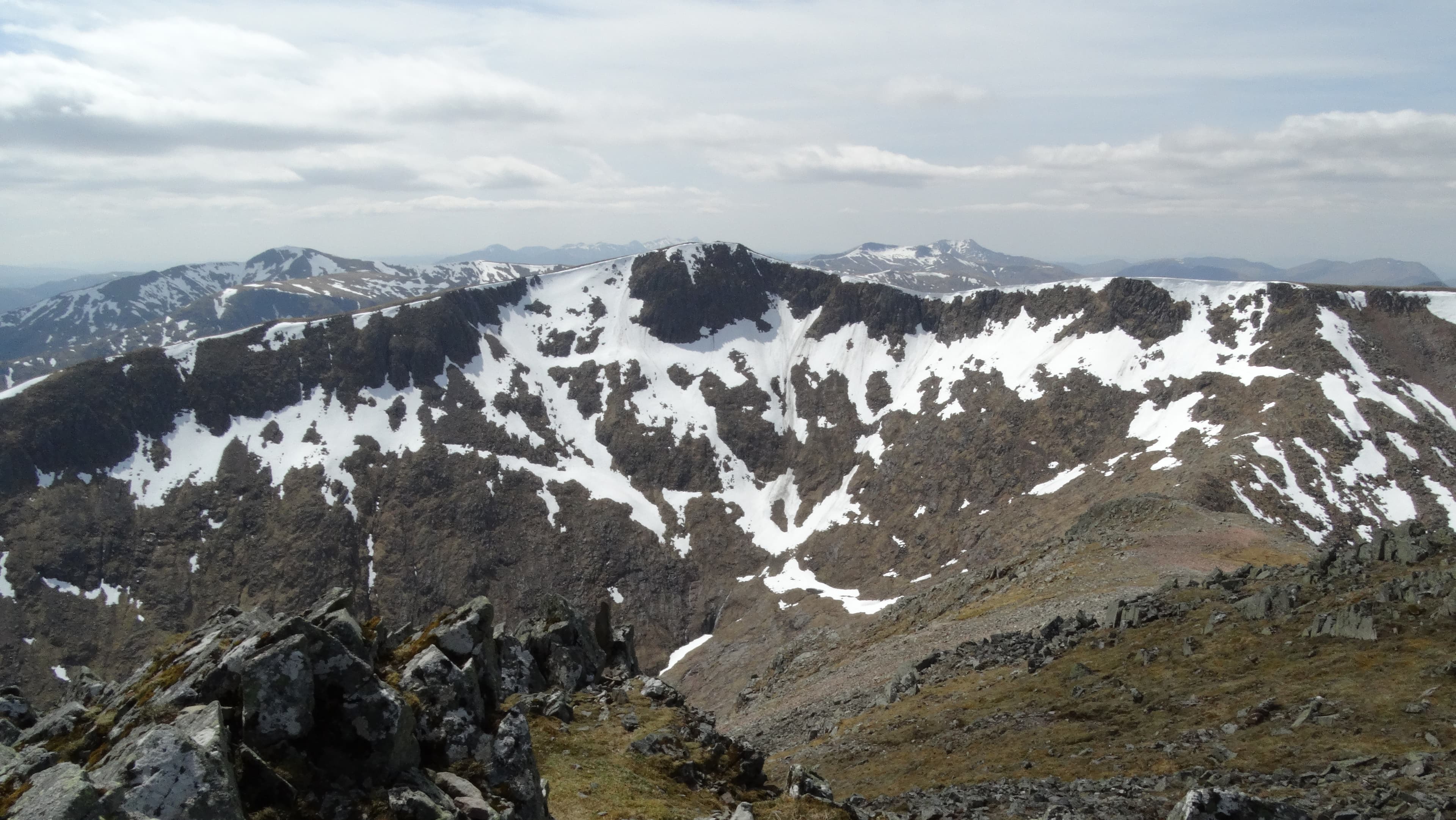
Meall a' Bhuiridh — the Gaelic name evokes the roaring of red deer in the autumn rut — is the 1108m Munro that hosts the Glencoe Mountain ski area on its north-east flank, rising directly above Rannoch Moor at the eastern entrance to Glen Coe. The summit is a rocky outcrop on a broad plateau with one of the most extensive views in the Highlands: the full length of Rannoch Moor east, the Black Mount ridge south, and the Glen Coe peaks west. Often paired with Creise via the high south ridge.
Gaelic: “rounded hill, of the, roaring” · Pronunciation: myowl uh bhuiridh
Quick facts
- Height
- 1107.9m/ 3635ft
- Prominence
- 795 m
- Distance
- 10.5 km
- Ascent
- 1093 m
- Time
- 5–7 hrs
- Grid ref
- NN250503
- Parking
- NN267525
- Nearest city
- Fort William· 28km
- Dogs
- Dogs on lead required near livestockDog-friendly guide ↗
Height and prominence cross-checked against the Database of British and Irish Hills (CC BY).
No GPX track yet
Walked this route? Share your track to help other walkers.
Standard route
Ski area path 40% · Open hillside 35% · Summit / ridge to Creise 25%
The standard line is from the Glencoe Mountain ski centre off the A82. Climb the east ridge — directly up the ski piste in summer when the lifts are not running — to gain the summit. A direct out-and-back makes a quick half-day. Most parties traverse west to Creise via the connecting ridge for a two-Munro round (around 10.5km with 1090m of ascent).
Terrain
The ski-area access road is firm tarmac. In summer the ski piste lines give clear ground to the upper plateau; the path is informal in places. The summit area is broad rocky plateau with the cairn on a small outcrop. The connecting ridge to Creise is grass and rock with one short steep section onto Creise.
In winter
A working ski hill; the ski area runs Glencoe Mountain Resort. In and out of ski season the upper slopes hold significant snow and avalanche risk on the off-piste corries. Cornicing on the north-east edges. The A82 is gritted and reliable. SAIS Glencoe applies. Skiers and walkers share the slopes — be aware of fast piste traffic.
This hill is in the Glen Coe SAIS forecast area. Check SAIS forecasts in winter (December–April).
Best time of year
Getting there
- Glasgow2h 57m
- Edinburgh3h 41m
OS maps: OS Landranger 41
Mobile signal: Good signal at the Glencoe Mountain ski area. Signal drops above 800m.
Current conditions
Daylight Today
- Sunrise
- 05:03
- Sunset
- 21:49
- Civil dawn
- 04:09
- Civil dusk
- 22:43
NOAA Solar Calculator · 23 July 2026
Pair with
Curated multi-hill combinations from Meall a' Bhuiridh.
Around Meall a' Bhuiridh on the SCOT network
Getting there, basing yourself, and what to do off the hill.
Getting there: Bridge of Orchy station
Black Mount; Beinn Dorain, Beinn an Dothaidh, Beinn Achaladair, Beinn a Chreachain
12km from the hill
tripscot.co.uk
On TripSCOTBase yourself in Fort William
Ben Nevis base, West Highland Line, gateway to Lochaber
28km from the hill
tripscot.co.uk
On TasteSCOTAfter the hill: Ben Nevis Distillery
Fort William — Lochaber distillery at the foot of the Ben; long-aged Japanese-owned classics
29km from the hill
tastescot.co.uk
Meall a' Bhuiridh — common questions
- How hard is Meall a' Bhuiridh?
- We grade Meall a' Bhuiridh at 4/5, which puts it in challenging territory. The usual route is around 10.5km with 1093m of climbing; allow 5-7 hours. Underfoot: The ski-area access road is firm tarmac.
- What is Meall a' Bhuiridh's prominence?
- 795m of prominence. That's the vertical drop from the summit to the col that links Meall a' Bhuiridh to the next higher ground.
- Where do I park for Meall a' Bhuiridh?
- Most walkers start from NN267525. Verify the grid reference on an OS map before you set off — space is tight on busy summer weekends.
- When is the best time to climb Meall a' Bhuiridh?
- May, June, July, August, September, October give the most reliable conditions on Meall a' Bhuiridh. Beyond that window the high ground turns wintry: carry full mountain kit, be confident navigating, and check the SAIS avalanche forecast for the area.
- Is Meall a' Bhuiridh dog-friendly?
- Yes, but dogs must be kept on a lead — there is livestock or ground-nesting bird interest on the route.
- Is there mobile signal on Meall a' Bhuiridh?
- Good signal at the Glencoe Mountain ski area. Signal drops above 800m.
- Is Meall a' Bhuiridh safe in winter?
- A working ski hill; the ski area runs Glencoe Mountain Resort. In and out of ski season the upper slopes hold significant snow and avalanche risk on the off-piste corries. Cornicing on the north-east edges. The A82 is gritted and reliable. SAIS Glencoe applies. Skiers and walkers share the slopes — be aware of fast piste traffic.
Get the OutdoorSCOT weekly
One email a week — new route, hill and bothy guides, seasonal conditions and the odd hard-won lesson. No spam, unsubscribe in one click.