Long distance
Cape Wrath Trail
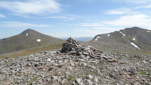
Unofficial but legendary route from Fort William to Cape Wrath, the north-westernmost point on the British mainland. One of the toughest long-distance walks in Europe. 18 days, 370 km (230 mi), 12,000 m of cumulative ascent; a unwaymarked route best tackled best south-to-north — a serious wilderness undertaking.
Quick facts
- Distance
- 370 km/ 230 mi
- Typical days
- 18
- Total ascent
- 12000 m
- Difficulty
- expert
- Start → Finish
- Fort William → Cape Wrath
- Best direction
- South to North
- Water sources
- Fort William, Glenfinnan, Shiel Bridge, Strathcarron, Torridon, Dundonnell, Ullapool, Inchnadamph, Rhiconich and Cape Wrath are the only resupply / tap points. Burns and rivers are reliable in the remote sections — treat. Carry 2-3L between Glenfinnan and Shiel Bridge (Knoydart day) and on the Fisherfield crossing. The Cape Wrath lighthouse café is the final refill.
- Mobile signal
- No coverage on most days. EE/Vodafone at Fort William, Shiel Bridge, Torridon (intermittent), Ullapool, Inchnadamph (poor), Rhiconich, and Cape Wrath lighthouse. Knoydart, Fisherfield, Assynt, and Sutherland all sit out-of-signal. Carry a satellite messenger if relying on remote contact.
⚠ Not waymarked — navigation skills required
Approximate profile derived from per-stage ascent — accurate on total climb and pattern, not a pixel-precise GPX trace.
Our take
The Cape Wrath Trail is the walk most ambitious UK long-distance hikers aspire to. It is genuinely serious: unmarked, river crossings that sometimes can't be crossed, multi-day gaps between resupply, exposed high-level sections, and the famous Cape Wrath bombing range that the MoD close at short notice. You need proper mountain skills, tolerance for solitude, and a willingness to flexibly reroute around weather. Do it in the short shoulder windows of late May or early September — midge hell in July.
Highlights
- Knoydart peninsula crossing
- The Falls of Glomach
- Beinn Dearg Mor and Fisherfield
- Sandwood Bay
- The final walk to Cape Wrath lighthouse
Day-by-day itinerary
A suggested 11-day schedule. Adjust to your fitness and conditions.
1Fort William to Glenfinnan27km · 500m ascent
Follow the road and paths west from Fort William past the Caledonian Canal to Glenfinnan at the head of Loch Shiel. The Glenfinnan Viaduct and monument set the tone.
- Terrain
- Road walking, forest tracks, rough paths. Variable quality.
- Overnight
- Glenfinnan has the Sleeping Car bunkhouse and B&Bs. Wild camping near the monument.
- Stats
- Fort William → Glenfinnan · 27km · ↑500m
2Glenfinnan to Kinloch Hourn40km · 900m ascent
A major day crossing remote terrain through Glen Finnan and over to Loch Hourn. This section enters true wilderness — no roads, no services. Can be split with a wild camp.
- Terrain
- Rough mountain paths, river crossings, trackless moorland. Navigation essential.
- Overnight
- A'Chuil bothy or wild camping. No facilities until Kinloch Hourn.
- Stats
- Glenfinnan → Kinloch Hourn · 40km · ↑900m
3Kinloch Hourn to Kintail22km · 700m ascent
Over the hills between Loch Hourn and Loch Duich. Steep, remote terrain with stunning views to the Knoydart peninsula and the Five Sisters of Kintail.
- Terrain
- Mountain passes, steep descents, rough paths.
- Overnight
- Shiel Bridge has the Kintail Lodge and bunkhouse. Ratagan SYHA is nearby.
- Stats
- Kinloch Hourn → Shiel Bridge · 22km · ↑700m
4Kintail to Strathcarron35km · 800m ascent
Through Glen Elchaig or via the high route over the hills. A long day through increasingly dramatic Wester Ross landscape.
- Terrain
- Glen paths, hill passes, some forestry tracks. Remote and rough.
- Overnight
- Strathcarron has the Strathcarron Hotel and a few B&Bs. Resupply at the small shop.
- Stats
- Shiel Bridge → Strathcarron · 35km · ↑800m
5Strathcarron to Torridon25km · 600m ascent
Through Coulin forest and past Loch Clair into the heart of Torridon. The mountains — Liathach, Beinn Eighe — are some of the most dramatic in Scotland.
- Terrain
- Forest paths, hill tracks, some road walking. Moderate terrain.
- Overnight
- Torridon SYHA, Torridon Inn, campsite. Good facilities for this point on the trail.
- Stats
- Strathcarron → Torridon · 25km · ↑600m
6Torridon to Dundonnell40km · 1000m ascent
Through the Fisherfield wilderness — the most remote section of the route. Shenavall bothy is the mid-point. River crossings can be dangerous in spate.
- Terrain
- Trackless moorland, mountain passes, river crossings. Serious navigation required.
- Overnight
- Shenavall bothy (mid-point). Dundonnell Hotel at the end. Wild camping throughout.
- Stats
- Torridon → Dundonnell · 40km · ↑1000m
7Dundonnell to Ullapool32km · 500m ascent
Along the coast or over the hills to Ullapool — the first real town since Fort William. Resupply here for the final push north.
- Terrain
- Coastal paths, hill tracks, road walking into Ullapool.
- Overnight
- Ullapool has full facilities — hostels, hotels, B&Bs, supermarket. Rest day recommended.
- Stats
- Dundonnell → Ullapool · 32km · ↑500m
8Ullapool to Inchnadamph35km · 600m ascent
Into the Assynt landscape — some of the most geologically distinctive terrain in Europe. Suilven, Canisp and Quinag are visible throughout.
- Terrain
- Road walking, moorland paths, rough ground. Improving paths near Inchnadamph.
- Overnight
- Inchnadamph Lodge (hostel). Wild camping. Very limited other options.
- Stats
- Ullapool → Inchnadamph · 35km · ↑600m
9Inchnadamph to Rhiconich42km · 700m ascent
Through the heart of Sutherland past Loch More and beneath Arkle and Foinaven. Remote, wild and beautiful. Usually split over two days.
- Terrain
- Mountain paths, trackless moorland, river crossings. Very remote.
- Overnight
- Glencoul bothy (detour). Wild camping. Rhiconich Hotel at the end.
- Stats
- Inchnadamph → Rhiconich · 42km · ↑700m
10Rhiconich to Sandwood Bay22km · 300m ascent
Along the coast to Sandwood Bay — widely considered Scotland's most beautiful beach. The perfect penultimate camp.
- Terrain
- Moorland paths, some coastal walking. Easier terrain than previous days.
- Overnight
- Wild camp at Sandwood Bay. Strathchailleach bothy is nearby. No other options.
- Stats
- Rhiconich → Sandwood Bay · 22km · ↑300m
11Sandwood Bay to Cape Wrath18km · 400m ascent
The final day along the cliff tops to Cape Wrath lighthouse — the northwestern tip of mainland Britain. Check MOD firing range schedules before setting out. Kearvaig bothy is near the end.
- Terrain
- Cliff-top paths, moorland, some exposed coastal walking. MOD range crossing.
- Overnight
- Kearvaig bothy near the lighthouse. Return via ferry and minibus from Cape Wrath.
- Stats
- Sandwood Bay → Cape Wrath · 18km · ↑400m
Hills along the route
Munros, Corbetts, Grahams and Donalds within 5km of the route line — extensions or rest-day options.
- Druim nan Cnamh (Beinn Loinne)corbett0.1km
- Meall a' Chrasgaidhmunro0.2km
- Sgurr nan Clach Gealamunro0.3km
- Carn a' Choire Ghairbhcorbett0.4km
- Sgurr nan Eachmunro0.5km
- Sail Chaorainnmunro0.5km
- Sgurr Choinnich (Sgurr Choinich)graham0.5km
- Sgurr nan Conbhaireanmunro0.7km
- Sgurr na Lapaichmunro0.7km
- An Sithean (An Sidhean)corbett1km
- Carn Ghluasaidmunro1km
- Quinag — Sail Gharbhcorbett1.4km
Transport
To start (Fort William)
Train · ScotRail West Highland Line
Glasgow Queen Street to Fort William
3 daily; ~3h45
Check times & book →Train · Caledonian Sleeper
London Euston to Fort William overnight
Nightly except Saturday
Check times & book →
From finish (Cape Wrath)
Ferry · Cape Wrath Ferry
Cape Wrath lighthouse to Keoldale Pier (Durness) via Kyle of Durness minibus + ferry
Tide & weather dependent; book ahead
11-mile minibus then 10-min ferry across Kyle of Durness
Check times & book →Bus · Far North Bus 803 / Stagecoach
Durness to Inverness via Lairg
Limited; check seasonal timetable
Check times & book →
Best months
Accommodation
Bothies, wild camps, occasional bunkhouses. Shenavall, Strabeg, Strathchailleach and Kearvaig are the famous overnight bothies along the route. Postal-drop options work to the Old Forge in Inverie and to Ullapool; coordinate with operators who handle backpacker drops. Bunkhouses at Strathcarron, Ullapool and Kinlochbervie are the main indoor stops.
Night-by-night guide: where to stay →Resupply
Limited. Fort William, Strathcarron, Ullapool, Kinlochbervie are the main resupply points. Some sections require 5+ days of food between resupplies. Plan around the Ullapool resupply carefully — it is the only proper supermarket on the route. The longest gap (Ullapool to Kinlochbervie) is about 100km and 4-5 days without resupply.
Connect with
Chain into a longer expedition by combining with adjacent long-distance routes.
Cape Wrath Trail + Great Glen Way
Cape Wrath Trail and Great Glen Way share Fort William as start
Walk the Great Glen Way to Inverness first as a wayfinding warm-up before heading north on the Cape Wrath Trail.
Cape Wrath Trail + Affric Kintail Way
Cape Wrath Trail crosses the Affric Kintail Way at Morvich / Glen Affric
The Affric Kintail Way runs through Glen Affric — Cape Wrath Trail walkers cross this section. A natural connecting route for a Highland traverse.
Current conditions
Weather at the start point (Fort William)
Daylight Today
- Sunrise
- 04:46
- Sunset
- 22:06
- Civil dawn
- 03:46
- Civil dusk
- 23:06
NOAA Solar Calculator · 13 July 2026
Share your experience
Walked the Cape Wrath Trail? Help others plan their trip.
Getting to and from the Cape Wrath Trail
Train and town anchors at each end of the route — on TripSCOT.