Long distance
Southern Upland Way
Scotland's only coast-to-coast long-distance trail, crossing the Southern Uplands from the Rhinns of Galloway to Cockburnspath on the Berwickshire coast. Best walked best west-to-east with the prevailing weather behind you over 14 days. The full route covers 341 km (212 mi) with 9,200 m of climbing — a committing multi-day route.
Quick facts
- Distance
- 341 km/ 212 mi
- Typical days
- 14
- Total ascent
- 9200 m
- Difficulty
- challenging
- Start → Finish
- Portpatrick → Cockburnspath
- Best direction
- West to East
- Water sources
- Towns at Portpatrick, Castle Kennedy, New Luce, Bargrennan, St John's Town of Dalry, Sanquhar, Wanlockhead, Beattock, Traquair, Galashiels, Melrose, Lauder, Longformacus and Cockburnspath provide tap water. The Galloway Hills and Lammermuir sections cross open moorland with reliable burns — treat. Carry 2L for the day across the Galloway Hills (no resupply for 28km).
- Mobile signal
- EE/Vodafone reliable in all towns. Signal drops on the Galloway Hills (Bargrennan to St John's Town), the Lowther Hills above Wanlockhead, and the Lammermuirs between Lauder and Longformacus. The remote middle sections need a paper map regardless.
✔ Waymarked throughout
Approximate profile derived from per-stage ascent — accurate on total climb and pattern, not a pixel-precise GPX trace.
Our take
The Southern Upland Way is Scotland's proper long-distance walk — genuinely remote, serious navigation, and the least busy of any Great Trail. Walkers outnumber hikers' beds in some sections, which means bothies and wild camps become part of the plan. Much tougher than the WHW despite the lower hills. Do not underestimate the Galloway Hills section.
Highlights
- Galloway Hills wilderness
- Merrick diversion (optional)
- Sanquhar and the Crawick Multiverse
- Tweedsmuir hills and Lammermuirs
- Coastal finish at Cockburnspath
Day-by-day itinerary
A suggested 14-day schedule. Adjust to your fitness and conditions.
1Portpatrick to Castle Kennedy24km · 500m ascent
A coastal start from Portpatrick harbour, then inland through rolling Galloway farmland to Castle Kennedy and its gardens. Combines remote moorland crossings with rolling Borders farmland, demanding solid navigation in cloud and a tolerance for long days between accommodation; experienced multi-day walkers will find it the most satisfying of the Great Trails.
- Terrain
- Cliff-top paths, farm tracks, quiet lanes.
- Overnight
- Castle Kennedy has B&Bs. Wild camping on farmland with permission.
- Stats
- Portpatrick → Castle Kennedy · 24km · ↑500m
2Castle Kennedy to New Luce22km · 400m ascent
Through the Galloway lowlands via quiet farmland and forestry to the small village of New Luce in the Water of Luce valley.
- Terrain
- Farm tracks, forest roads, moorland paths.
- Overnight
- New Luce has a bunkhouse and limited B&Bs.
- Stats
- Castle Kennedy → New Luce · 22km · ↑400m
3New Luce to Bargrennan28km · 800m ascent
Over the wild Galloway Hills — the toughest section of the route. Remote moorland with limited shelter and demanding navigation.
- Terrain
- Rough moorland, hill paths, forestry tracks. Exposed and remote.
- Overnight
- Bargrennan has the House o Hill hotel. Wild camping on the moor.
- Stats
- New Luce → Bargrennan · 28km · ↑800m
4Bargrennan to St John's Town of Dalry30km · 750m ascent
Through Glentrool Forest and past Loch Dee into the heart of Galloway Forest Park. Wild and beautiful with the Merrick visible to the south.
- Terrain
- Forest tracks, loch-shore paths, rough moorland.
- Overnight
- St John's Town of Dalry has a pub, B&Bs and a campsite.
- Stats
- Bargrennan → St John's Town of Dalry · 30km · ↑750m
5St John's Town of Dalry to Sanquhar27km · 700m ascent
Over the hills to the Nith valley and Sanquhar, home to the oldest post office in the world. Open moorland and big skies.
- Terrain
- Moorland tracks, hill paths, descent to the Nith valley.
- Overnight
- Sanquhar has hotels, B&Bs and a campsite.
- Stats
- St John's Town of Dalry → Sanquhar · 27km · ↑700m
6Sanquhar to Wanlockhead17km · 650m ascent
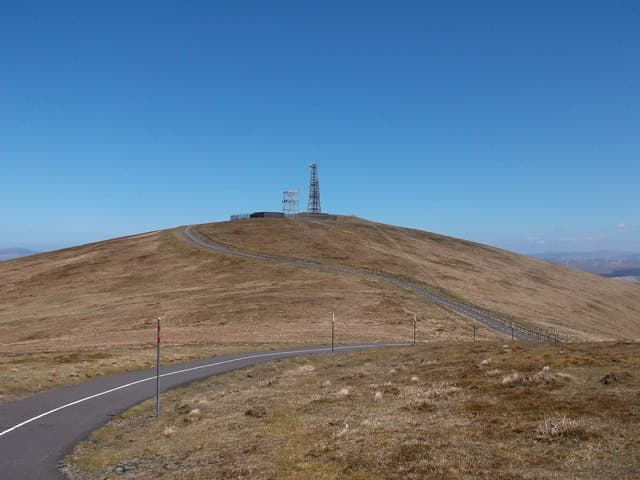
A shorter day climbing to Wanlockhead, Scotland's highest village at 467m. The lead mining museum is worth a visit.
- Terrain
- Hill paths, old mining tracks, steady climbing.
- Overnight
- Wanlockhead has a bunkhouse and B&Bs.
- Stats
- Sanquhar → Wanlockhead · 17km · ↑650m
7Wanlockhead to Beattock27km · 600m ascent
Descend from the Lowther Hills through moorland and farmland to Beattock in the Annandale valley. The terrain becomes gentler.
- Terrain
- Hill tracks, moorland, farm paths. Mostly downhill.
- Overnight
- Beattock has the Auchen Castle Hotel and B&Bs. Moffat is 3km off route with more choice.
- Stats
- Wanlockhead → Beattock · 27km · ↑600m
8Beattock to St Mary's Loch30km · 800m ascent
Over the Ettrick Hills to St Mary's Loch — one of the most scenic lochs in the Borders. A long day through remote hill country.
- Terrain
- Hill passes, moorland paths, rough ground. Remote and exposed.
- Overnight
- Tibbie Shiels Inn at St Mary's Loch. The Gordon Arms is nearby. Wild camping by the loch.
- Stats
- Beattock → St Mary's Loch · 30km · ↑800m
9St Mary's Loch to Traquair22km · 550m ascent
Along the loch shore then over the hills to Traquair in the Tweed valley. The walking eases as you enter the inhabited Borders.
- Terrain
- Loch-shore paths, hill tracks, farm roads.
- Overnight
- Traquair has B&Bs. Innerleithen is 2km away with more options.
- Stats
- St Mary's Loch → Traquair · 22km · ↑550m
10Traquair to Galashiels22km · 500m ascent
Through the Tweed valley via the Minch Moor ridge. Good paths and fine views over the Borders textile towns.
- Terrain
- Hill ridge paths, forest tracks, descent into the Tweed valley.
- Overnight
- Galashiels has hotels and B&Bs. Good resupply point.
- Stats
- Traquair → Galashiels · 22km · ↑500m
11Galashiels to Melrose10km · 300m ascent
A short day over the Eildon Hills with magnificent views, then down to Melrose and its famous abbey. Worth taking time to explore.
- Terrain
- Hill paths over the Eildons, riverside paths.
- Overnight
- Melrose has excellent hotels, B&Bs and the SYHA hostel.
- Stats
- Galashiels → Melrose · 10km · ↑300m
12Melrose to Lauder24km · 600m ascent
Over the gentle Lammermuir foothills from the Tweed valley to the market town of Lauder. Rolling farmland and open moorland.
- Terrain
- Hill tracks, moorland paths, farm roads.
- Overnight
- Lauder has hotels and B&Bs. The Black Bull is a good choice.
- Stats
- Melrose → Lauder · 24km · ↑600m
13Lauder to Longformacus28km · 700m ascent
Into the Lammermuir Hills — open heather moorland with big views and few people. The landscape feels surprisingly wild.
- Terrain
- Moorland tracks, hill paths, some rough ground.
- Overnight
- Longformacus has limited B&Bs. Wild camping on the moors.
- Stats
- Lauder → Longformacus · 28km · ↑700m
14Longformacus to Cockburnspath30km · 550m ascent
The final day descends from the Lammermuirs to the Berwickshire coast. The sea appears ahead and the trail finishes at Cockburnspath on the cliffs.
- Terrain
- Moorland paths, farm tracks, coastal descent.
- Overnight
- Cockburnspath has a pub and B&Bs. Connects to the Berwickshire Coastal Path.
- Stats
- Longformacus → Cockburnspath · 30km · ↑550m
Hills along the route
Munros, Corbetts, Grahams and Donalds within 5km of the route line — extensions or rest-day options.
Transport
To start (Portpatrick)
Train · ScotRail Glasgow South Western Line
Glasgow Central to Stranraer
Several daily
Check times & book →Bus · Stagecoach West Scotland 367
Stranraer to Portpatrick
Roughly hourly; ~20 min
Check times & book →
From finish (Cockburnspath)
Bus · Borders Buses 253
Cockburnspath to Berwick-upon-Tweed / Edinburgh
Roughly every 3 hours
Check times & book →Train · LNER East Coast Main Line
Dunbar or Berwick-upon-Tweed to Edinburgh / London Kings Cross
Hourly
Check times & book →
Best months
Accommodation
Accommodation is thin. Bothies, wild camps, and long taxi transfers to off-route B&Bs are all part of the plan. A serious undertaking. Pre-book everything in writing weeks ahead and arrange taxi transfers from Beattock or Sanquhar where on-route beds are full. Several MBA bothies (Over Phawhope) sit conveniently along the line.
Night-by-night guide: where to stay →Resupply
Resupply at Bargrennan, Sanquhar, Wanlockhead, Beattock, St Marys Loch, Traquair, Melrose, Lauder. Longest gap is ~35km. A post drop at Sanquhar post office (oldest in the world, still functioning) is the standard mid-route resupply trick used by long-distance walkers and is worth the planning.
Connect with
Chain into a longer expedition by combining with adjacent long-distance routes.
Southern Upland Way + Berwickshire Coastal Path
Connects at Cockburnspath (east end of SUW)
Finish the Southern Upland Way at Cockburnspath then continue south along the Berwickshire coast to Berwick-upon-Tweed. Adds 48km of dramatic cliff walking.
Southern Upland Way + Mull of Galloway Trail
Nearby Galloway coast routes share the Portpatrick area
Walk south from Portpatrick on the Mull of Galloway Trail for a Galloway peninsula extension before starting east on the SUW.
Current conditions
Weather at the start point (Portpatrick)
Daylight Today
- Sunrise
- 05:00
- Sunset
- 21:53
- Civil dawn
- 04:07
- Civil dusk
- 22:46
NOAA Solar Calculator · 13 July 2026
Share your experience
Walked the Southern Upland Way? Help others plan their trip.
Getting to and from the Southern Upland Way
Train and town anchors at each end of the route — on TripSCOT.