Long distance
Mull of Galloway Trail
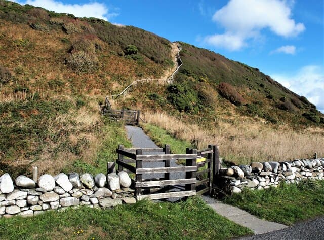
Coastal walking along Scotland's southernmost coastline to the Mull of Galloway lighthouse. Gentle terrain, warm climate (by Scottish standards) and a genuine sense of remoteness in Dumfries and Galloway. 3 days, 56 km (35 mi), 900 m of cumulative ascent; a waymarked route best tackled best east-to-west — a friendly short trail.
Quick facts
- Distance
- 56 km/ 35 mi
- Typical days
- 3
- Total ascent
- 900 m
- Difficulty
- easy
- Start → Finish
- Mull of Galloway Lighthouse → Mull of Galloway
- Best direction
- East to West
- Water sources
- Isle of Whithorn, Garlieston, Wigtown, Stranraer, Port Logan, Mull of Galloway lighthouse — all have taps and shops along the populated Galloway coast. The Rhins peninsula carries reliable streams; treat. The lighthouse cafe is the final refill.
- Mobile signal
- EE/Vodafone reliable in Isle of Whithorn, Wigtown, Stranraer and Port Logan. The Rhins peninsula moor sections may drop signal in deeper glens. Mull of Galloway lighthouse has signal from both Galloway and Antrim transmitters.
✔ Waymarked throughout
Approximate profile derived from per-stage ascent — accurate on total climb and pattern, not a pixel-precise GPX trace.
Our take
Dumfries and Galloway is the forgotten corner of Scottish walking — milder than anywhere else, empty of crowds, and surprisingly beautiful. The Mull of Galloway Trail makes the most of the dramatic southern coastline. The finish at Scotland's most southerly point — further south than Carlisle — always surprises people. RSPB Mull of Galloway is excellent for seabirds.
Highlights
- Isle of Whithorn — early Christian site
- Port William harbour
- Drummore — Scotlands most southerly village
- Mull of Galloway lighthouse and RSPB reserve
Day-by-day itinerary
A suggested 3-day schedule. Adjust to your fitness and conditions.
1Isle of Whithorn to Port William22km · 350m ascent
From the early Christian site at Isle of Whithorn along the coast past Burrow Head to the harbour village of Port William on Luce Bay. Gentle coastal terrain with farm paths and quiet lanes; this is some of the warmest, driest walking in Scotland and suits casual multi-day walking and birdwatching trips.
- Terrain
- Coastal paths, farm tracks, beach walking.
- Overnight
- Port William has the Monreith Arms and B&Bs.
- Stats
- Isle of Whithorn → Port William · 22km · ↑350m
2Port William to Drummore18km · 300m ascent
Along the west shore of Luce Bay through quiet Galloway farmland to Drummore, Scotland's most southerly village.
- Terrain
- Coastal paths, farm tracks, quiet lanes.
- Overnight
- Drummore has the Clashwhannon B&B and the Queens Hotel.
- Stats
- Port William → Drummore · 18km · ↑300m
3Drummore to Mull of Galloway16km · 250m ascent
The final stretch south to Scotland's most southerly point. The lighthouse and RSPB seabird reserve at the Mull are a dramatic finish.
- Terrain
- Coastal paths, cliff-top walking, farm tracks.
- Overnight
- No accommodation at the Mull itself. Return to Drummore or arrange transport to Stranraer.
- Stats
- Drummore → Mull of Galloway · 16km · ↑250m
Transport
To start (Mull of Galloway Lighthouse)
Bus · DGC Buses (service 415)
Newton Stewart–Whithorn–Isle of Whithorn (every ~4 hours)
Connects with Stagecoach service 500 from Dumfries / Stranraer at Newton Stewart.
Check times & book →
From finish (Mull of Galloway)
Bus · Stagecoach West Scotland (service 407)
Stranraer–Drummore, 5 daily Mon–Sat (~45 min)
The Mull of Galloway is 5 miles south of Drummore with no public transport — walk in/out or pre-arrange a taxi.
Check times & book →
Best months
Accommodation
B&Bs at Isle of Whithorn, Port William and Drummore. Limited but charming. Book ahead in summer. B&Bs at Isle of Whithorn, Port William and Drummore; book ahead in summer as Galloway accommodation is limited and clusters around tiny villages.
Night-by-night guide: where to stay →Resupply
Small shops at Isle of Whithorn, Port William and Drummore. Carry lunch each day. Small shops at Isle of Whithorn, Port William, Drummore and (off-route) Stranraer; longest gap is around 18km on the Mull approach — carry a packed lunch.
Connect with
Chain into a longer expedition by combining with adjacent long-distance routes.
Current conditions
Weather at the start point (Mull of Galloway Lighthouse)
Daylight Today
- Sunrise
- 05:26
- Sunset
- 21:26
- Civil dawn
- 04:40
- Civil dusk
- 22:12
NOAA Solar Calculator · 30 July 2026
Share your experience
Walked the Mull of Galloway Trail? Help others plan their trip.