Donald · Borders
Stob Law
Stob Law is the southern outlier of the Glensax ridge above Peebles, a steep grassy cone rising from the floor of the Manor Valley. Despite the Gaelic-sounding name, the hill sits firmly in Border country between the Tweed and the Cademuir.
Quick facts
- Height
- 676m/ 2218ft
- Prominence
- 67 m
- Distance
- ~7 km
- Ascent
- ~446 m
- Time
- 2–3 hrs
- Grid ref
- NT230332
- Parking
- NT234331
- Nearest city
- Edinburgh· 41km
- Dogs
- Dogs on lead required near livestockDog-friendly guide ↗
Height and prominence cross-checked against the Database of British and Irish Hills (CC BY).
No GPX track yet
Walked this route? Share your track to help other walkers.
Standard route
grass moorland 80% · heather patches 15% · summit area 5%
Cleanly tackled from Glenrath Farm in the Manor valley, a short steep climb of about 7km return with 450m of ascent. Often linked into a longer Manor ridge round.
Terrain
Bracken on the lower slopes that yields to clean turf on the upper ridge. No path of note — but the gradient is uniform and easy to read in clear weather.
In winter
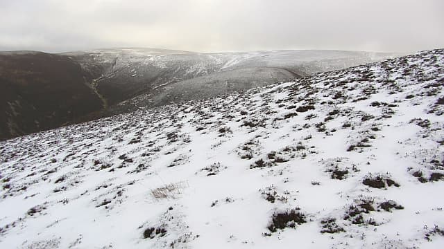
Steep grass freezes into hard neve on the south face after a freeze — an axe is wise. The summit area is small and exposed in eastern winds.
Kit for this: the winter Munro kit list · which boots take crampons
Best time of year
Getting there
- Glasgow2h 42m
- Edinburgh1h 58m
OS maps: OS Landranger 73
Current conditions
Daylight Today
- Sunrise
- 07:41
- Sunset
- 18:17
- Civil dawn
- 07:04
- Civil dusk
- 18:54
NOAA Solar Calculator · 14 October 2026
On a long-distance route
Stob Law sits within 5km of these named long-distance walks — useful for trail-pack rest days or section extensions.
Around Stob Law on the SCOT network
Getting there, basing yourself, and what to do off the hill.
Stob Law — common questions
- Is Stob Law a hard climb?
- Stob Law is rated 3/5 (moderately challenging) on the OutdoorSCOT scale. The standard route covers about 7km with 446m of ascent and takes most walkers 2-3 hours. Ground conditions: Bracken on the lower slopes that yields to clean turf on the upper ridge.
- How much drop does Stob Law have?
- The drop is 67m: measured from the summit of Stob Law down to the saddle joining it to higher terrain.
- Where's the parking for Stob Law?
- Park at NT234331. Double-check the grid reference on an OS map first; informal laybys here fill early in high season.
- What's the best month to climb Stob Law?
- Aim for March, April, May, June, July, August, September, October, November on Stob Law. In the remaining months treat it as a winter hill — full kit, solid navigation, and a look at the relevant SAIS avalanche forecast before you go.
- Can dogs go up Stob Law?
- Dogs are fine on a lead. The route passes livestock or ground-nesting bird habitat, so keep them close throughout.
- Is Stob Law safe in winter?
- Steep grass freezes into hard neve on the south face after a freeze — an axe is wise. The summit area is small and exposed in eastern winds.
Get the OutdoorSCOT weekly
One email a week — new route, hill and bothy guides, seasonal conditions and the odd hard-won lesson. No spam, unsubscribe in one click.