Graham · Borders
Dun Rig
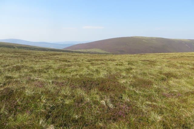
The highest of the Manor Hills, a smooth grassy ridge between the Tweed at Peebles and the Yarrow Valley. The summit cairn sits on a long undulating crest favoured by mountain bikers using the old drove road to the south.
Quick facts
- Height
- 742.7m/ 2437ft
- Prominence
- 242 m
- Distance
- 14 km
- Ascent
- 608 m
- Time
- 4–6 hrs
- Grid ref
- NT253315
- Parking
- NT264377
- Nearest city
- Edinburgh· 42km
- Dogs
- Dogs on lead required near livestockDog-friendly guide ↗
Height and prominence cross-checked against the Database of British and Irish Hills (CC BY).
No GPX track yet
Walked this route? Share your track to help other walkers.
Standard route
glen path 25% · moorland path 45% · grassy ridge 20% · summit area 10%
Park near Glensax or use the Cademuir Hill carpark south of Peebles, then follow the old drove road (Glensax Track) south. Leave it where it crosses the watershed and follow the fence west to the summit.
Terrain
Surfaced track and clear quad-bike trail throughout. Sheep-grazed grass on the summit ridge. Few obstacles.
In winter
Southern Uplands summit where snow comes and goes with each Atlantic system. Frost-hardened ground gives easy fast walking; main hazard is reduced visibility on the featureless ridge when low cloud presses down.
Best time of year
Getting there
- Glasgow2h 46m
- Edinburgh1h 1m
OS maps: OS Landranger 73
Mobile signal: Good signal near Innerleithen; 2-3 bars at the cairn
Current conditions
Daylight Today
- Sunrise
- 04:47
- Sunset
- 21:50
- Civil dawn
- 03:52
- Civil dusk
- 22:45
NOAA Solar Calculator · 13 July 2026
Pair with
Curated multi-hill combinations from Dun Rig.
Around Dun Rig on the SCOT network
Getting there, basing yourself, and what to do off the hill.
Dun Rig — common questions
- How difficult is Dun Rig?
- Dun Rig carries a 3/5 (moderately challenging) grade on the OutdoorSCOT scale. Count on about 14km, 608m of ascent and a 4-6 hour day on the standard route. Terrain: Surfaced track and clear quad-bike trail throughout.
- How prominent is Dun Rig?
- Dun Rig has 242m of topographic prominence — the height of its summit above the highest col connecting it to higher ground.
- Where should I park to climb Dun Rig?
- Standard parking is at NT264377. Check the parking grid reference on an OS map before travel; informal laybys can fill on summer weekends.
- When should I climb Dun Rig?
- The standard good-weather months for Dun Rig are April, May, June, July, August, September, October. Outside those months, expect winter conditions on the high ground — full mountain kit, navigation skills, and a check of the SAIS avalanche forecast for the relevant region.
- Can I bring my dog up Dun Rig?
- On a lead only — the route crosses ground with livestock or nesting-bird interest.
- What's mobile reception like on Dun Rig?
- Good signal near Innerleithen; 2-3 bars at the cairn
- Is Dun Rig safe in winter?
- Southern Uplands summit where snow comes and goes with each Atlantic system. Frost-hardened ground gives easy fast walking; main hazard is reduced visibility on the featureless ridge when low cloud presses down.
Get the OutdoorSCOT weekly
One email a week — new route, hill and bothy guides, seasonal conditions and the odd hard-won lesson. No spam, unsubscribe in one click.