Corbett · Borders
White Coomb
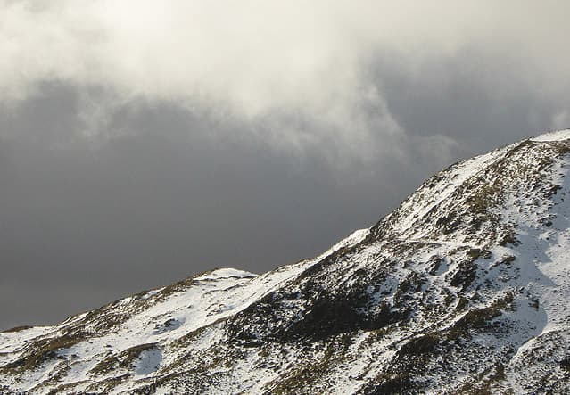
White Coomb is the highest hill in the Moffat Hills and one of the most striking summits in the Southern Uplands, rising directly above the Grey Mare's Tail — one of the highest single-drop waterfalls in Britain. At 821m a stone cairn tops a wide grassy plateau, but the hill's real character comes from the spectacular Loch Skeen hanging valley scooped into its eastern flank and the deep cleft of the Tail Burn dropping 60m off the lip. The view east into Galloway and west to the Lowther Hills covers most of southern Scotland.
Quick facts
- Height
- 821.6m/ 2696ft
- Prominence
- 375 m
- Distance
- ~11 km
- Ascent
- ~690 m
- Time
- 5–7 hrs
- Grid ref
- NT163150
- Parking
- NT186145
- Nearest
- Edinburgh· Dumfries 43km
- Dogs
- Dogs on lead required near livestockDog-friendly guide ↗
Height and prominence cross-checked against the Database of British and Irish Hills (CC BY).
No GPX track yet
Walked this route? Share your track to help other walkers.
Standard route
waterfall path 30% · loch shore 15% · open hill 45% · summit cairn 10%
Start from the NTS Grey Mare's Tail car park on the A708 between Moffat and St Mary's Loch. Take the well-built path up the east side of the Tail Burn to Loch Skeen, then climb the broad north ridge of White Coomb pathless on short grass to the summit. Around 11km return with some 690m of climb; a longer circuit over Lochcraig Head extends the day.
Terrain
The Grey Mare's Tail path is well-built and engineered — steep but with steps. Above the falls the going is short grass and gritted path to Loch Skeen. Off the path the climb onto White Coomb is open short grass with no path; the broad summit plateau is featureless and demands compass work in mist. The cliffs around Loch Skeen are unfenced and undercut in places — keep well back from the edge.
In winter
A serious winter hill despite its modest height — White Coomb has a long and well-documented history of fatal accidents involving cornicing on the corrie rim above Loch Skeen. The grass slopes ice up quickly and the broad plateau becomes a navigation trap in whiteout. The waterfall path itself can be treacherous in winter. The A708 is gritted but the lay-by ices.
Kit for this: the winter Munro kit list · which boots take crampons
Best time of year
Getting there
- Glasgow2h 48m
- Edinburgh1h 25m
OS maps: OS Landranger 79
Mobile signal: Good signal at the NTS car park; usable throughout the ascent
Current conditions
Daylight Today
- Sunrise
- 07:41
- Sunset
- 18:18
- Civil dawn
- 07:04
- Civil dusk
- 18:55
NOAA Solar Calculator · 14 October 2026
Pair with
Curated multi-hill combinations from White Coomb.
Around White Coomb on the SCOT network
Getting there, basing yourself, and what to do off the hill.
White Coomb — common questions
- How difficult is White Coomb?
- White Coomb carries a 2/5 (moderate) grade on the OutdoorSCOT scale. Count on about 11km, 690m of ascent and a 5-7 hour day on the standard route. Underfoot: The Grey Mare's Tail path is well-built and engineered — steep but with steps.
- What is White Coomb's prominence?
- 375m of prominence. That's the vertical drop from the summit to the col that links White Coomb to the next higher ground.
- Where do I park for White Coomb?
- Most walkers start from NT186145 near Edinburgh. Verify the grid reference on an OS map before you set off — space is tight on busy summer weekends.
- When is the best time to climb White Coomb?
- April, May, June, July, August, September, October give the most reliable conditions on White Coomb. Beyond that window the high ground turns wintry: carry full mountain kit, be confident navigating, and check the SAIS avalanche forecast for the area.
- Is White Coomb dog-friendly?
- Yes, but dogs must be kept on a lead — there is livestock or ground-nesting bird interest on the route.
- Is there mobile signal on White Coomb?
- Good signal at the NTS car park; usable throughout the ascent
- Is White Coomb safe in winter?
- A serious winter hill despite its modest height — White Coomb has a long and well-documented history of fatal accidents involving cornicing on the corrie rim above Loch Skeen. The grass slopes ice up quickly and the broad plateau becomes a navigation trap in whiteout. The waterfall path itself can be treacherous in winter. The A708 is gritted but the lay-by ices.
Get the OutdoorSCOT weekly
One email a week — new route, hill and bothy guides, seasonal conditions and the odd hard-won lesson. No spam, unsubscribe in one click.