Graham · Borders
Capel Fell
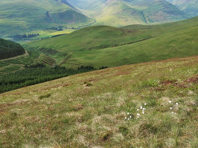
Capel Fell (678m) marks the watershed between Ettrick and Eskdalemuir in the NT10 square, a smooth Southern Uplands hump on the line of the Scottish-English county boundary. The Southern Upland Way crosses just east of the top and a single fence post marks the highest ground above a sea of grass and rush. The view spans Eskdalemuir Observatory to the Galloway hills.
Quick facts
- Height
- 678.3m/ 2225ft
- Prominence
- 159 m
- Distance
- 13 km
- Ascent
- 556 m
- Time
- 3–6 hrs
- Grid ref
- NT163069
- Parking
- NT171063
- Nearest city
- Dumfries· 36km
- Dogs
- Dogs on lead required near livestockDog-friendly guide ↗
Height and prominence cross-checked against the Database of British and Irish Hills (CC BY).
No GPX track yet
Walked this route? Share your track to help other walkers.
Standard route
grass moorland 75% · forestry edge 15% · heather patches 10%
Start at the Capel Burn bridge at the head of Ettrick Water. Follow the Southern Upland Way west past the Over Phawhope bothy and climb the broad south ridge on close-cropped sheep grass. The summit fence post sits in a featureless patch of moss-haggs north-east of the official Way; a short diversion off the route gets you to the actual top.
Terrain
Sheep-cropped grass and rush throughout, with the Southern Upland Way giving firm going to the bealach. The summit moss-haggs are wet but never deep. The fence line west along the watershed is the best line of march in cloud.
In winter
Snow on Capel Fell tends to be wind-blasted and patchy, lying longest in the moss-haggs near the top. Bitter Solway-side winds bring more discomfort than technical hazard, though hard frost on the wet grass can produce surprise slips. SAIS does not cover the Southern Uplands; check Eskdalemuir Observatory readings for a guide to conditions.
Best time of year
Getting there
- Glasgow2h 44m
- Edinburgh2h 37m
OS maps: OS Landranger 79
Mobile signal: Decent up top; EE reliable with fine views across the Border hills.
Current conditions
Daylight Today
- Sunrise
- 04:49
- Sunset
- 21:49
- Civil dawn
- 03:55
- Civil dusk
- 22:43
NOAA Solar Calculator · 13 July 2026
Pair with
Curated multi-hill combinations from Capel Fell.
Around Capel Fell on the SCOT network
Getting there, basing yourself, and what to do off the hill.
Capel Fell — common questions
- Is Capel Fell a hard climb?
- Capel Fell is rated 3/5 (moderately challenging) on the OutdoorSCOT scale. The standard route covers about 13km with 556m of ascent and takes most walkers 3-6 hours. Underfoot: Sheep-cropped grass and rush throughout, with the Southern Upland Way giving firm going to the bealach.
- What is Capel Fell's prominence?
- 159m of prominence. That's the vertical drop from the summit to the col that links Capel Fell to the next higher ground.
- Where do I park for Capel Fell?
- Most walkers start from NT171063. Verify the grid reference on an OS map before you set off — space is tight on busy summer weekends.
- When is the best time to climb Capel Fell?
- March, April, May, June, July, August, September, October, November give the most reliable conditions on Capel Fell. Beyond that window the high ground turns wintry: carry full mountain kit, be confident navigating, and check the SAIS avalanche forecast for the area.
- Is Capel Fell dog-friendly?
- Yes, but dogs must be kept on a lead — there is livestock or ground-nesting bird interest on the route.
- Is there mobile signal on Capel Fell?
- Decent up top; EE reliable with fine views across the Border hills.
- Is Capel Fell safe in winter?
- Snow on Capel Fell tends to be wind-blasted and patchy, lying longest in the moss-haggs near the top. Bitter Solway-side winds bring more discomfort than technical hazard, though hard frost on the wet grass can produce surprise slips. SAIS does not cover the Southern Uplands; check Eskdalemuir Observatory readings for a guide to conditions.
Get the OutdoorSCOT weekly
One email a week — new route, hill and bothy guides, seasonal conditions and the odd hard-won lesson. No spam, unsubscribe in one click.