Graham · Southern Uplands
Queensberry
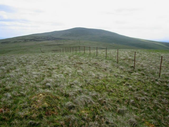
Queensberry (697m) is the grassy giant above Thornhill, set in the NX99 square at the southern end of the Lowther Hills. The hill gave its name to the Marquess of Queensberry and the boxing rules he sponsored. From the broad summit cairn the view sweeps across the Nith valley to Criffel and south to the Solway sands.
Quick facts
- Height
- 697.1m/ 2287ft
- Prominence
- 363 m
- Distance
- 13 km
- Ascent
- 572 m
- Time
- 3–6 hrs
- Grid ref
- NX989997
- Parking
- NS914083
- Nearest city
- Dumfries· 23km
- Dogs
- Dogs on lead required near livestockDog-friendly guide ↗
Height and prominence cross-checked against the Database of British and Irish Hills (CC BY).
No GPX track yet
Walked this route? Share your track to help other walkers.
Standard route
grass moorland 75% · heather slopes 15% · summit plateau 10%
From the parking spot at Mitchellslacks farm follow the rough farm road north-east toward the foot of the hill. A clear quad track climbs the south-west ridge through sheep pasture and onto cropped grass. The cairn sits at the eastern end of a level summit plateau.
Terrain
Farm road, then a quad track on short turf — much of the ascent is on close-cropped sheep pasture. The summit plateau is smooth grass with occasional bog around old fence lines. Notably dry underfoot for a Southern Uplands hill.
In winter
Easterly winds bring drifting snow across the broad top but the hill rarely holds deep cover for long. The exposed plateau can be disorienting in poor visibility and there is no shelter for over a kilometre. With a quick southern approach this is a popular winter walk when the Highland hills are out of condition.
Best time of year
Getting there
- Glasgow2h 49m
- Edinburgh2h 53m
OS maps: OS Landranger 78
Mobile signal: Good summit signal; steady on EE and Vodafone. Clear line to Dumfries and Nithsdale.
Current conditions
Daylight Today
- Sunrise
- 04:51
- Sunset
- 21:49
- Civil dawn
- 03:56
- Civil dusk
- 22:44
NOAA Solar Calculator · 13 July 2026
Around Queensberry on the SCOT network
Getting there, basing yourself, and what to do off the hill.
Queensberry — common questions
- Is Queensberry a hard climb?
- Queensberry is rated 3/5 (moderately challenging) on the OutdoorSCOT scale. The standard route covers about 13km with 572m of ascent and takes most walkers 3-6 hours. Ground conditions: Farm road, then a quad track on short turf — much of the ascent is on close-cropped sheep pasture.
- How much drop does Queensberry have?
- The drop is 363m: measured from the summit of Queensberry down to the saddle joining it to higher terrain.
- Where's the parking for Queensberry?
- Park at NS914083. Double-check the grid reference on an OS map first; informal laybys here fill early in high season.
- What's the best month to climb Queensberry?
- Aim for March, April, May, June, July, August, September, October, November on Queensberry. In the remaining months treat it as a winter hill — full kit, solid navigation, and a look at the relevant SAIS avalanche forecast before you go.
- Can dogs go up Queensberry?
- Dogs are fine on a lead. The route passes livestock or ground-nesting bird habitat, so keep them close throughout.
- Will I get phone signal on Queensberry?
- Good summit signal; steady on EE and Vodafone. Clear line to Dumfries and Nithsdale.
- Is Queensberry safe in winter?
- Easterly winds bring drifting snow across the broad top but the hill rarely holds deep cover for long. The exposed plateau can be disorienting in poor visibility and there is no shelter for over a kilometre. With a quick southern approach this is a popular winter walk when the Highland hills are out of condition.
Get the OutdoorSCOT weekly
One email a week — new route, hill and bothy guides, seasonal conditions and the odd hard-won lesson. No spam, unsubscribe in one click.