Graham · Borders
Windlestraw Law
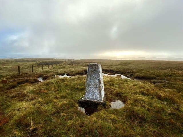
Windlestraw Law (659m) is the highest point of the Moorfoot Hills, sitting in the NT34 square between Innerleithen and the upper Tweed. The summit is unmarked beside a fence junction on rolling grass — a high, lonely vantage looking south over the Tweed valley to Eildon and the Cheviots.
Quick facts
- Height
- 659.2m/ 2163ft
- Prominence
- 460 m
- Distance
- 13 km
- Ascent
- 540 m
- Time
- 3–6 hrs
- Grid ref
- NT371430
- Parking
- NT363378
- Nearest city
- Edinburgh· 33km
- Dogs
- Dogs on lead required near livestockDog-friendly guide ↗
Height and prominence cross-checked against the Database of British and Irish Hills (CC BY).
No GPX track yet
Walked this route? Share your track to help other walkers.
Standard route
grass moorland 80% · heather patches 15% · summit area 5%
From the Glentress side, park at Walkerburn and take the back road to the foot of Glen Sax. A landrover track climbs north-west, then a grassy ridge runs north over the rounded Scawd Law before easing to the fence junction at the high point. Most parties continue along the fence for an easy circuit back via Bareback Knowe.
Terrain
Farm track at the foot, then grassy moorland ridge with sheep tracks for company. Fence lines are the main navigational aids — handy in cloud and easy to follow without a path. The summit area is featureless short grass.
In winter
Snow on the Moorfoots is fickle, blown into corn-snow drifts in easterlies and gone with the next thaw. When it lies, the absence of features makes a bearing essential — the fence line is your friend. Sub-zero wind chill is the regular hazard rather than deep snow.
Best time of year
Getting there
- Glasgow2h 43m
- Edinburgh1h 47m
OS maps: OS Landranger 73
Mobile signal: Solid summit coverage; EE reliable with clear views across the Moorfoot Hills.
Current conditions
Daylight Today
- Sunrise
- 04:46
- Sunset
- 21:50
- Civil dawn
- 03:50
- Civil dusk
- 22:45
NOAA Solar Calculator · 13 July 2026
On a long-distance route
Windlestraw Law sits within 5km of these named long-distance walks — useful for trail-pack rest days or section extensions.
Around Windlestraw Law on the SCOT network
Getting there, basing yourself, and what to do off the hill.
Windlestraw Law — common questions
- Is Windlestraw Law a hard climb?
- Windlestraw Law is rated 3/5 (moderately challenging) on the OutdoorSCOT scale. The standard route covers about 13km with 540m of ascent and takes most walkers 3-6 hours. Terrain: Farm track at the foot, then grassy moorland ridge with sheep tracks for company.
- How prominent is Windlestraw Law?
- Windlestraw Law has 460m of topographic prominence — the height of its summit above the highest col connecting it to higher ground.
- Where should I park to climb Windlestraw Law?
- Standard parking is at NT363378. Check the parking grid reference on an OS map before travel; informal laybys can fill on summer weekends.
- When should I climb Windlestraw Law?
- The standard good-weather months for Windlestraw Law are March, April, May, June, July, August, September, October, November. Outside those months, expect winter conditions on the high ground — full mountain kit, navigation skills, and a check of the SAIS avalanche forecast for the relevant region.
- Can I bring my dog up Windlestraw Law?
- On a lead only — the route crosses ground with livestock or nesting-bird interest.
- What's mobile reception like on Windlestraw Law?
- Solid summit coverage; EE reliable with clear views across the Moorfoot Hills.
- Is Windlestraw Law safe in winter?
- Snow on the Moorfoots is fickle, blown into corn-snow drifts in easterlies and gone with the next thaw. When it lies, the absence of features makes a bearing essential — the fence line is your friend. Sub-zero wind chill is the regular hazard rather than deep snow.
Get the OutdoorSCOT weekly
One email a week — new route, hill and bothy guides, seasonal conditions and the odd hard-won lesson. No spam, unsubscribe in one click.