Graham · Borders
Culter Fell
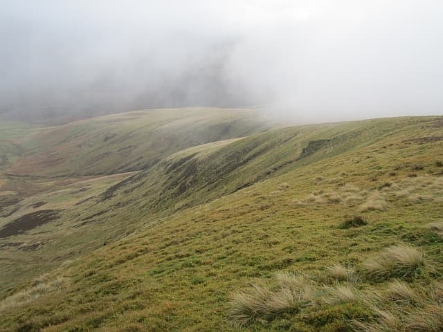
The highest point in South Lanarkshire and the dominant summit of the Culter Hills above Biggar. Its trig point looks across the Clyde-Tweed watershed to the Tweedsmuir Hills and on clear days to the Forth bridges and the Pentlands.
Quick facts
- Height
- 748.4m/ 2455ft
- Prominence
- 350 m
- Distance
- 14 km
- Ascent
- 613 m
- Time
- 4–6 hrs
- Grid ref
- NT052290
- Parking
- NT048291
- Nearest city
- Edinburgh· 49km
- Dogs
- Dogs on lead required near livestockDog-friendly guide ↗
Height and prominence cross-checked against the Database of British and Irish Hills (CC BY).
No GPX track yet
Walked this route? Share your track to help other walkers.
Standard route
valley path 25% · moorland path 45% · grassy ridge 20% · summit area 10%
Park at the Culter Reservoir at the head of Culter Water and follow the gravel reservoir track north before striking up the grassy north-west ridge over Fell Shin. A clear quad track leads to the trig and beyond.
Terrain
Tarmac and gravel road for the approach, then short sheep-cropped grass with a faint quad track most of the way to the top. Few peat hags.
In winter
Southern Uplands snow is generally shallow but the open ridge is fully exposed to easterlies that can pile drifts against the cornice line on the east face. Frozen turf at this height needs simple care rather than crampons.
Best time of year
Getting there
- Glasgow1h 24m
- Edinburgh1h 10m
OS maps: OS Landranger 72
Mobile signal: Good signal near Biggar; 2-3 bars on the summit
Current conditions
Daylight Today
- Sunrise
- 04:54
- Sunset
- 21:46
- Civil dawn
- 04:01
- Civil dusk
- 22:40
NOAA Solar Calculator · 17 July 2026
Pair with
Curated multi-hill combinations from Culter Fell.
Around Culter Fell on the SCOT network
Getting there, basing yourself, and what to do off the hill.
Culter Fell — common questions
- Is Culter Fell a hard climb?
- Culter Fell is rated 3/5 (moderately challenging) on the OutdoorSCOT scale. The standard route covers about 14km with 613m of ascent and takes most walkers 4-6 hours. Ground conditions: Tarmac and gravel road for the approach, then short sheep-cropped grass with a faint quad track most of the way to the top.
- How much drop does Culter Fell have?
- The drop is 350m: measured from the summit of Culter Fell down to the saddle joining it to higher terrain.
- Where's the parking for Culter Fell?
- Park at NT048291. Double-check the grid reference on an OS map first; informal laybys here fill early in high season.
- What's the best month to climb Culter Fell?
- Aim for April, May, June, July, August, September, October on Culter Fell. In the remaining months treat it as a winter hill — full kit, solid navigation, and a look at the relevant SAIS avalanche forecast before you go.
- Can dogs go up Culter Fell?
- Dogs are fine on a lead. The route passes livestock or ground-nesting bird habitat, so keep them close throughout.
- Will I get phone signal on Culter Fell?
- Good signal near Biggar; 2-3 bars on the summit
- Is Culter Fell safe in winter?
- Southern Uplands snow is generally shallow but the open ridge is fully exposed to easterlies that can pile drifts against the cornice line on the east face. Frozen turf at this height needs simple care rather than crampons.
Get the OutdoorSCOT weekly
One email a week — new route, hill and bothy guides, seasonal conditions and the odd hard-won lesson. No spam, unsubscribe in one click.