Donald · Borders
Birkscairn Hill
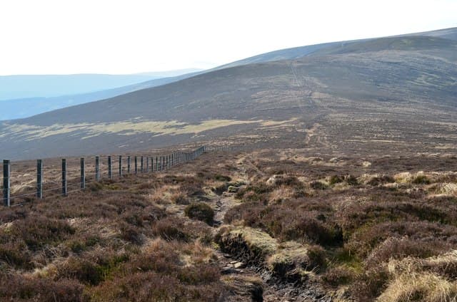
Birkscairn Hill stands on the long ridge running south from Peebles between the Glensax and Quair valleys. A large rough cairn — visible for miles on a clear day — caps a heathery plateau, the only real high point on this stretch of the Manor watershed.
Quick facts
- Height
- 661.6m/ 2171ft
- Prominence
- 62 m
- Distance
- 13 km
- Ascent
- 542 m
- Time
- 3–6 hrs
- Grid ref
- NT274331
- Parking
- NT269325
- Nearest city
- Edinburgh· 41km
- Dogs
- Dogs on lead required near livestockDog-friendly guide ↗
Height and prominence cross-checked against the Database of British and Irish Hills (CC BY).
No GPX track yet
Walked this route? Share your track to help other walkers.
Standard route
grass moorland 80% · heather patches 15% · summit area 5%
Standard approach is from the Glensax road end above Peebles, on the right of way that crosses the ridge towards Yarrow. Around 10km return with 480m of climb.
Terrain
Heather and bilberry on the upper slopes — heavier going than the cropped grass typical of nearby tops. A clear path on the right of way.
In winter
Heather holds soft snow that hides the ground beneath; wet feet are guaranteed in a thaw. The cairn is a useful landmark in cloud.
Best time of year
Getting there
- Glasgow2h 47m
- Edinburgh1h 58m
OS maps: OS Landranger 73
Mobile signal: Signal is good; EE works well. Fine Moorfoot Hills viewpoint.
Current conditions
Daylight Today
- Sunrise
- 04:47
- Sunset
- 21:50
- Civil dawn
- 03:52
- Civil dusk
- 22:45
NOAA Solar Calculator · 13 July 2026
Around Birkscairn Hill on the SCOT network
Getting there, basing yourself, and what to do off the hill.
Birkscairn Hill — common questions
- What difficulty is Birkscairn Hill?
- On the OutdoorSCOT scale, Birkscairn Hill comes in at 3/5 — moderately challenging. Expect roughly 13km and 542m of ascent on the usual route — 3-6 hours for most parties. Underfoot: Heather and bilberry on the upper slopes — heavier going than the cropped grass typical of nearby tops.
- What is Birkscairn Hill's prominence?
- 62m of prominence. That's the vertical drop from the summit to the col that links Birkscairn Hill to the next higher ground.
- Where do I park for Birkscairn Hill?
- Most walkers start from NT269325. Verify the grid reference on an OS map before you set off — space is tight on busy summer weekends.
- When is the best time to climb Birkscairn Hill?
- March, April, May, June, July, August, September, October, November give the most reliable conditions on Birkscairn Hill. Beyond that window the high ground turns wintry: carry full mountain kit, be confident navigating, and check the SAIS avalanche forecast for the area.
- Is Birkscairn Hill dog-friendly?
- Yes, but dogs must be kept on a lead — there is livestock or ground-nesting bird interest on the route.
- Is there mobile signal on Birkscairn Hill?
- Signal is good; EE works well. Fine Moorfoot Hills viewpoint.
- Is Birkscairn Hill safe in winter?
- Heather holds soft snow that hides the ground beneath; wet feet are guaranteed in a thaw. The cairn is a useful landmark in cloud.
Get the OutdoorSCOT weekly
One email a week — new route, hill and bothy guides, seasonal conditions and the odd hard-won lesson. No spam, unsubscribe in one click.