Graham · North-West Highlands
Glas Bheinn (Assynt)
Quartzite summit overlooking the Eas a' Chùal Aluinn waterfall — Britain's highest free-falling waterfall — which is reached as a side-trip from this hill. 776 m summit, 12 km out-and-back from Ullapool, 700 m of ascent. North-West Highlands.
Gaelic: “grey-green” · Pronunciation: glass bheinn (assynt)
Quick facts
- Height
- 776m/ 2546ft
- Distance
- 12 km
- Ascent
- 700 m
- Time
- 3–6 hrs
- Grid ref
- NC254264
- Parking
- NC239282
- Nearest
- Ullapool· Inverness 94km
- Dogs
- Dogs on lead required near livestockDog-friendly guide ↗
No GPX track yet
Walked this route? Share your track to help other walkers.
Standard route
moorland path 25% · heather moorland 40% · rocky upper slopes 25% · summit area 10%
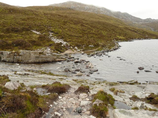
Approach from the layby on the A894 north of Loch na Gainmhich. Pathless walk-in across moor, then a steady climb to the broad quartzite summit. Most parties detour first to the waterfall viewpoint above the Eas a' Chùal Aluinn before doubling back.
Terrain
Boggy, pathless approach. Quartzite blocks underfoot near the summit.
In winter
Significant snow possible Dec-Mar. Navigation important — featureless plateau.
This hill is in the Torridon SAIS forecast area. Check SAIS forecasts in winter (December–April).
Best time of year
Getting there
- Glasgow5h 5m
- Edinburgh5h 10m
OS maps: OS Explorer 442
Mobile signal: No signal in the Assynt interior near Inchnadamph
Current conditions
Daylight Today
- Sunrise
- 04:27
- Sunset
- 22:08
- Civil dawn
- 03:19
- Civil dusk
- 23:16
NOAA Solar Calculator · 31 May 2026
Pair with
Curated multi-hill combinations from Glas Bheinn (Assynt).
On a long-distance route
Glas Bheinn (Assynt) sits within 5km of these named long-distance walks — useful for trail-pack rest days or section extensions.
Around Glas Bheinn (Assynt) on the SCOT network
Getting there, basing yourself, and what to do off the hill.
Glas Bheinn (Assynt) — common questions
- How hard is Glas Bheinn (Assynt)?
- Glas Bheinn (Assynt) is rated 3/5 (moderately challenging) on the OutdoorSCOT scale. The standard route covers about 12km with 700m of ascent and takes most walkers 3-6 hours. Terrain: Boggy, pathless approach.
- Where do I park for Glas Bheinn (Assynt)?
- Standard parking is at NC239282 near Ullapool. Check the parking grid reference on an OS map before travel; informal laybys can fill on summer weekends.
- When is the best time to climb Glas Bheinn (Assynt)?
- The standard good-weather months for Glas Bheinn (Assynt) are May, June, July, August, September, October. Outside those months, expect winter conditions on the high ground — full mountain kit, navigation skills, and a check of the SAIS avalanche forecast for the relevant region.
- Can I bring my dog up Glas Bheinn (Assynt)?
- Yes, but dogs must be kept on a lead — there is livestock or ground-nesting bird interest on the route.
- Is there mobile signal on Glas Bheinn (Assynt)?
- No signal in the Assynt interior near Inchnadamph
- Is Glas Bheinn (Assynt) safe in winter?
- Significant snow possible Dec-Mar. Navigation important — featureless plateau.