Corbett · Far North
Quinag - Spidean Coinich
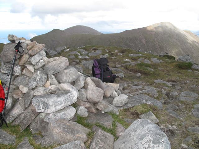
Spidean Coinich — the mossy peak — is the southern summit of Quinag, the three-topped Y-shaped mountain rising above Loch Assynt in Sutherland. At 764m it is one of three Corbett tops on the same massif (Sail Gharbh and Sail Ghorm being the others) and the most accessible from the A894 below. The ascent is the closest thing to a paved path on a Corbett: John Muir Trust have rebuilt long sections in pitched stone. The summit gives a panorama of Suilven, Canisp, Quinag's own corries, and Loch Assynt sweeping south.
Quick facts
- Height
- 764m/ 2507ft
- Prominence
- 192 m
- Distance
- 9 km
- Ascent
- 670 m
- Time
- 2–4 hrs
- Grid ref
- NC206277
- Parking
- NC233274
- Nearest
- Ullapool· Inverness 94km
- Dogs
- Dogs on lead required near livestockDog-friendly guide ↗
Height and prominence cross-checked against the Database of British and Irish Hills (CC BY).
No GPX track yet
Walked this route? Share your track to help other walkers.
Standard route
road path 20% · sandstone path 40% · rocky ridge 30% · summit area 10%
Park in the JMT car park on the A894 at NC233274. A well-built stone path climbs steadily west-north-west onto the south ridge of Spidean Coinich, gaining height through a series of sandstone steps. Follow the ridge over a subsidiary top and on to the summit. To return, descend the same way — or, for the full Quinag traverse, continue north over the bealach to Sail Gharbh and Sail Ghorm before descending back to the road. Allow 4–5 hours for Spidean Coinich alone, 7–8 for the full traverse.
Terrain
The JMT path is among the best-built in Sutherland — pitched stone for most of the lower ascent, easy to follow. Above the path the ridge is firm Torridonian sandstone with a few small steps. The summit is small but the ridge has occasional cliff edges to either side; navigate carefully in cloud.
In winter
Spidean Coinich's pitched path holds snow and ice late into spring. In hard winter the upper ridge becomes a serious mountain day with cornices on the east side. The descent line on the south ridge is straightforward in clear weather, committing in cloud.
Best time of year
Getting there
- Glasgow5h 6m
- Edinburgh5h 16m
OS maps: OS Landranger 15
Mobile signal: No signal on the mountain; brief EE on the A894 between Skiag Bridge and Kylesku
Current conditions
Daylight Today
- Sunrise
- 04:36
- Sunset
- 22:16
- Civil dawn
- 03:28
- Civil dusk
- 23:23
NOAA Solar Calculator · 13 July 2026
Pair with
Curated multi-hill combinations from Quinag - Spidean Coinich.
On a long-distance route
Quinag - Spidean Coinich sits within 5km of these named long-distance walks — useful for trail-pack rest days or section extensions.
Around Quinag - Spidean Coinich on the SCOT network
Getting there, basing yourself, and what to do off the hill.
Quinag - Spidean Coinich — common questions
- How difficult is Quinag - Spidean Coinich?
- Quinag - Spidean Coinich carries a 2/5 (moderate) grade on the OutdoorSCOT scale. Count on about 9km, 670m of ascent and a 2-4 hour day on the standard route. Underfoot: The JMT path is among the best-built in Sutherland — pitched stone for most of the lower ascent, easy to follow.
- What is Quinag - Spidean Coinich's prominence?
- 192m of prominence. That's the vertical drop from the summit to the col that links Quinag - Spidean Coinich to the next higher ground.
- Where do I park for Quinag - Spidean Coinich?
- Most walkers start from NC233274 near Ullapool. Verify the grid reference on an OS map before you set off — space is tight on busy summer weekends.
- When is the best time to climb Quinag - Spidean Coinich?
- May, June, July, August, September give the most reliable conditions on Quinag - Spidean Coinich. Beyond that window the high ground turns wintry: carry full mountain kit, be confident navigating, and check the SAIS avalanche forecast for the area.
- Is Quinag - Spidean Coinich dog-friendly?
- Yes, but dogs must be kept on a lead — there is livestock or ground-nesting bird interest on the route.
- Is there mobile signal on Quinag - Spidean Coinich?
- No signal on the mountain; brief EE on the A894 between Skiag Bridge and Kylesku
- Is Quinag - Spidean Coinich safe in winter?
- Spidean Coinich's pitched path holds snow and ice late into spring. In hard winter the upper ridge becomes a serious mountain day with cornices on the east side. The descent line on the south ridge is straightforward in clear weather, committing in cloud.
Get the OutdoorSCOT weekly
One email a week — new route, hill and bothy guides, seasonal conditions and the odd hard-won lesson. No spam, unsubscribe in one click.