Corbett · Fife & Perthshire
Ben Vrackie
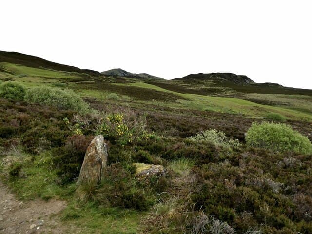
Ben Vrackie is Pitlochry's home hill — the 842m Corbett that everyone who has spent a weekend in Highland Perthshire seems to have climbed. The mountain rises directly behind the village of Moulin, a mile up the road from Pitlochry itself, and the pitched path to the summit is among the busiest non-Munro hill paths in Scotland. The summit gives a panorama south over Strathtay to the Trossachs and north to the wild bulk of Beinn a' Ghlò. Beloved as an introduction to Corbetts and as a regular fitness round by locals.
Quick facts
- Height
- 842.2m/ 2763ft
- Prominence
- 406 m
- Distance
- 11 km
- Ascent
- 740 m
- Time
- 3–5 hrs
- Grid ref
- NN951632
- Parking
- NN944597
- Nearest city
- Perth· 43km
- Dogs
- Dogs on lead required near livestockDog-friendly guide ↗
Height and prominence cross-checked against the Database of British and Irish Hills (CC BY).
No GPX track yet
Walked this route? Share your track to help other walkers.
Standard route
woodland path 20% · moorland path 40% · stony path 30% · summit plateau 10%
Park at the Moulin car park behind the Moulin Hotel (NN944597). The path is signed throughout: through birch woodland, across a footbridge, then steeply up onto open moor. Pass the small loch — Loch a' Choire — sitting in a corrie about three-quarters of the way up, then climb the final steep stony section to the trig point. Descent reverses the line. Allow 4–5 hours including time at the loch.
Terrain
Excellent pitched-stone path from Moulin all the way to the upper hill — by some distance the best-built Corbett path in central Scotland. The final section above the loch is rougher: loose stones over a steeper gradient. The summit plateau itself is broad with a trig pillar and shelter wall.
In winter
Snow lies on the upper hill from December through February in most years. The path stays obvious under cover but the final stony pull above Loch a' Choire ices up readily and a slip there has consequences. Crampons rarely essential but useful; an axe should be carried. Ben Vrackie produces winter incidents disproportionate to its unassuming height because it attracts walkers underestimating Highland conditions.
Best time of year
Getting there
- Glasgow2h 50m
- Edinburgh2h 45m
OS maps: OS Explorer OL49
Mobile signal: Reliable EE/Vodafone in Moulin and on most of the lower path; weakens on the rim of Coire na Cròiseige; brief 4G up top facing south to Pitlochry
Current conditions
Daylight Today
- Sunrise
- 04:41
- Sunset
- 22:00
- Civil dawn
- 03:41
- Civil dusk
- 23:00
NOAA Solar Calculator · 13 July 2026
On a long-distance route
Ben Vrackie sits within 5km of these named long-distance walks — useful for trail-pack rest days or section extensions.
Around Ben Vrackie on the SCOT network
Getting there, basing yourself, and what to do off the hill.
Getting there: Pitlochry station
Schiehallion, Ben Vrackie, Beinn a Ghlo, Edradour distillery
5km from the hill
tripscot.co.uk
On TripSCOTBase yourself in Pitlochry
Perthshire base — Schiehallion, Beinn a Ghlo, Ben Vrackie
5km from the hill
tripscot.co.uk
On TasteSCOTAfter the hill: Edradour
Pitlochry — until recently Scotland's smallest distillery; charming Perthshire setting
4km from the hill
tastescot.co.uk
Ben Vrackie — common questions
- Is Ben Vrackie a hard climb?
- Ben Vrackie is rated 2/5 (moderate) on the OutdoorSCOT scale. The standard route covers about 11km with 740m of ascent and takes most walkers 3-5 hours. Ground conditions: Excellent pitched-stone path from Moulin all the way to the upper hill — by some distance the best-built Corbett path in central Scotland.
- How much drop does Ben Vrackie have?
- The drop is 406m: measured from the summit of Ben Vrackie down to the saddle joining it to higher terrain.
- Where's the parking for Ben Vrackie?
- Park at NN944597. Double-check the grid reference on an OS map first; informal laybys here fill early in high season.
- What's the best month to climb Ben Vrackie?
- Aim for March, April, May, June, July, August, September, October, November on Ben Vrackie. In the remaining months treat it as a winter hill — full kit, solid navigation, and a look at the relevant SAIS avalanche forecast before you go.
- Can dogs go up Ben Vrackie?
- Dogs are fine on a lead. The route passes livestock or ground-nesting bird habitat, so keep them close throughout.
- Will I get phone signal on Ben Vrackie?
- Reliable EE/Vodafone in Moulin and on most of the lower path; weakens on the rim of Coire na Cròiseige; brief 4G up top facing south to Pitlochry
- Is Ben Vrackie safe in winter?
- Snow lies on the upper hill from December through February in most years. The path stays obvious under cover but the final stony pull above Loch a' Choire ices up readily and a slip there has consequences. Crampons rarely essential but useful; an axe should be carried. Ben Vrackie produces winter incidents disproportionate to its unassuming height because it attracts walkers underestimating Highland conditions.
Get the OutdoorSCOT weekly
One email a week — new route, hill and bothy guides, seasonal conditions and the odd hard-won lesson. No spam, unsubscribe in one click.