Graham · Cairngorms
Blath Bhalg
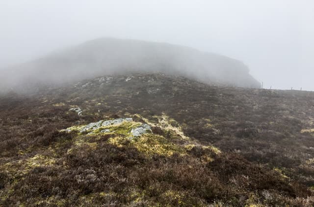
Blath Bhalg (640m) — the warm bag — is an eastern Perthshire hill in the NO06 square, between Bridge of Cally and the Glen Shee road. A small cairn marks the top of a managed grouse moor with sweeping views east to the Strathmore lowlands and north into Glen Shee.
Quick facts
- Height
- 640.4m/ 2101ft
- Prominence
- 266 m
- Distance
- 12 km
- Ascent
- 480 m
- Time
- 3–5 hrs
- Grid ref
- NO019611
- Parking
- NO053628
- Nearest city
- Perth· 39km
- Dogs
- Dogs on lead required near livestockDog-friendly guide ↗
Height and prominence cross-checked against the Database of British and Irish Hills (CC BY).
No GPX track yet
Walked this route? Share your track to help other walkers.
Standard route
heather moorland 60% · grass slopes 30% · rocky summit 10%
Park beside the A924 near Kindrogan field studies centre. Take the estate landrover track north onto Carn Liath, then a quad rut south-east along the open moor toward the watershed. The summit cairn lies a short distance from the track on slightly rising ground; the return reverses the line.
Terrain
Excellent estate tracks throughout the lower walk, with a final short stretch of cropped heather to the cairn. The grouse-moor management keeps the heather short and easy underfoot — a relief after pathless ground elsewhere.
In winter
East Perthshire grouse moors get patchy snow but the open watershed funnels easterly wind. Blath Bhalg holds drift in its small hollows; the tracks themselves remain walkable. A short midwinter walk fits comfortably from Kindrogan with daylight to spare.
This hill is in the Northern Cairngorms SAIS forecast area. Check SAIS forecasts in winter (December–April).
Best time of year
Getting there
- Glasgow2h 14m
- Edinburgh2h 55m
OS maps: OS Landranger 43
Mobile signal: Moderate. EE reliable on the open moor; useful for weather updates.
Current conditions
Daylight Today
- Sunrise
- 04:47
- Sunset
- 21:54
- Civil dawn
- 03:49
- Civil dusk
- 22:52
NOAA Solar Calculator · 17 July 2026
Around Blath Bhalg on the SCOT network
Getting there, basing yourself, and what to do off the hill.
Getting there: Pitlochry station
Schiehallion, Ben Vrackie, Beinn a Ghlo, Edradour distillery
8km from the hill
tripscot.co.uk
On TripSCOTBase yourself in Pitlochry
Perthshire base — Schiehallion, Beinn a Ghlo, Ben Vrackie
8km from the hill
tripscot.co.uk
On TasteSCOTAfter the hill: Edradour
Pitlochry — until recently Scotland's smallest distillery; charming Perthshire setting
6km from the hill
tastescot.co.uk
Blath Bhalg — common questions
- How difficult is Blath Bhalg?
- Blath Bhalg carries a 3/5 (moderately challenging) grade on the OutdoorSCOT scale. Count on about 12km, 480m of ascent and a 3-5 hour day on the standard route. Underfoot: Excellent estate tracks throughout the lower walk, with a final short stretch of cropped heather to the cairn.
- What is Blath Bhalg's prominence?
- 266m of prominence. That's the vertical drop from the summit to the col that links Blath Bhalg to the next higher ground.
- Where do I park for Blath Bhalg?
- Most walkers start from NO053628. Verify the grid reference on an OS map before you set off — space is tight on busy summer weekends.
- When is the best time to climb Blath Bhalg?
- March, April, May, June, July, August, September, October, November give the most reliable conditions on Blath Bhalg. Beyond that window the high ground turns wintry: carry full mountain kit, be confident navigating, and check the SAIS avalanche forecast for the area.
- Is Blath Bhalg dog-friendly?
- Yes, but dogs must be kept on a lead — there is livestock or ground-nesting bird interest on the route.
- Is there mobile signal on Blath Bhalg?
- Moderate. EE reliable on the open moor; useful for weather updates.
- Is Blath Bhalg safe in winter?
- East Perthshire grouse moors get patchy snow but the open watershed funnels easterly wind. Blath Bhalg holds drift in its small hollows; the tracks themselves remain walkable. A short midwinter walk fits comfortably from Kindrogan with daylight to spare.
Get the OutdoorSCOT weekly
One email a week — new route, hill and bothy guides, seasonal conditions and the odd hard-won lesson. No spam, unsubscribe in one click.