Graham · Fife & Perthshire
Meall Dearg
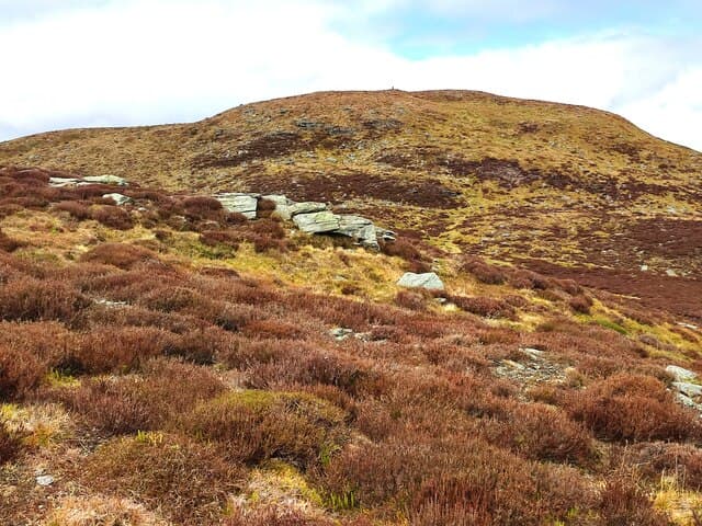
Meall Dearg (690m) — the red lump — is a grassy summit on the south side of Glen Quaich in the NN84 square. Its red-brown schist gives the name, and the trig pillar caps a long whaleback ridge looking south to the Sma' Glen and north to the Schiehallion massif. Far less visited than its many namesakes elsewhere in the Highlands.
Gaelic: “rounded hill, red” · Pronunciation: myowl jerr-ak
Quick facts
- Height
- 690.3m/ 2265ft
- Prominence
- 172 m
- Distance
- 13 km
- Ascent
- 566 m
- Time
- 3–6 hrs
- Grid ref
- NN886414
- Parking
- NN842420
- Nearest city
- Perth· 29km
- Dogs
- Dogs on lead required near livestockDog-friendly guide ↗
Height and prominence cross-checked against the Database of British and Irish Hills (CC BY).
No GPX track yet
Walked this route? Share your track to help other walkers.
Standard route
grass and rock 50% · heather moorland 30% · rocky ridge 20%
From the small lay-by on the unclassified Amulree to Kenmore road follow the estate track south up the Allt Gleann a' Chilleine. Where the track ends strike west onto heather and gain the broad north ridge. A fence-line then runs all the way to the trig.
Terrain
Estate track, then heather and cropped sheep grass. The north ridge fence-line is the most reliable feature, holding the line through any cloud. Bog around the headwater of the burn is unavoidable after rain.
In winter
Mid-Perthshire winters are drier than the west and the heather here freezes hard before the high tops do. The fence-line is buried in any sustained easterly. Wind chill on the long open ridge is the dominant risk; avalanche on these gentle slopes is negligible.
Best time of year
Getting there
- Glasgow2h 44m
- Edinburgh2h 50m
OS maps: OS Landranger 52
Mobile signal: Moderate. EE connects on summit; Vodafone intermittent. Clear views over Glencoe.
Current conditions
Daylight Today
- Sunrise
- 04:43
- Sunset
- 21:59
- Civil dawn
- 03:44
- Civil dusk
- 22:58
NOAA Solar Calculator · 13 July 2026
Around Meall Dearg on the SCOT network
Getting there, basing yourself, and what to do off the hill.
Getting there: Dunkeld & Birnam station
Birnam Hill, Hermitage walks, southern Perthshire gateway
14km from the hill
tripscot.co.uk
On TripSCOTBase yourself in Aberfeldy
Loch Tay base — Ben Lawers, Tarmachan ridge, Birks of Aberfeldy
8km from the hill
tripscot.co.uk
On TasteSCOTAfter the hill: Aberfeldy
Aberfeldy — heart of Dewar's blends; honey-and-heather Highland style
8km from the hill
tastescot.co.uk
Meall Dearg — common questions
- Is Meall Dearg a hard climb?
- Meall Dearg is rated 3/5 (moderately challenging) on the OutdoorSCOT scale. The standard route covers about 13km with 566m of ascent and takes most walkers 3-6 hours. Terrain: Estate track, then heather and cropped sheep grass.
- How prominent is Meall Dearg?
- Meall Dearg has 172m of topographic prominence — the height of its summit above the highest col connecting it to higher ground.
- Where should I park to climb Meall Dearg?
- Standard parking is at NN842420. Check the parking grid reference on an OS map before travel; informal laybys can fill on summer weekends.
- When should I climb Meall Dearg?
- The standard good-weather months for Meall Dearg are March, April, May, June, July, August, September, October, November. Outside those months, expect winter conditions on the high ground — full mountain kit, navigation skills, and a check of the SAIS avalanche forecast for the relevant region.
- Can I bring my dog up Meall Dearg?
- On a lead only — the route crosses ground with livestock or nesting-bird interest.
- What's mobile reception like on Meall Dearg?
- Moderate. EE connects on summit; Vodafone intermittent. Clear views over Glencoe.
- Is Meall Dearg safe in winter?
- Mid-Perthshire winters are drier than the west and the heather here freezes hard before the high tops do. The fence-line is buried in any sustained easterly. Wind chill on the long open ridge is the dominant risk; avalanche on these gentle slopes is negligible.
Get the OutdoorSCOT weekly
One email a week — new route, hill and bothy guides, seasonal conditions and the odd hard-won lesson. No spam, unsubscribe in one click.