Graham · Fife & Perthshire
Shee of Ardtalnaig (Ciste Buide a' Claidheimh)
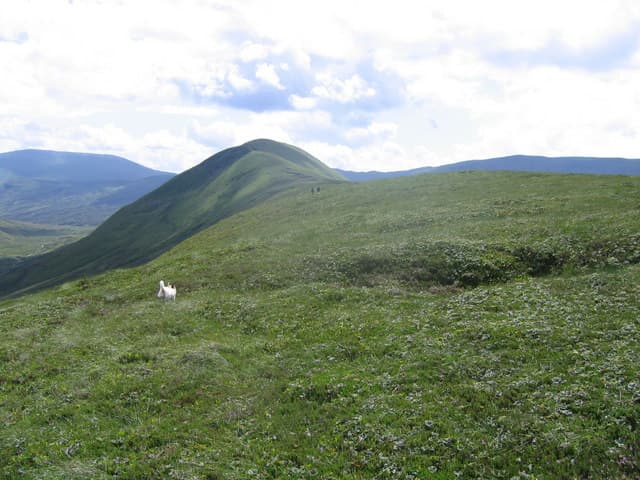
A broad rolling Perthshire hill rising south of Loch Tay above the hamlet of Ardtalnaig, the second name meaning the yellow chest of the sword. Forms part of the line of grassy summits separating Glen Almond from the Tay, sharing its ridge with Creag Uchdag to the south-west.
Quick facts
- Height
- 758.2m/ 2488ft
- Prominence
- 226 m
- Distance
- 14 km
- Ascent
- 622 m
- Time
- 4–6 hrs
- Grid ref
- NN729351
- Parking
- NN723352
- Nearest city
- Perth· 40km
- Dogs
- Dogs on lead required near livestockDog-friendly guide ↗
Height and prominence cross-checked against the Database of British and Irish Hills (CC BY).
No GPX track yet
Walked this route? Share your track to help other walkers.
Standard route
farm track 15% · heather hillside 50% · grassy upper slopes 25% · summit area 10%
From the small carpark above Ardtalnaig village a vehicle track follows the Invergeldie Burn south into the glen; leave it on the east side and walk grassy whaleback slopes directly to the cairn. Rolling ridge walking continues toward Creag Uchdag for those wanting more.
Terrain
Easy estate track for the approach, then short cropped grass and bilberry on the broad upper slopes. Few rocks, no scrambling.
In winter
A modest hill that takes a thin cover of snow when easterly weather pushes cold air over the Breadalbane front; the grass becomes a slick of frozen turf. The summit dome is exposed to wind chill but technically straightforward.
Best time of year
Getting there
- Glasgow2h 41m
- Edinburgh2h 43m
OS maps: OS Landranger 51, OS Landranger 52
Mobile signal: Poor signal on this Perthshire Graham above Loch Tay
Current conditions
Daylight Today
- Sunrise
- 04:51
- Sunset
- 21:54
- Civil dawn
- 03:54
- Civil dusk
- 22:51
NOAA Solar Calculator · 17 July 2026
Pair with
Curated multi-hill combinations from Shee of Ardtalnaig (Ciste Buide a' Claidheimh).
On a long-distance route
Shee of Ardtalnaig (Ciste Buide a' Claidheimh) sits within 5km of these named long-distance walks — useful for trail-pack rest days or section extensions.
Got a photo of Shee of Ardtalnaig (Ciste Buide a' Claidheimh)?
30 seconds, helps other walkers.
Submit a photoAround Shee of Ardtalnaig (Ciste Buide a' Claidheimh) on the SCOT network
Getting there, basing yourself, and what to do off the hill.
Getting there: Gleneagles station
Glen Devon; Ochil ridges; Auchterarder; PGA Centenary course access
30km from the hill
tripscot.co.uk
On TripSCOTBase yourself in Aberfeldy
Loch Tay base — Ben Lawers, Tarmachan ridge, Birks of Aberfeldy
19km from the hill
tripscot.co.uk
On TasteSCOTAfter the hill: The Glenturret
Crieff — Scotland's oldest working distillery; Famous Grouse Experience
16km from the hill
tastescot.co.uk
Shee of Ardtalnaig (Ciste Buide a' Claidheimh) — common questions
- Is Shee of Ardtalnaig (Ciste Buide a' Claidheimh) a hard climb?
- Shee of Ardtalnaig (Ciste Buide a' Claidheimh) is rated 3/5 (moderately challenging) on the OutdoorSCOT scale. The standard route covers about 14km with 622m of ascent and takes most walkers 4-6 hours. Underfoot: Easy estate track for the approach, then short cropped grass and bilberry on the broad upper slopes.
- What is Shee of Ardtalnaig (Ciste Buide a' Claidheimh)'s prominence?
- 226m of prominence. That's the vertical drop from the summit to the col that links Shee of Ardtalnaig (Ciste Buide a' Claidheimh) to the next higher ground.
- Where do I park for Shee of Ardtalnaig (Ciste Buide a' Claidheimh)?
- Most walkers start from NN723352. Verify the grid reference on an OS map before you set off — space is tight on busy summer weekends.
- When is the best time to climb Shee of Ardtalnaig (Ciste Buide a' Claidheimh)?
- April, May, June, July, August, September, October give the most reliable conditions on Shee of Ardtalnaig (Ciste Buide a' Claidheimh). Beyond that window the high ground turns wintry: carry full mountain kit, be confident navigating, and check the SAIS avalanche forecast for the area.
- Is Shee of Ardtalnaig (Ciste Buide a' Claidheimh) dog-friendly?
- Yes, but dogs must be kept on a lead — there is livestock or ground-nesting bird interest on the route.
- Is there mobile signal on Shee of Ardtalnaig (Ciste Buide a' Claidheimh)?
- Poor signal on this Perthshire Graham above Loch Tay
- Is Shee of Ardtalnaig (Ciste Buide a' Claidheimh) safe in winter?
- A modest hill that takes a thin cover of snow when easterly weather pushes cold air over the Breadalbane front; the grass becomes a slick of frozen turf. The summit dome is exposed to wind chill but technically straightforward.
Get the OutdoorSCOT weekly
One email a week — new route, hill and bothy guides, seasonal conditions and the odd hard-won lesson. No spam, unsubscribe in one click.