Long distance
Rob Roy Way
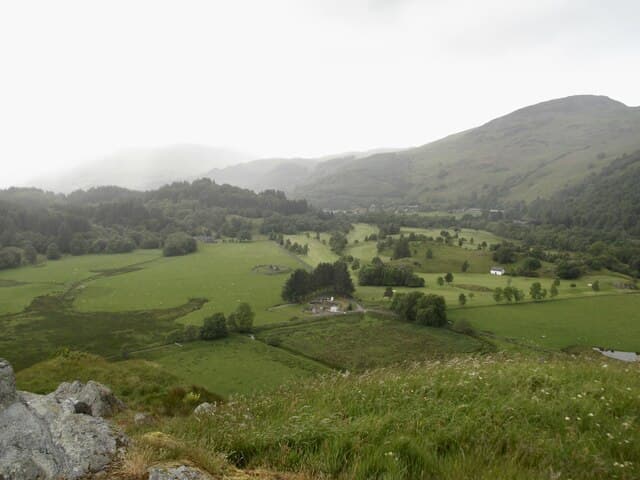
Links Drymen (start of the West Highland Way) with Pitlochry, crossing the heart of the Trossachs and the southern Highlands via Aberfoyle and Callander. Best walked best west-to-east with the prevailing weather behind you over 6 days. The full route covers 124 km (77 mi) with 2,500 m of climbing — a manageable mid-distance route.
Quick facts
- Distance
- 124 km/ 77 mi
- Typical days
- 6
- Total ascent
- 2500 m
- Difficulty
- moderate
- Start → Finish
- Drymen → Pitlochry
- Best direction
- West to East
- Water sources
- Drymen, Aberfoyle, Callander, Strathyre, Killin, Ardtalnaig, Aberfeldy and Pitlochry have tap water and full shops. The route crosses several burns on each leg — treat before drinking. The Loch Tay shore has frequent inns and cafes.
- Mobile signal
- EE/Vodafone reliable in all the named towns. Signal drops on the Menteith Hills (Drymen-Aberfoyle), above Strathyre on the climb to Glen Ample, and on the high ground south of Aberfeldy. Generally better coverage than the West Highland Way.
✔ Waymarked throughout
Approximate profile derived from per-stage ascent — accurate on total climb and pattern, not a pixel-precise GPX trace.
Our take
The Rob Roy Way is the unofficial cousin of the WHW — less famous, less crowded, and arguably more varied. It's built on existing paths and drove roads through Rob Roy MacGregor country. A brilliant choice for anyone put off by the WHW's crowds.
Highlights
- Loch Ard forest trails
- Loch Katrine and the Trossachs
- Strathyre and Balquhidder (Rob Roy's grave)
- Killin and the Falls of Dochart
- Finish over the Atholl hills into Pitlochry
Day-by-day itinerary
A suggested 6-day schedule. Adjust to your fitness and conditions.
1Drymen to Aberfoyle19km · 350m ascent
Through the Garadhban Forest and over the hills to Aberfoyle at the gateway to the Trossachs. Gentle forest walking to start.
- Terrain
- Forest tracks, hill paths, quiet lanes.
- Overnight
- Aberfoyle has hotels, B&Bs and a campsite.
- Stats
- Drymen → Aberfoyle · 19km · ↑350m
2Aberfoyle to Callander22km · 400m ascent
Past Loch Venachar and through the Queen Elizabeth Forest Park. The Trossachs scenery is at its finest on this section.
- Terrain
- Forest paths, loch-shore tracks, some road walking.
- Overnight
- Callander has ample hotels, B&Bs and restaurants. A popular tourist town.
- Stats
- Aberfoyle → Callander · 22km · ↑400m
3Callander to Strathyre18km · 350m ascent
Along the old Callander-Oban railway line past the Falls of Leny and through Glen Ogle. Balquhidder kirkyard with Rob Roy's grave is a short detour.
- Terrain
- Disused railway, riverside paths, glen tracks.
- Overnight
- Strathyre has B&Bs and the Munro Inn. Balquhidder has the Monachyle Mhor hotel.
- Stats
- Callander → Strathyre · 18km · ↑350m
4Strathyre to Killin23km · 500m ascent
Over the hills via Glen Ogle viaduct and down to Killin at the western end of Loch Tay. The Falls of Dochart at Killin are spectacular.
- Terrain
- Old railway viaduct, hill paths, moorland tracks.
- Overnight
- Killin has hotels, B&Bs and a youth hostel. Falls of Dochart Inn is popular.
- Stats
- Strathyre → Killin · 23km · ↑500m
5Killin to Aberfeldy22km · 450m ascent
Along the north shore of Loch Tay through quiet Perthshire farmland to the market town of Aberfeldy. Castle Menzies is worth a stop.
- Terrain
- Loch-shore paths, farm tracks, woodland trails.
- Overnight
- Aberfeldy has hotels, B&Bs and good restaurants. Dewar's distillery is on the route.
- Stats
- Killin → Aberfeldy · 22km · ↑450m
6Aberfeldy to Pitlochry20km · 450m ascent
Over the Atholl hills past Grandtully and Logierait to the Victorian resort town of Pitlochry. A satisfying finish in a lively Highland town.
- Terrain
- Hill tracks, woodland paths, riverside trails.
- Overnight
- Pitlochry has ample accommodation of all types. Celebrate at the Festival Theatre.
- Stats
- Aberfeldy → Pitlochry · 20km · ↑450m
Hills along the route
Munros, Corbetts, Grahams and Donalds within 5km of the route line — extensions or rest-day options.
- Creag na h-Eararuidh (Stuc na Cabaig)graham0.8km
- Ben Chonziemunro1.4km
- Meall na Fearnacorbett1.9km
- Mor Bheinngraham2.1km
- Ben Vrackiecorbett3.1km
- Ben Ledicorbett3.7km
- Ben Vorlichmunro3.8km
- Stuc a' Chroinmunro4km
- Beinn Eachcorbett4.3km
- Auchnafree Hillcorbett4.3km
- Creagan na Beinnecorbett4.4km
- Shee of Ardtalnaig (Ciste Buide a' Claidheimh)graham4.6km
Transport
To start (Drymen)
Train · ScotRail + First Glasgow / McGill's (309)
Glasgow Queen Street to Balloch (rail), then 309 bus Balloch to Drymen
Hourly trains; bus roughly every 1–2 hours
Total journey c.1h55. No direct rail to Drymen.
Check times & book →
From finish (Pitlochry)
Train · ScotRail
Pitlochry to Edinburgh Waverley / Glasgow Queen Street (Highland Main Line)
Up to 11/day to Edinburgh (~2h01); to Glasgow ~1h44
Caledonian Sleeper also stops here for direct London services
Check times & book →
Best months
Accommodation
Well-served but book ahead in peak season. Pubs and B&Bs at every stop. B&Bs and small hotels in Aberfoyle, Callander, Strathyre, Killin, Aberfeldy and Pitlochry; Booking.com and the route's own guide-book listing both work well. Wild camping in the hills between is straightforward.
Night-by-night guide: where to stay →Resupply
Drymen, Aberfoyle, Callander, Strathyre, Killin, Aberfeldy, Pitlochry all have shops. The longest stretch between shops is around 20km on the Killin-to-Aberfeldy section over Glen Lyon; carry a packed lunch. Pitlochry and Callander have the best supermarket choice.
Connect with
Chain into a longer expedition by combining with adjacent long-distance routes.
Current conditions
Weather at the start point (Drymen)
Daylight Today
- Sunrise
- 04:49
- Sunset
- 21:58
- Civil dawn
- 03:52
- Civil dusk
- 22:55
NOAA Solar Calculator · 13 July 2026
Share your experience
Walked the Rob Roy Way? Help others plan their trip.
Getting to and from the Rob Roy Way
Train and town anchors at each end of the route — on TripSCOT.
Start: Balloch station
South Loch Lomond — WHW start at Drymen / Conic Hill
10km from Drymen
tripscot.co.uk
On TripSCOTFinish: Pitlochry station
Schiehallion, Ben Vrackie, Beinn a Ghlo, Edradour distillery
1km from Pitlochry
tripscot.co.uk
On TripSCOTStock up: Luss
West Loch Lomond village — Highland Boundary, Loch Lomond Way
tripscot.co.uk