Graham · Cairngorms
Mount Blair
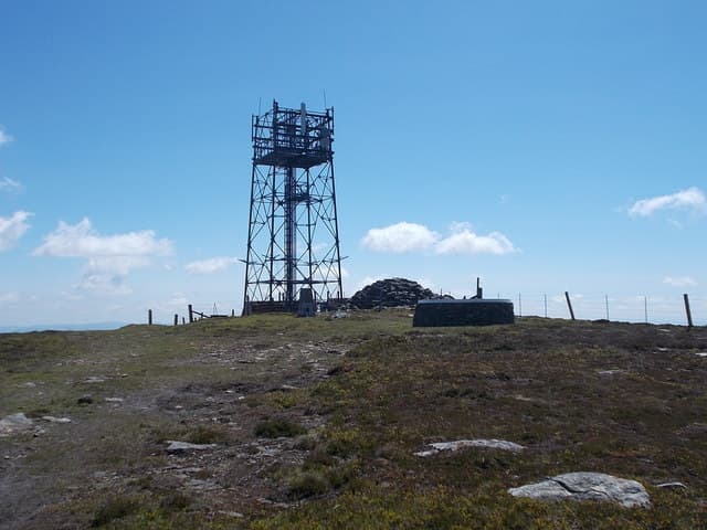
An isolated conical hill straddling the Angus-Perthshire boundary between Glen Shee and Glen Isla, with a trig point and a chairlift-pole-topped cairn marking the summit. The 400m of prominence and its standalone position make it a landmark from miles around.
Quick facts
- Height
- 744.4m/ 2442ft
- Prominence
- 400 m
- Distance
- 14 km
- Ascent
- 610 m
- Time
- 4–7 hrs
- Grid ref
- NO167629
- Parking
- NO163635
- Nearest city
- Perth· 40km
- Dogs
- Dogs on lead required near livestockDog-friendly guide ↗
Height and prominence cross-checked against the Database of British and Irish Hills (CC BY).
No GPX track yet
Walked this route? Share your track to help other walkers.
Standard route
estate track 35% · heather moorland 40% · grassy plateau 15% · summit area 10%
Park at the cattle grid on the minor road from Cray to Glenisla and walk directly up the south-east shoulder on a clear quad track. The grade is steady throughout and the trig is reached in just over an hour.
Terrain
A continuous quad track on managed grouse moor for the whole ascent. No bog, no scramble — one of the most straightforward Grahams.
In winter
The shapely cone collects easterly snow against its east flank and the lone summit is fully exposed to wind, but the track makes for safer navigation than most. Good winter introduction in cold settled weather.
This hill is in the Northern Cairngorms SAIS forecast area. Check SAIS forecasts in winter (December–April).
Best time of year
Getting there
- Glasgow2h 24m
- Edinburgh2h 54m
OS maps: OS Landranger 43
Mobile signal: Reasonable signal near Kirkmichael; 2 bars at the cairn
Current conditions
Daylight Today
- Sunrise
- 04:40
- Sunset
- 21:58
- Civil dawn
- 03:40
- Civil dusk
- 22:58
NOAA Solar Calculator · 13 July 2026
Pair with
Curated multi-hill combinations from Mount Blair.
Around Mount Blair on the SCOT network
Getting there, basing yourself, and what to do off the hill.
Getting there: Pitlochry station
Schiehallion, Ben Vrackie, Beinn a Ghlo, Edradour distillery
23km from the hill
tripscot.co.uk
On TripSCOTBase yourself in Pitlochry
Perthshire base — Schiehallion, Beinn a Ghlo, Ben Vrackie
23km from the hill
tripscot.co.uk
On TasteSCOTAfter the hill: Edradour
Pitlochry — until recently Scotland's smallest distillery; charming Perthshire setting
20km from the hill
tastescot.co.uk
Mount Blair — common questions
- How difficult is Mount Blair?
- Mount Blair carries a 4/5 (challenging) grade on the OutdoorSCOT scale. Count on about 14km, 610m of ascent and a 4-7 hour day on the standard route. Terrain: A continuous quad track on managed grouse moor for the whole ascent.
- How prominent is Mount Blair?
- Mount Blair has 400m of topographic prominence — the height of its summit above the highest col connecting it to higher ground.
- Where should I park to climb Mount Blair?
- Standard parking is at NO163635. Check the parking grid reference on an OS map before travel; informal laybys can fill on summer weekends.
- When should I climb Mount Blair?
- The standard good-weather months for Mount Blair are April, May, June, July, August, September, October. Outside those months, expect winter conditions on the high ground — full mountain kit, navigation skills, and a check of the SAIS avalanche forecast for the relevant region.
- Can I bring my dog up Mount Blair?
- On a lead only — the route crosses ground with livestock or nesting-bird interest.
- What's mobile reception like on Mount Blair?
- Reasonable signal near Kirkmichael; 2 bars at the cairn
- Is Mount Blair safe in winter?
- The shapely cone collects easterly snow against its east flank and the lone summit is fully exposed to wind, but the track makes for safer navigation than most. Good winter introduction in cold settled weather.
Get the OutdoorSCOT weekly
One email a week — new route, hill and bothy guides, seasonal conditions and the odd hard-won lesson. No spam, unsubscribe in one click.