Munro · Cairngorms
Beinn a' Ghlo - Braigh Coire Chruinn-bhalgain
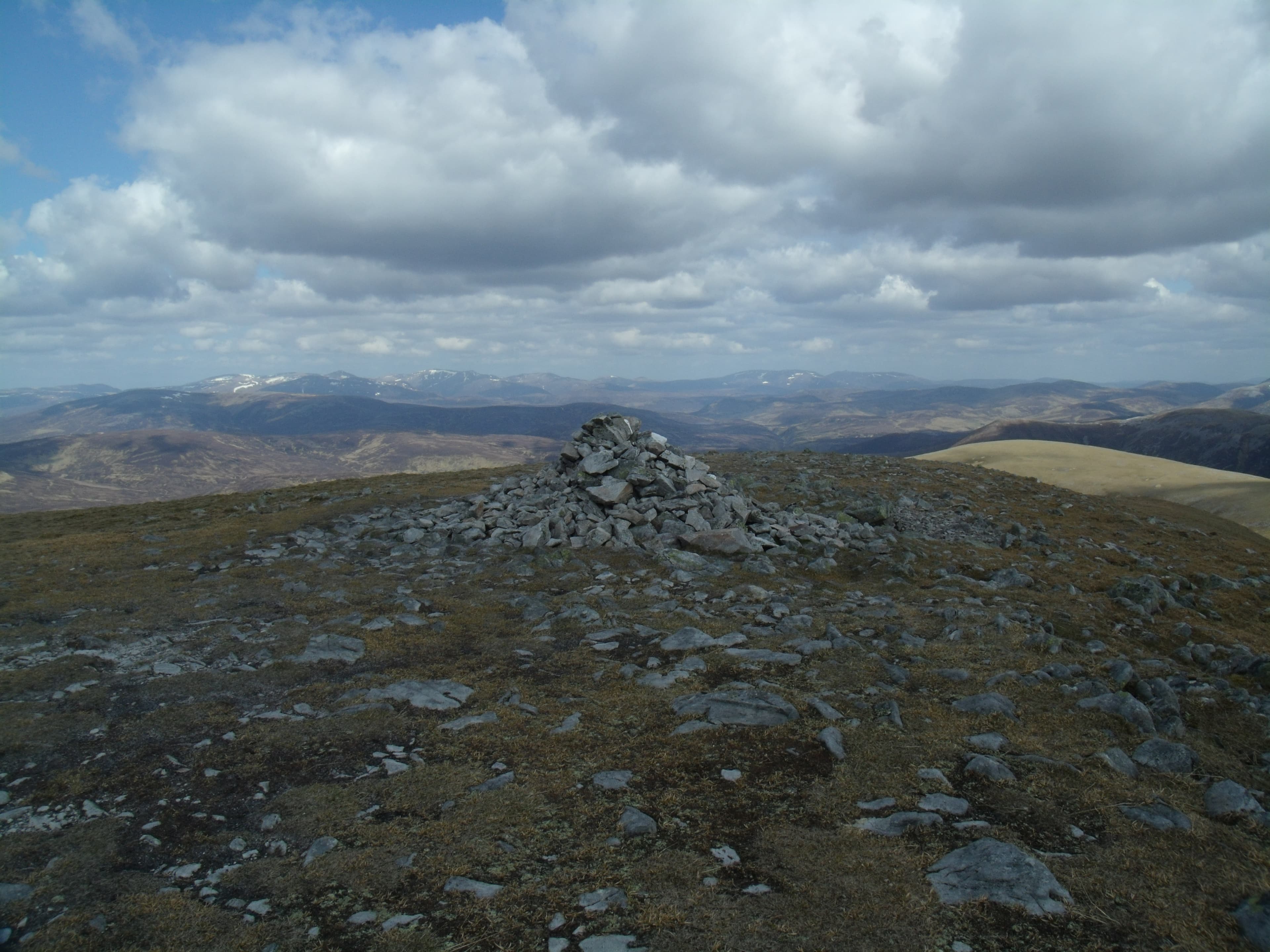
Bràigh Coire Chruinn-bhalgain (1070m) — "the height of the corrie of round blisters" — is the central and highest Munro of the Beinn a' Ghlo massif above Blair Atholl. The three Munros of Beinn a' Ghlo (Càrn Liath, Bràigh Coire Chruinn-bhalgain, Càrn nan Gabhar) make one of the great Cairngorms-edge horseshoes, often described as having "nineteen corries". The group sits south of the main Cairngorm massif on the southern margin of the Drumochter–Atholl deer forest country.
Gaelic: “mountain, of the, corrie” · Pronunciation: bine uh ghlo braigh kor-a chruinn bhalgain
Quick facts
- Height
- 1070m/ 3510ft
- Prominence
- 222 m
- Distance
- 18 km
- Ascent
- 942 m
- Time
- 6–9 hrs
- Grid ref
- NN945724
- Parking
- NN905671
- Nearest city
- Perth· 52km
- Dogs
- Dogs on lead required near livestockDog-friendly guide ↗
Height and prominence cross-checked against the Database of British and Irish Hills (CC BY).
No GPX track yet
Walked this route? Share your track to help other walkers.
Standard route
Forest / moorland path 35% · Mountain path 35% · Plateau / boulder field 30%
The standard round starts from the Loch Moraig car park north-east of Blair Atholl. Take the rough estate track east to the foot of Càrn Liath, climb its eroded south ridge to the cairn, then drop into the long Bealach an Fhiodha and climb the south-west ridge of Bràigh Coire Chruinn-bhalgain. Continue east-north-east to Càrn nan Gabhar via another deep bealach. Descent reverses the line back to Loch Moraig. Around 22km with 1500m of ascent for all three Munros.
Terrain
The Loch Moraig estate track is firm landrover surface but the path onto Càrn Liath is severely eroded — wide braided trenches through stone and grass. Above the first summit the going is broad turf and gravel ridges, easier underfoot. The two bealachs between the Munros are deep, with substantial re-ascent on each. The route involves three full ascents, not one — keep this in mind when judging pace.
In winter
A serious winter horseshoe. The deep bealachs trap deep snow and the ridges between are fully exposed to easterly Cairngorm winds. Cornicing on the east sides of the connecting ridges is consistent through the season. The standard approach gets little sun and stays cold. Phone signal is absent throughout. SAIS Southern Cairngorms applies. Allow extra time — full traverse in winter is a long day.
This hill is in the Northern Cairngorms SAIS forecast area. Check SAIS forecasts in winter (December–April).
Best time of year
Getting there
- Glasgow2h 24m
- Edinburgh2h 12m
OS maps: OS Landranger 43
Mobile signal: No coverage above the treeline. The Loch Moraig start has very patchy reception. Bràigh Coire Chruinn-bhalgain demands offline mapping and self-sufficient navigation.
Current conditions
Daylight Today
- Sunrise
- 04:57
- Sunset
- 21:46
- Civil dawn
- 04:02
- Civil dusk
- 22:41
NOAA Solar Calculator · 23 July 2026
Got a photo of Beinn a' Ghlo - Braigh Coire Chruinn-bhalgain?
30 seconds, helps other walkers.
Submit a photoAround Beinn a' Ghlo - Braigh Coire Chruinn-bhalgain on the SCOT network
Getting there, basing yourself, and what to do off the hill.
Getting there: Blair Atholl station
Beinn a Ghlo; Glen Tilt corridor north to the Cairngorms
10km from the hill
tripscot.co.uk
On TripSCOTBase yourself in Pitlochry
Perthshire base — Schiehallion, Beinn a Ghlo, Ben Vrackie
14km from the hill
tripscot.co.uk
On TasteSCOTAfter the hill: Edradour
Pitlochry — until recently Scotland's smallest distillery; charming Perthshire setting
13km from the hill
tastescot.co.uk
Beinn a' Ghlo - Braigh Coire Chruinn-bhalgain — common questions
- Is Beinn a' Ghlo - Braigh Coire Chruinn-bhalgain a hard climb?
- Beinn a' Ghlo - Braigh Coire Chruinn-bhalgain is rated 4/5 (challenging) on the OutdoorSCOT scale. The standard route covers about 18km with 942m of ascent and takes most walkers 6-9 hours. Terrain: The Loch Moraig estate track is firm landrover surface but the path onto Càrn Liath is severely eroded — wide braided trenches through stone and grass.
- How prominent is Beinn a' Ghlo - Braigh Coire Chruinn-bhalgain?
- Beinn a' Ghlo - Braigh Coire Chruinn-bhalgain has 222m of topographic prominence — the height of its summit above the highest col connecting it to higher ground.
- Where should I park to climb Beinn a' Ghlo - Braigh Coire Chruinn-bhalgain?
- Standard parking is at NN905671. Check the parking grid reference on an OS map before travel; informal laybys can fill on summer weekends.
- When should I climb Beinn a' Ghlo - Braigh Coire Chruinn-bhalgain?
- The standard good-weather months for Beinn a' Ghlo - Braigh Coire Chruinn-bhalgain are May, June, July, August, September, October. Outside those months, expect winter conditions on the high ground — full mountain kit, navigation skills, and a check of the SAIS avalanche forecast for the relevant region.
- Can I bring my dog up Beinn a' Ghlo - Braigh Coire Chruinn-bhalgain?
- On a lead only — the route crosses ground with livestock or nesting-bird interest.
- What's mobile reception like on Beinn a' Ghlo - Braigh Coire Chruinn-bhalgain?
- No coverage above the treeline. The Loch Moraig start has very patchy reception. Bràigh Coire Chruinn-bhalgain demands offline mapping and self-sufficient navigation.
- Is Beinn a' Ghlo - Braigh Coire Chruinn-bhalgain safe in winter?
- A serious winter horseshoe. The deep bealachs trap deep snow and the ridges between are fully exposed to easterly Cairngorm winds. Cornicing on the east sides of the connecting ridges is consistent through the season. The standard approach gets little sun and stays cold. Phone signal is absent throughout. SAIS Southern Cairngorms applies. Allow extra time — full traverse in winter is a long day.
Get the OutdoorSCOT weekly
One email a week — new route, hill and bothy guides, seasonal conditions and the odd hard-won lesson. No spam, unsubscribe in one click.