Graham · Skye & The Small Isles
Sgurr na Coinnich
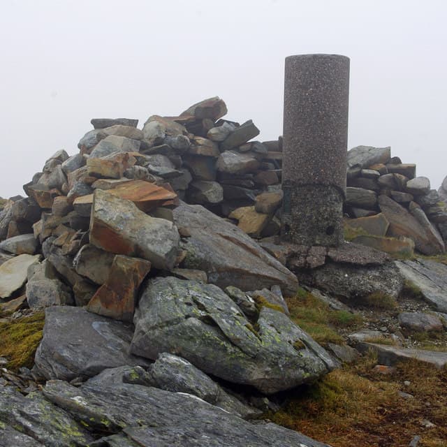
A rugged Graham on the Kyle Rhea peninsula directly opposite the Glenelg-Kylerhea ferry slip. Despite being the highest hill on the Skye side of the narrows, it is overlooked by walkers heading for the Cuillin. The pull from the Bealach Udal pass is short and rewarding.
Quick facts
- Height
- 739.1m/ 2425ft
- Prominence
- 714 m
- Distance
- 14 km
- Ascent
- 606 m
- Time
- 4–7 hrs
- Grid ref
- NG762222
- Parking
- NG765214
- Nearest
- Fort William· Inverness 93km
- Dogs
- Dogs on lead required near livestockDog-friendly guide ↗
Height and prominence cross-checked against the Database of British and Irish Hills (CC BY).
No GPX track yet
Walked this route? Share your track to help other walkers.
Standard route
glen path 20% · heather hillside 45% · grassy ridge 25% · summit area 10%
Drive up to the high point of the single-track road across Bealach Udal at roughly NG765214. Strike north up the heathery slopes onto the south ridge and follow this directly to the cairn. Easily combined with Beinn na Caillich (Kyle Rhea) on the same outing.
Terrain
Steep heather and grass on the lower slopes giving way to broken Torridonian sandstone slabs near the top. Damp underfoot in most months — the bealach is a notorious wind funnel.
In winter
Wet snow more often than hard neve at this latitude, but the south ridge can ice up after a clearance. The drive over Bealach Udal can be the crux in winter — the single-track road is gritted only sporadically.
Best time of year
Getting there
- Glasgow3h 24m
- Edinburgh4h 2m
OS maps: OS Landranger 33
Mobile signal: Patchy reception around Bealach Udal; better on the Skye side of the narrows
Current conditions
Daylight Today
- Sunrise
- 04:46
- Sunset
- 22:11
- Civil dawn
- 03:44
- Civil dusk
- 23:13
NOAA Solar Calculator · 13 July 2026
Pair with
Curated multi-hill combinations from Sgurr na Coinnich.
Around Sgurr na Coinnich on the SCOT network
Getting there, basing yourself, and what to do off the hill.
Getting there: Kyle of Lochalsh station
Skye Bridge; Five Sisters of Kintail; Glen Shiel; Plockton
5km from the hill
tripscot.co.uk
On TripSCOTBase yourself in Mallaig
Ferry port for Skye and the Small Isles; CWT finish supply
27km from the hill
tripscot.co.uk
On TasteSCOTAfter the hill: Isle of Raasay Distillery
Raasay — new island distillery with rooms; Dun Caan walks from the door
26km from the hill
tastescot.co.uk
Sgurr na Coinnich — common questions
- Is Sgurr na Coinnich a hard climb?
- Sgurr na Coinnich is rated 4/5 (challenging) on the OutdoorSCOT scale. The standard route covers about 14km with 606m of ascent and takes most walkers 4-7 hours. Terrain: Steep heather and grass on the lower slopes giving way to broken Torridonian sandstone slabs near the top.
- How prominent is Sgurr na Coinnich?
- Sgurr na Coinnich has 714m of topographic prominence — the height of its summit above the highest col connecting it to higher ground.
- Where should I park to climb Sgurr na Coinnich?
- Standard parking is at NG765214 near Fort William. Check the parking grid reference on an OS map before travel; informal laybys can fill on summer weekends.
- When should I climb Sgurr na Coinnich?
- The standard good-weather months for Sgurr na Coinnich are May, June, July, August, September. Outside those months, expect winter conditions on the high ground — full mountain kit, navigation skills, and a check of the SAIS avalanche forecast for the relevant region.
- Can I bring my dog up Sgurr na Coinnich?
- On a lead only — the route crosses ground with livestock or nesting-bird interest.
- What's mobile reception like on Sgurr na Coinnich?
- Patchy reception around Bealach Udal; better on the Skye side of the narrows
- Is Sgurr na Coinnich safe in winter?
- Wet snow more often than hard neve at this latitude, but the south ridge can ice up after a clearance. The drive over Bealach Udal can be the crux in winter — the single-track road is gritted only sporadically.
Get the OutdoorSCOT weekly
One email a week — new route, hill and bothy guides, seasonal conditions and the odd hard-won lesson. No spam, unsubscribe in one click.