Graham · Kintail
Beinn a' Chapuill
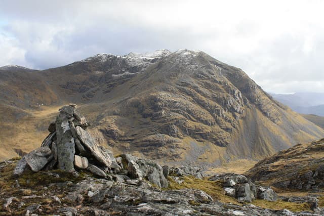
The hill of the horse stands on the Glenelg peninsula opposite Skye, overlooking the Sound of Sleat and the mouth of Loch Hourn. Its position gives one of the best low-summit panoramas in the west, with the Cuillin filling the horizon and Beinn Sgritheall rising to the south.
Quick facts
- Height
- 759.8m/ 2493ft
- Prominence
- 259 m
- Distance
- 14 km
- Ascent
- 622 m
- Time
- 4–7 hrs
- Grid ref
- NG835148
- Parking
- NG815172
- Nearest city
- Fort William· 49km
- Dogs
- Dogs on lead required near livestockDog-friendly guide ↗
Height and prominence cross-checked against the Database of British and Irish Hills (CC BY).
No GPX track yet
Walked this route? Share your track to help other walkers.
Standard route
glen track 20% · heather hillside 50% · grassy upper slopes 20% · summit area 10%
Start from the road end at Arnisdale or, more commonly, the bridge in Gleann Beag near the brochs. A landrover track climbs west then a faint stalkers' line zig-zags up a shoulder to the broad summit plateau.
Terrain
Good track for the first three kilometres, then intermittent boggy path on the shoulder. The top is open and grassy with peat hags in the central plateau area.
In winter
Snow lies only sporadically at this western maritime location, but the plateau is featureless in mist and the peat hags freeze into a treacherous chequer-board. Carry compass and back-bearings.
Best time of year
Getting there
- Glasgow3h 13m
- Edinburgh4h 51m
OS maps: OS Landranger 33
Mobile signal: No signal in remote upper Loch Etive area
Current conditions
Daylight Today
- Sunrise
- 04:46
- Sunset
- 22:10
- Civil dawn
- 03:44
- Civil dusk
- 23:12
NOAA Solar Calculator · 13 July 2026
Around Beinn a' Chapuill on the SCOT network
Getting there, basing yourself, and what to do off the hill.
Beinn a' Chapuill — common questions
- How hard is Beinn a' Chapuill?
- We grade Beinn a' Chapuill at 4/5, which puts it in challenging territory. The usual route is around 14km with 622m of climbing; allow 4-7 hours. Terrain: Good track for the first three kilometres, then intermittent boggy path on the shoulder.
- How prominent is Beinn a' Chapuill?
- Beinn a' Chapuill has 259m of topographic prominence — the height of its summit above the highest col connecting it to higher ground.
- Where should I park to climb Beinn a' Chapuill?
- Standard parking is at NG815172. Check the parking grid reference on an OS map before travel; informal laybys can fill on summer weekends.
- When should I climb Beinn a' Chapuill?
- The standard good-weather months for Beinn a' Chapuill are May, June, July, August, September. Outside those months, expect winter conditions on the high ground — full mountain kit, navigation skills, and a check of the SAIS avalanche forecast for the relevant region.
- Can I bring my dog up Beinn a' Chapuill?
- On a lead only — the route crosses ground with livestock or nesting-bird interest.
- What's mobile reception like on Beinn a' Chapuill?
- No signal in remote upper Loch Etive area
- Is Beinn a' Chapuill safe in winter?
- Snow lies only sporadically at this western maritime location, but the plateau is featureless in mist and the peat hags freeze into a treacherous chequer-board. Carry compass and back-bearings.
Get the OutdoorSCOT weekly
One email a week — new route, hill and bothy guides, seasonal conditions and the odd hard-won lesson. No spam, unsubscribe in one click.