Corbett · Knoydart
Beinn na h-Eaglaise
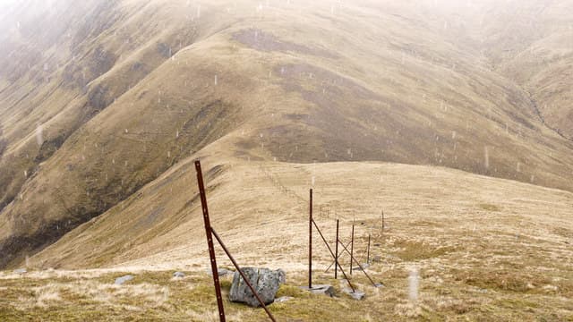
Beinn na h-Eaglaise — 'hill of the church' — is the 805m Corbett standing east of Beinn Sgritheall (Munro) above the south shore of Loch Hourn. The mountain forms a natural pair with Beinn na Caillich (mainland — not the Skye one) and is reached from the township of Arnisdale on the long single-track drive from Glenelg. The summit gives a striking view across the loch into the wild heart of Knoydart, with Ladhar Bheinn rising directly opposite on the north shore.
Quick facts
- Height
- 805m/ 2641ft
- Prominence
- 201 m
- Distance
- 10 km
- Ascent
- 850 m
- Time
- 3–5 hrs
- Grid ref
- NG854120
- Parking
- NG842105
- Nearest
- Fort William· Fort William 45km
- Dogs
- Dogs on lead required near livestockDog-friendly guide ↗
Height and prominence cross-checked against the Database of British and Irish Hills (CC BY).
No GPX track yet
Walked this route? Share your track to help other walkers.
Standard route
village path 15% · heather hillside 50% · grassy upper slopes 25% · summit area 10%
Park at the small layby at Arnisdale on the Loch Hourn road (NG842105). Climb north-east straight up the open hillside onto the south ridge of Beinn na h-Eaglaise. Heather and grass underfoot lead steadily upward to the summit cairn. For the obvious pair, drop east to the bealach and continue up Beinn na Caillich to the south-east. Allow 5–6 hours for Beinn na h-Eaglaise alone, 7–8 for the double.
Terrain
Open hillside from the road — no path of note. The ascent is steep grass with rocky outcrops in places. The summit ridge is firmer underfoot. The Glenelg-to-Arnisdale single-track drive is the limiting factor on time — allow extra both ways.
In winter
Maritime coastal hill — snow rarely persistent but Atlantic gales can put the open ridge in full mountain mode whenever it does lie. The Arnisdale road is single-track and weather-vulnerable. The east face holds snow longer than the south-facing ascent route. In firm conditions a fine short winter day with stunning Knoydart views; in marginal weather, painful.
Best time of year
Getting there
- Glasgow3h 9m
- Edinburgh4h 47m
OS maps: OS Landranger 33
Mobile signal: No signal in Glenelg area; completely off the network
Current conditions
Daylight Today
- Sunrise
- 04:46
- Sunset
- 22:10
- Civil dawn
- 03:44
- Civil dusk
- 23:12
NOAA Solar Calculator · 13 July 2026
Pair with
Curated multi-hill combinations from Beinn na h-Eaglaise.
Around Beinn na h-Eaglaise on the SCOT network
Getting there, basing yourself, and what to do off the hill.
Beinn na h-Eaglaise — common questions
- How hard is Beinn na h-Eaglaise?
- We grade Beinn na h-Eaglaise at 3/5, which puts it in moderately challenging territory. The usual route is around 10km with 850m of climbing; allow 3-5 hours. Terrain: Open hillside from the road — no path of note.
- How prominent is Beinn na h-Eaglaise?
- Beinn na h-Eaglaise has 201m of topographic prominence — the height of its summit above the highest col connecting it to higher ground.
- Where should I park to climb Beinn na h-Eaglaise?
- Standard parking is at NG842105 near Fort William. Check the parking grid reference on an OS map before travel; informal laybys can fill on summer weekends.
- When should I climb Beinn na h-Eaglaise?
- The standard good-weather months for Beinn na h-Eaglaise are May, June, July, August, September. Outside those months, expect winter conditions on the high ground — full mountain kit, navigation skills, and a check of the SAIS avalanche forecast for the relevant region.
- Can I bring my dog up Beinn na h-Eaglaise?
- On a lead only — the route crosses ground with livestock or nesting-bird interest.
- What's mobile reception like on Beinn na h-Eaglaise?
- No signal in Glenelg area; completely off the network
- Is Beinn na h-Eaglaise safe in winter?
- Maritime coastal hill — snow rarely persistent but Atlantic gales can put the open ridge in full mountain mode whenever it does lie. The Arnisdale road is single-track and weather-vulnerable. The east face holds snow longer than the south-facing ascent route. In firm conditions a fine short winter day with stunning Knoydart views; in marginal weather, painful.
Get the OutdoorSCOT weekly
One email a week — new route, hill and bothy guides, seasonal conditions and the odd hard-won lesson. No spam, unsubscribe in one click.