Corbett · Knoydart
Beinn na Caillich
Beinn na Caillich — 'the old woman's hill' — is the 785m Corbett rising directly east of Beinn na h-Eaglaise above Arnisdale on the south shore of Loch Hourn. (Not to be confused with the Skye Beinn na Caillich above Broadford, which is a different hill.) The mainland Beinn na Caillich is the higher of the two Loch Hourn Corbetts, with views across the loch to Ladhar Bheinn and out to the small islands. Most parties tackle it as half of a natural double with Beinn na h-Eaglaise from Arnisdale.
Quick facts
- Height
- 785m/ 2575ft
- Prominence
- 317 m
- Distance
- 10 km
- Ascent
- 870 m
- Time
- 3–5 hrs
- Grid ref
- NG795066
- Parking
- NG842105
- Nearest city
- Fort William· 45km
- Dogs
- Dogs on lead required near livestockDog-friendly guide ↗
Height and prominence cross-checked against the Database of British and Irish Hills (CC BY).
No GPX track yet
Walked this route? Share your track to help other walkers.
Standard route
glen path 20% · steep grass 40% · rocky upper slopes 30% · summit area 10%
The mountain is usually approached from Arnisdale on Loch Hourn (NG842105), most efficiently after climbing Beinn na h-Eaglaise: drop east off that summit to the bealach, then work south-east up the wide west flank of Beinn na Caillich. A short level crest leads to the cairn at the top. For a single-hill day instead, walk east along the coast road to NG866110 and take the south-west ridge straight up. Five to six hours for the hill alone, seven to eight as a pair with Beinn na h-Eaglaise.
Terrain
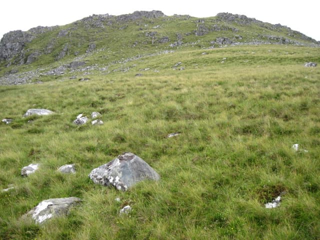
Steep grass and heather on the ascent from Arnisdale. The bealach between Beinn na Caillich and Beinn na h-Eaglaise is broad and grassy. The summit ridge has a few small rocky outcrops; the cairn is substantial. Views into Loch Hourn from the rim of the summit area are the day's highlight.
In winter
Maritime hill — snow rarely persistent but Atlantic systems make the open ridge a serious place in any cover. The single-track approach from Glenelg is itself the main winter complication; it ices up readily and isn't on the gritting network. The east-facing slope holds late snow and rock outcrops can verglas in cold spells. A demanding short winter day in firm conditions.
Best time of year
Getting there
- Glasgow3h 7m
- Edinburgh4h 47m
OS maps: OS Landranger 33
Mobile signal: Brief signal possible on the summit with views toward Broadford on Skye
Current conditions
Daylight Today
- Sunrise
- 04:53
- Sunset
- 22:05
- Civil dawn
- 03:54
- Civil dusk
- 23:04
NOAA Solar Calculator · 17 July 2026
Around Beinn na Caillich on the SCOT network
Getting there, basing yourself, and what to do off the hill.
Beinn na Caillich — common questions
- What difficulty is Beinn na Caillich?
- On the OutdoorSCOT scale, Beinn na Caillich comes in at 3/5 — moderately challenging. Expect roughly 10km and 870m of ascent on the usual route — 3-5 hours for most parties. Ground conditions: Steep grass and heather on the ascent from Arnisdale.
- How much drop does Beinn na Caillich have?
- The drop is 317m: measured from the summit of Beinn na Caillich down to the saddle joining it to higher terrain.
- Where's the parking for Beinn na Caillich?
- Park at NG842105. Double-check the grid reference on an OS map first; informal laybys here fill early in high season.
- What's the best month to climb Beinn na Caillich?
- Aim for May, June, July, August, September on Beinn na Caillich. In the remaining months treat it as a winter hill — full kit, solid navigation, and a look at the relevant SAIS avalanche forecast before you go.
- Can dogs go up Beinn na Caillich?
- Dogs are fine on a lead. The route passes livestock or ground-nesting bird habitat, so keep them close throughout.
- Will I get phone signal on Beinn na Caillich?
- Brief signal possible on the summit with views toward Broadford on Skye
- Is Beinn na Caillich safe in winter?
- Maritime hill — snow rarely persistent but Atlantic systems make the open ridge a serious place in any cover. The single-track approach from Glenelg is itself the main winter complication; it ices up readily and isn't on the gritting network. The east-facing slope holds late snow and rock outcrops can verglas in cold spells. A demanding short winter day in firm conditions.
Get the OutdoorSCOT weekly
One email a week — new route, hill and bothy guides, seasonal conditions and the odd hard-won lesson. No spam, unsubscribe in one click.