Graham · Kintail
Beinn a' Chuirn
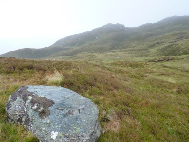
Beinn a' Chuirn (603m) is a small but shapely Graham above Glen Beag, sitting at NG87 in the rough Glenelg hinterland east of Loch Duich. A weathered trig pillar caps the summit, with views east into the Five Sisters of Kintail, south to Beinn Sgritheall and west across the Sound of Sleat to the Sleat ridge. The hill is reached through some of the most overlooked country in Wester Ross, the broch-rich glens of Gleann Beag and Gleann Mor providing the only access.
Quick facts
- Height
- 603m/ 1978ft
- Prominence
- 261 m
- Distance
- 12 km
- Ascent
- 452 m
- Time
- 3–5 hrs
- Grid ref
- NG870220
- Parking
- NG901197
- Nearest
- Fort William· Inverness 83km
- Dogs
- Dogs on lead required near livestockDog-friendly guide ↗
Height and prominence cross-checked against the Database of British and Irish Hills (CC BY).
No GPX track yet
Walked this route? Share your track to help other walkers.
Standard route
heather and bog 65% · grass slopes 20% · rocky summit 15%
A short and steep ascent begins from the head of Glen Beag near NG901197, working up the bracken-clad south flank onto the south-east ridge. About 12km return with 452m of climb if extended along the ridge to the subsidiary tops; the summit alone takes about an hour and a half up. The trig pillar sits a short way back from the brink of the eastern crags — a clear weather treat with the Kintail ridgeline on the skyline.
Terrain
The lower hill is a tangle of bracken and birch scrub that catches morning sun and warms early in the year. Higher up, the ground stiffens into short heather and outcrops of Moine schist, with the south-east ridge giving the cleanest line of ascent. The east face drops abruptly in broken crags — useful as a navigation feature but a hazard to cornice-prone walkers in winter.
In winter
The east-facing crags accumulate large cornices in north-westerly weather and the SAIS Northwest Highlands bulletin is essential reading before any winter visit. The south-east ridge is the safe line up and down whatever the snow has done. Glen Beag is sheltered enough to drive in even when the main Glen Shiel road is closed by drifts, which can make for a quieter winter day than the higher Kintail Munros across the watershed.
Best time of year
Getting there
- Glasgow3h 19m
- Edinburgh4h 54m
OS maps: OS Landranger 33
Mobile signal: Poor. Remote Argyll interior; limited coverage.
Current conditions
Daylight Today
- Sunrise
- 04:45
- Sunset
- 22:11
- Civil dawn
- 03:43
- Civil dusk
- 23:13
NOAA Solar Calculator · 13 July 2026
Around Beinn a' Chuirn on the SCOT network
Getting there, basing yourself, and what to do off the hill.
Beinn a' Chuirn — common questions
- How difficult is Beinn a' Chuirn?
- Beinn a' Chuirn carries a 3/5 (moderately challenging) grade on the OutdoorSCOT scale. Count on about 12km, 452m of ascent and a 3-5 hour day on the standard route. Underfoot: The lower hill is a tangle of bracken and birch scrub that catches morning sun and warms early in the year.
- What is Beinn a' Chuirn's prominence?
- 261m of prominence. That's the vertical drop from the summit to the col that links Beinn a' Chuirn to the next higher ground.
- Where do I park for Beinn a' Chuirn?
- Most walkers start from NG901197 near Fort William. Verify the grid reference on an OS map before you set off — space is tight on busy summer weekends.
- When is the best time to climb Beinn a' Chuirn?
- May, June, July, August, September give the most reliable conditions on Beinn a' Chuirn. Beyond that window the high ground turns wintry: carry full mountain kit, be confident navigating, and check the SAIS avalanche forecast for the area.
- Is Beinn a' Chuirn dog-friendly?
- Yes, but dogs must be kept on a lead — there is livestock or ground-nesting bird interest on the route.
- Is there mobile signal on Beinn a' Chuirn?
- Poor. Remote Argyll interior; limited coverage.
- Is Beinn a' Chuirn safe in winter?
- The east-facing crags accumulate large cornices in north-westerly weather and the SAIS Northwest Highlands bulletin is essential reading before any winter visit. The south-east ridge is the safe line up and down whatever the snow has done. Glen Beag is sheltered enough to drive in even when the main Glen Shiel road is closed by drifts, which can make for a quieter winter day than the higher Kintail Munros across the watershed.
Get the OutdoorSCOT weekly
One email a week — new route, hill and bothy guides, seasonal conditions and the odd hard-won lesson. No spam, unsubscribe in one click.