Graham · North-West Highlands
Beinn an Eòin
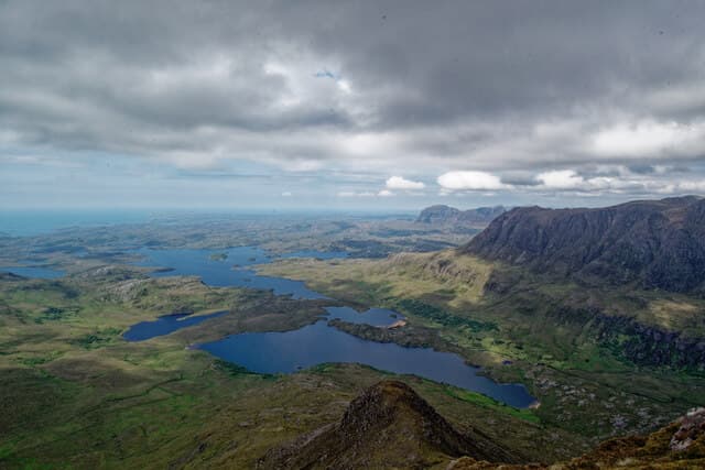
Twin-summited ridge in Coigach with the same Torridonian sandstone character as Stac Pollaidh next door, but a fraction of the visitors. Sits between Loch Lurgainn and Loch Bad a' Ghaill with the Summer Isles spread to the west.
Quick facts
- Height
- 619m/ 2031ft
- Prominence
- 355 m
- Distance
- 11 km
- Ascent
- 600 m
- Time
- 3–5 hrs
- Grid ref
- NC104064
- Parking
- NC162051
- Nearest
- Ullapool· Inverness 83km
- Dogs
- Dogs on lead required near livestockDog-friendly guide ↗
Height and prominence cross-checked against the Database of British and Irish Hills (CC BY).
No GPX track yet
Walked this route? Share your track to help other walkers.
Standard route
moorland path 25% · rough heather 35% · sandstone ridge 30% · summit area 10%
Approach from the Drumrunie road end across moor and lochan-strewn ground to the south ridge. Pathless sandstone shelves lead to the lower top before the short connecting crest gains the main summit.
Terrain
Wet, pathless moor on the approach. Easy ridge walking once on the hill.
In winter
Less snow than higher hills inland but heavy rain and wind year-round.
This hill is in the Torridon SAIS forecast area. Check SAIS forecasts in winter (December–April).
Best time of year
Getting there
- Glasgow5h 50m
- Edinburgh5h 55m
OS maps: OS Explorer 439
Mobile signal: No usable signal across the Coigach interior — Stac Pollaidh, Suilven and the Inverpolly lochans all sit in radio shadow. Patchy EE/Vodafone returns only near the Achiltibuie road and on summit ridges facing west to the Minch. Plan navigation and weather entirely offline.
Current conditions
Daylight Today
- Sunrise
- 04:38
- Sunset
- 22:15
- Civil dawn
- 03:32
- Civil dusk
- 23:21
NOAA Solar Calculator · 13 July 2026
Around Beinn an Eòin on the SCOT network
Getting there, basing yourself, and what to do off the hill.
Beinn an Eòin — common questions
- How hard is Beinn an Eòin?
- We grade Beinn an Eòin at 3/5, which puts it in moderately challenging territory. The usual route is around 11km with 600m of climbing; allow 3-5 hours. Terrain: Wet, pathless moor on the approach.
- How prominent is Beinn an Eòin?
- Beinn an Eòin has 355m of topographic prominence — the height of its summit above the highest col connecting it to higher ground.
- Where should I park to climb Beinn an Eòin?
- Standard parking is at NC162051 near Ullapool. Check the parking grid reference on an OS map before travel; informal laybys can fill on summer weekends.
- When should I climb Beinn an Eòin?
- The standard good-weather months for Beinn an Eòin are May, June, July, August, September, October. Outside those months, expect winter conditions on the high ground — full mountain kit, navigation skills, and a check of the SAIS avalanche forecast for the relevant region.
- Can I bring my dog up Beinn an Eòin?
- On a lead only — the route crosses ground with livestock or nesting-bird interest.
- What's mobile reception like on Beinn an Eòin?
- No usable signal across the Coigach interior — Stac Pollaidh, Suilven and the Inverpolly lochans all sit in radio shadow. Patchy EE/Vodafone returns only near the Achiltibuie road and on summit ridges facing west to the Minch. Plan navigation and weather entirely offline.
- Is Beinn an Eòin safe in winter?
- Less snow than higher hills inland but heavy rain and wind year-round.
Get the OutdoorSCOT weekly
One email a week — new route, hill and bothy guides, seasonal conditions and the odd hard-won lesson. No spam, unsubscribe in one click.