Graham · North-West Highlands
Stac Pollaidh
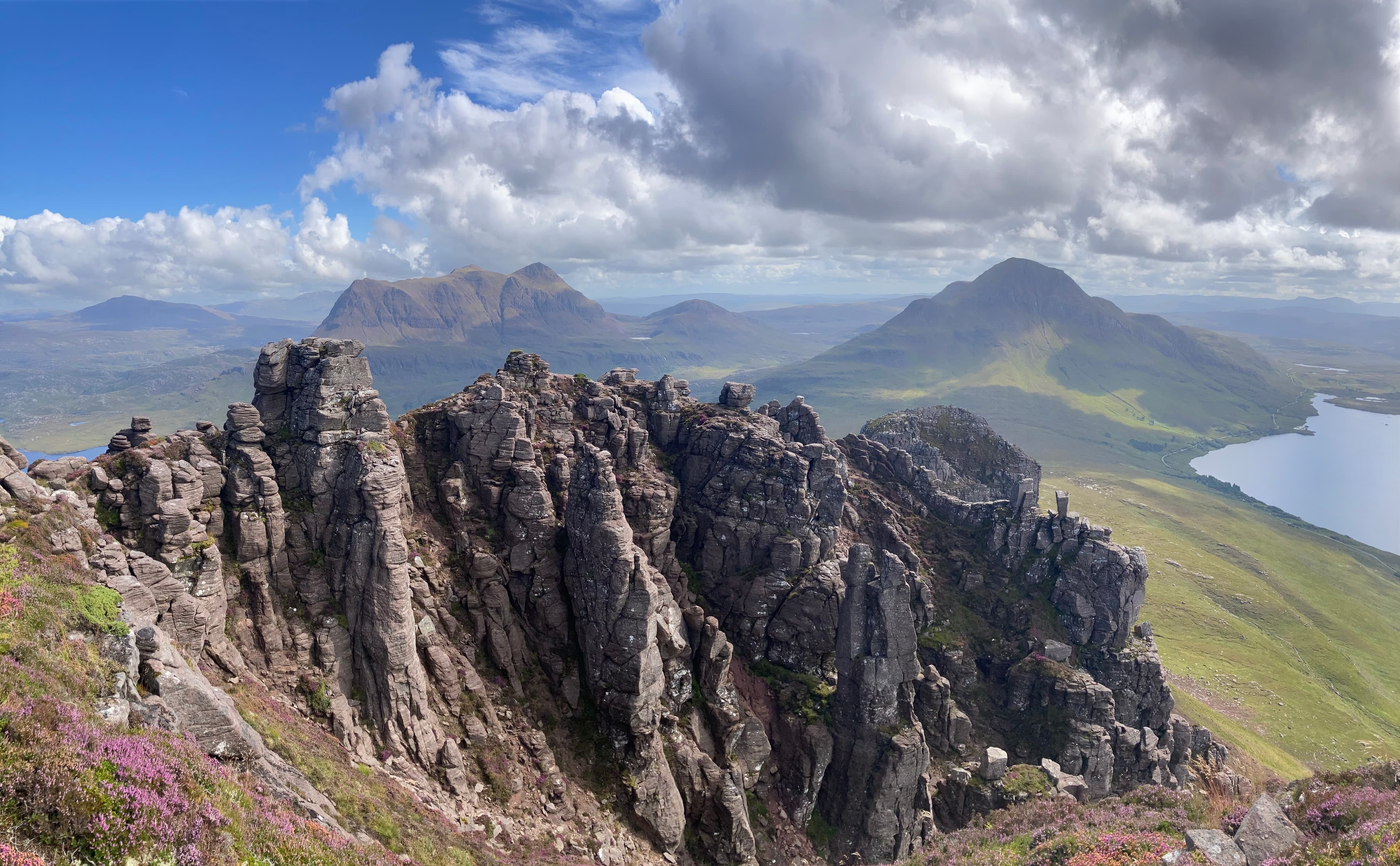
Probably the most photographed hill in the North-West, despite being barely a Graham by height. The pinnacled summit ridge offers genuine scrambling and a 360-degree view across Inverpolly that beats hills three times its height.
Quick facts
- Height
- 612.4m/ 2009ft
- Prominence
- 440 m
- Distance
- 5 km
- Ascent
- 540 m
- Time
- 2–3 hrs
- Grid ref
- NC107106
- Parking
- NC108095
- Nearest
- Ullapool· Inverness 86km
- Dogs
- Dogs on lead required near livestockDog-friendly guide ↗
Height and prominence cross-checked against the Database of British and Irish Hills (CC BY).
No GPX track yet
Walked this route? Share your track to help other walkers.
Standard route
forest path 15% · sandstone path 30% · pinnacle scramble 40% · summit rocks 15%
Path circuit from the layby on the Achiltibuie road. Excellent stone-built path climbs to the eastern end of the ridge. The true summit at the western end requires a moderate scramble with one tricky move.
Terrain
Restored stone path. Optional scrambling on the summit ridge — the true summit is genuinely exposed.
In winter
Snow can stick on the ridge into April. The scramble becomes serious under any verglas.
This hill is in the Torridon SAIS forecast area. Check SAIS forecasts in winter (December–April).
Best time of year
Getting there
- Glasgow5h 55m
- Edinburgh5h 0m
OS maps: OS Explorer 439
Mobile signal: The hill itself is blank; brief coverage in the Achiltibuie/Inverpolly car park area
Current conditions
Daylight Today
- Sunrise
- 04:38
- Sunset
- 22:16
- Civil dawn
- 03:31
- Civil dusk
- 23:22
NOAA Solar Calculator · 13 July 2026
Pair with
Curated multi-hill combinations from Stac Pollaidh.
Around Stac Pollaidh on the SCOT network
Getting there, basing yourself, and what to do off the hill.
Stac Pollaidh — common questions
- How hard is Stac Pollaidh?
- We grade Stac Pollaidh at 3/5, which puts it in moderately challenging territory. The usual route is around 5km with 540m of climbing; allow 2-3 hours. Terrain: Restored stone path.
- How prominent is Stac Pollaidh?
- Stac Pollaidh has 440m of topographic prominence — the height of its summit above the highest col connecting it to higher ground.
- Where should I park to climb Stac Pollaidh?
- Standard parking is at NC108095 near Ullapool. Check the parking grid reference on an OS map before travel; informal laybys can fill on summer weekends.
- When should I climb Stac Pollaidh?
- The standard good-weather months for Stac Pollaidh are April, May, June, July, August, September, October. Outside those months, expect winter conditions on the high ground — full mountain kit, navigation skills, and a check of the SAIS avalanche forecast for the relevant region.
- Can I bring my dog up Stac Pollaidh?
- On a lead only — the route crosses ground with livestock or nesting-bird interest.
- What's mobile reception like on Stac Pollaidh?
- The hill itself is blank; brief coverage in the Achiltibuie/Inverpolly car park area
- Is Stac Pollaidh safe in winter?
- Snow can stick on the ridge into April. The scramble becomes serious under any verglas.
Get the OutdoorSCOT weekly
One email a week — new route, hill and bothy guides, seasonal conditions and the odd hard-won lesson. No spam, unsubscribe in one click.