Corbett · Moidart
Sgurr na Ba Glaise
Sgùrr na Bà Glaise — 'peak of the grey cow' — is the highest summit of the Rois-bheinn group in Moidart, a 874m Corbett standing above Lochailort and the West Highland railway. The mountain forms the central peak of easily the finest small ridges in the western Highlands: a four-Corbett traverse linking Rois-bheinn, Sgùrr na Bà Glaise, An Stac and Beinn Mhic Cedidh in a long day from the coast road. The summit gives views west to the small islands of Eigg and Rum and east to the Glenfinnan Munros.
Quick facts
- Height
- 874.1m/ 2868ft
- Prominence
- 173 m
- Distance
- ~13 km
- Ascent
- ~920 m
- Time
- 4–6 hrs
- Grid ref
- NM770777
- Parking
- NM767812
- Nearest city
- Fort William· 34km
- Dogs
- Dogs on lead required near livestockDog-friendly guide ↗
Height and prominence cross-checked against the Database of British and Irish Hills (CC BY).
No GPX track yet
Walked this route? Share your track to help other walkers.
Standard route
roadside access 10% · heather hillside 45% · rocky slopes 35% · summit area 10%
Park at the Inversilort parking area on the A861 between Lochailort and Glenuig (NM767812). Pass under the West Highland railway line and pick up a path heading up Coire a' Bhuiridh onto the broad east ridge of Sgùrr na Bà Glaise. The route climbs steadily to the summit cairn perched on a low rock outcrop. For the full Moidart traverse, continue west over An Stac and Rois-bheinn for a 9–10 hour day with significant re-ascent. Sgùrr na Bà Glaise alone is 6–7 hours.
Terrain
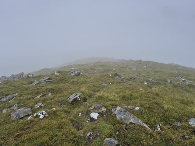
Lower slopes are heather and bracken — slow in summer growth. The middle section is grass with occasional rock outcrops. The summit ridge is firm rock and grass with mild exposure on the south side. The four-Corbett traverse involves several steep cols requiring careful footwork.
In winter
In winter the Rois-bheinn ridge becomes a serious mountaineering proposition — narrow connecting cols, exposed traverses, and tight daylight windows even on the shortest options. Sgùrr na Bà Glaise alone gives a manageable winter day with snow lying well on the east aspect. The A861 is usually clear of snow but the Glenuig road can be slow.
Kit for this: the winter Munro kit list · which boots take crampons
Best time of year
Getting there
- Glasgow3h 57m
- Edinburgh3h 29m
OS maps: OS Landranger 40
Mobile signal: Brief EE/Vodafone at Inversilort and on the Lochailort road; no signal in the Moidart hills
Current conditions
Daylight Today
- Sunrise
- 07:53
- Sunset
- 18:25
- Civil dawn
- 07:14
- Civil dusk
- 19:03
NOAA Solar Calculator · 14 October 2026
Around Sgurr na Ba Glaise on the SCOT network
Getting there, basing yourself, and what to do off the hill.
Sgurr na Ba Glaise — common questions
- How hard is Sgurr na Ba Glaise?
- We grade Sgurr na Ba Glaise at 3/5, which puts it in moderately challenging territory. The usual route is around 13km with 920m of climbing; allow 4-6 hours. Terrain: Lower slopes are heather and bracken — slow in summer growth.
- How prominent is Sgurr na Ba Glaise?
- Sgurr na Ba Glaise has 173m of topographic prominence — the height of its summit above the highest col connecting it to higher ground.
- Where should I park to climb Sgurr na Ba Glaise?
- Standard parking is at NM767812. Check the parking grid reference on an OS map before travel; informal laybys can fill on summer weekends.
- When should I climb Sgurr na Ba Glaise?
- The standard good-weather months for Sgurr na Ba Glaise are May, June, July, August, September. Outside those months, expect winter conditions on the high ground — full mountain kit, navigation skills, and a check of the SAIS avalanche forecast for the relevant region.
- Can I bring my dog up Sgurr na Ba Glaise?
- On a lead only — the route crosses ground with livestock or nesting-bird interest.
- What's mobile reception like on Sgurr na Ba Glaise?
- Brief EE/Vodafone at Inversilort and on the Lochailort road; no signal in the Moidart hills
- Is Sgurr na Ba Glaise safe in winter?
- In winter the Rois-bheinn ridge becomes a serious mountaineering proposition — narrow connecting cols, exposed traverses, and tight daylight windows even on the shortest options. Sgùrr na Bà Glaise alone gives a manageable winter day with snow lying well on the east aspect. The A861 is usually clear of snow but the Glenuig road can be slow.
Get the OutdoorSCOT weekly
One email a week — new route, hill and bothy guides, seasonal conditions and the odd hard-won lesson. No spam, unsubscribe in one click.