Corbett · Kintail
Sgurr Gaorsaic
Sgurr Gaorsaic — "peak of horror" or "peak of terror", depending on the gloss — is the secluded Corbett tucked between A' Ghlas-bheinn and the Munros of the Five Sisters at the head of Gleann Lichd. At 838m it is overlooked by every walker on the standard Kintail-Affric crossing, who passes within sight of the summit without diverting. The pointed top gives one of the closest views of the Falls of Glomach — Britain's tallest single-drop waterfall — directly beneath its south flank.
Quick facts
- Height
- 838.2m/ 2750ft
- Prominence
- 169 m
- Distance
- 15 km
- Ascent
- 737 m
- Time
- 5–7 hrs
- Grid ref
- NH036219
- Parking
- NG981222
- Nearest city
- Fort William· 48km
- Dogs
- Dogs on lead required near livestockDog-friendly guide ↗
Height and prominence cross-checked against the Database of British and Irish Hills (CC BY).
No GPX track yet
Walked this route? Share your track to help other walkers.
Standard route
engineered path 35% · steep grass 25% · rocky ridge 30% · summit area 10%
The standard line starts from Dorusduain on the Morvich road and follows the well-built path south-east up Gleann Choinneachain to the Bealach an Sgairne. From the bealach, leave the main path and climb steep grass and broken rock east onto the long north ridge of Sgurr Gaorsaic and follow it to the summit. Around 15km return with 737m of ascent. The hill can be combined with A' Ghlas-bheinn (Munro) by traversing the connecting ridge to the north.
Terrain
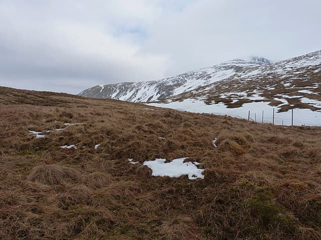
The Bealach an Sgairne path is one of the best-built in Kintail — wide, gravelled and well drained. Above the bealach the climb is pathless steep grass and broken sandstone steps. The summit ridge is short and rocky with one airy section above the Glomach gorge — keep clear of the south edge in mist as the drop is severe. The connecting ridge to A' Ghlas-bheinn is grassy and easy underfoot.
In winter
A serious winter hill despite the modest height — the south face above the Falls of Glomach is a recognised avalanche slope and the ridge develops cornices in westerly winds. The Bealach an Sgairne path is generally followable under snow but the climb onto Sgurr Gaorsaic itself becomes a steep snow climb needing axe and crampons. Morvich access road is reliable in any conditions.
Best time of year
Getting there
- Glasgow3h 11m
- Edinburgh4h 41m
OS maps: OS Landranger 25, OS Landranger 33
Mobile signal: Reasonable signal at Morvich; nothing beyond the bealach
Current conditions
Daylight Today
- Sunrise
- 04:44
- Sunset
- 22:10
- Civil dawn
- 03:42
- Civil dusk
- 23:12
NOAA Solar Calculator · 13 July 2026
On a long-distance route
Sgurr Gaorsaic sits within 5km of these named long-distance walks — useful for trail-pack rest days or section extensions.
Around Sgurr Gaorsaic on the SCOT network
Getting there, basing yourself, and what to do off the hill.
Sgurr Gaorsaic — common questions
- How hard is Sgurr Gaorsaic?
- We grade Sgurr Gaorsaic at 4/5, which puts it in challenging territory. The usual route is around 15km with 737m of climbing; allow 5-7 hours. Ground conditions: The Bealach an Sgairne path is one of the best-built in Kintail — wide, gravelled and well drained.
- How much drop does Sgurr Gaorsaic have?
- The drop is 169m: measured from the summit of Sgurr Gaorsaic down to the saddle joining it to higher terrain.
- Where's the parking for Sgurr Gaorsaic?
- Park at NG981222. Double-check the grid reference on an OS map first; informal laybys here fill early in high season.
- What's the best month to climb Sgurr Gaorsaic?
- Aim for April, May, June, July, August, September, October on Sgurr Gaorsaic. In the remaining months treat it as a winter hill — full kit, solid navigation, and a look at the relevant SAIS avalanche forecast before you go.
- Can dogs go up Sgurr Gaorsaic?
- Dogs are fine on a lead. The route passes livestock or ground-nesting bird habitat, so keep them close throughout.
- Will I get phone signal on Sgurr Gaorsaic?
- Reasonable signal at Morvich; nothing beyond the bealach
- Is Sgurr Gaorsaic safe in winter?
- A serious winter hill despite the modest height — the south face above the Falls of Glomach is a recognised avalanche slope and the ridge develops cornices in westerly winds. The Bealach an Sgairne path is generally followable under snow but the climb onto Sgurr Gaorsaic itself becomes a steep snow climb needing axe and crampons. Morvich access road is reliable in any conditions.
Get the OutdoorSCOT weekly
One email a week — new route, hill and bothy guides, seasonal conditions and the odd hard-won lesson. No spam, unsubscribe in one click.